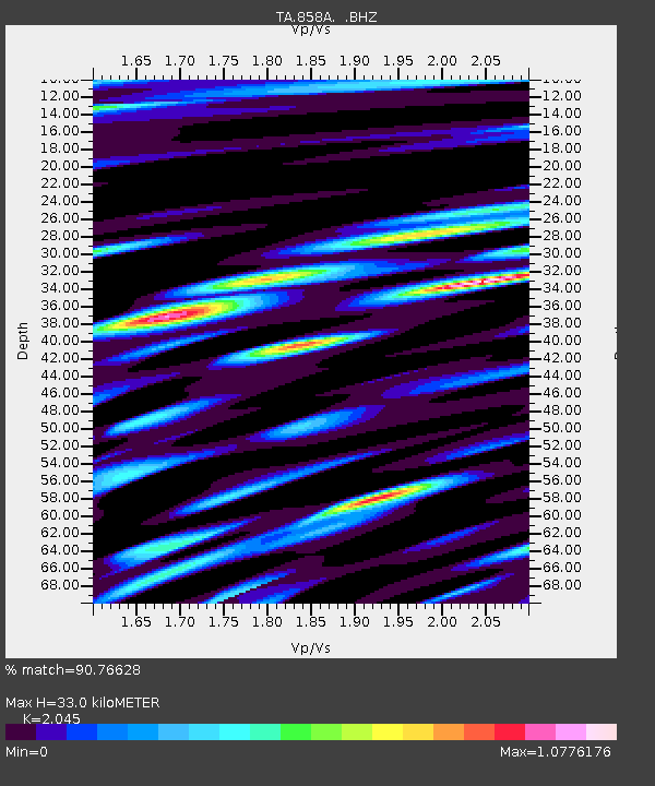
858A St. Cloud, FL, USA - Earthquake Result Viewer
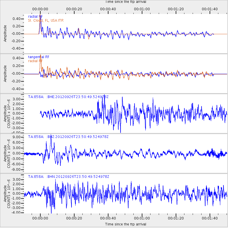
Earthquake location: Andreanof Islands, Aleutian Is.
Earthquake latitude/longitude: 51.6/-178.3
Earthquake time(UTC): 2012/09/26 (270) 23:39:55 GMT
Earthquake Depth: 16 km
Earthquake Magnitude: 6.3 MB, 6.5 MS, 6.4 MW, 6.4 MW
Earthquake Catalog/Contributor: WHDF/NEIC
Network: TA USArray Transportable Network (new EarthScope stations)
Station: 858A St. Cloud, FL, USA
Lat/Lon: 28.21 N/81.36 W
Elevation: 27 m
Distance: 72.5 deg
Az: 66.736 deg
Baz: 319.504 deg
Ray Param: 0.053623267
Estimated Moho Depth: 33.0 km
Estimated Crust Vp/Vs: 2.05
Assumed Crust Vp: 6.134 km/s
Estimated Crust Vs: 2.999 km/s
Estimated Crust Poisson's Ratio: 0.34
Radial Match: 90.76628 %
Radial Bump: 400
Transverse Match: 80.25943 %
Transverse Bump: 400
SOD ConfigId: 478790
Insert Time: 2013-02-22 23:44:14.555 +0000
GWidth: 2.5
Max Bumps: 400
Tol: 0.001

Signal To Noise

ChannelStoNSTALTA
TA:858A: :BHZ:20120926T23:50:49.524978Z5.95431232.2326783E-63.7496827E-7
TA:858A: :BHN:20120926T23:50:49.524978Z2.98679738.9763836E-73.0053542E-7
TA:858A: :BHE:20120926T23:50:49.524978Z2.6024251.0237859E-63.933969E-7
Arrivals
Ps5.8 SECOND
PpPs16 SECOND
PsPs/PpSs22 SECOND