You are here: Home > Network List > IC - New China Digital Seismograph Network Stations List
> Station HIA Hailar, Neimenggu Province, China > Earthquake Result Viewer
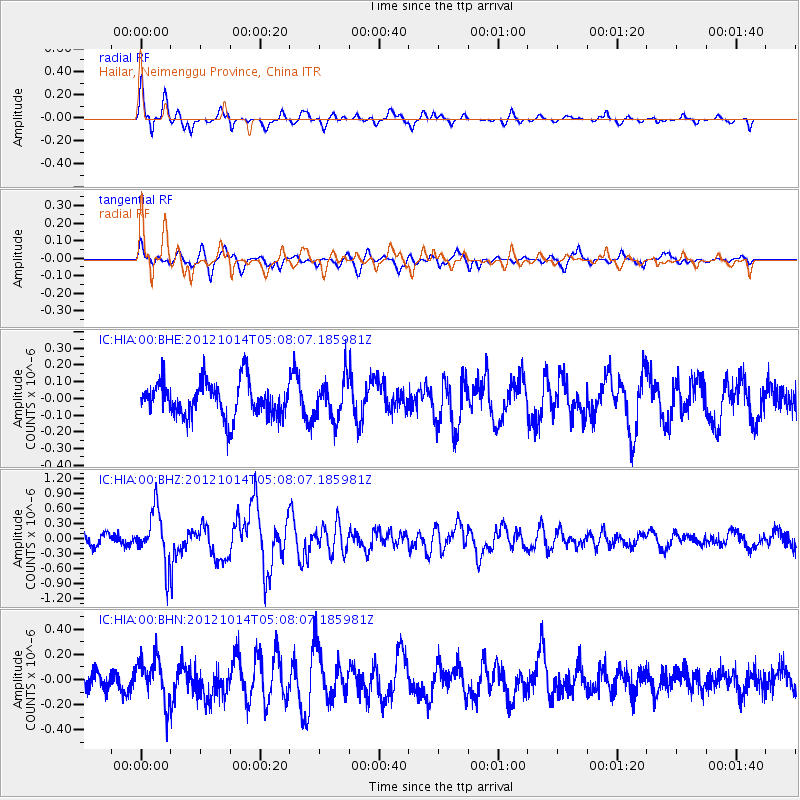
HIA Hailar, Neimenggu Province, China - Earthquake Result Viewer
*The percent match for this event was below the threshold and hence no stack was calculated.
| Earthquake location: |
Solomon Islands |
| Earthquake latitude/longitude: |
-7.1/156.0 |
| Earthquake time(UTC): |
2012/10/14 (288) 04:58:04 GMT |
| Earthquake Depth: |
37 km |
| Earthquake Magnitude: |
5.8 MB, 5.5 MS, 5.8 MW, 5.8 MW |
| Earthquake Catalog/Contributor: |
WHDF/NEIC |
|
| Network: |
IC New China Digital Seismograph Network |
| Station: |
HIA Hailar, Neimenggu Province, China |
| Lat/Lon: |
49.27 N/119.74 E |
| Elevation: |
620 m |
|
| Distance: |
64.5 deg |
| Az: |
334.553 deg |
| Baz: |
139.386 deg |
| Ray Param: |
$rayparam |
*The percent match for this event was below the threshold and hence was not used in the summary stack. |
|
| Radial Match: |
79.0311 % |
| Radial Bump: |
290 |
| Transverse Match: |
66.5605 % |
| Transverse Bump: |
400 |
| SOD ConfigId: |
478790 |
| Insert Time: |
2013-02-23 03:32:19.869 +0000 |
| GWidth: |
2.5 |
| Max Bumps: |
400 |
| Tol: |
0.001 |
|
Signal To Noise
| Channel | StoN | STA | LTA |
| IC:HIA:00:BHZ:20121014T05:08:07.185981Z | 3.5200477 | 5.196933E-7 | 1.4763815E-7 |
| IC:HIA:00:BHN:20121014T05:08:07.185981Z | 1.8089035 | 1.7344732E-7 | 9.588534E-8 |
| IC:HIA:00:BHE:20121014T05:08:07.185981Z | 1.1394745 | 1.2074509E-7 | 1.0596559E-7 |
| Arrivals |
| Ps | |
| PpPs | |
| PsPs/PpSs | |


