You are here: Home > Network List > IC - New China Digital Seismograph Network Stations List
> Station HIA Hailar, Neimenggu Province, China > Earthquake Result Viewer
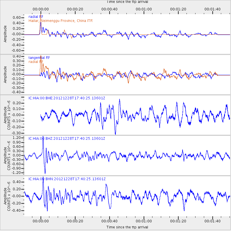
HIA Hailar, Neimenggu Province, China - Earthquake Result Viewer
*The percent match for this event was below the threshold and hence no stack was calculated.
| Earthquake location: |
Minahassa Peninsula, Sulawesi |
| Earthquake latitude/longitude: |
-0.1/122.9 |
| Earthquake time(UTC): |
2012/12/28 (363) 17:32:18 GMT |
| Earthquake Depth: |
112 km |
| Earthquake Magnitude: |
5.5 MW, 5.5 MW |
| Earthquake Catalog/Contributor: |
WHDF/NEIC |
|
| Network: |
IC New China Digital Seismograph Network |
| Station: |
HIA Hailar, Neimenggu Province, China |
| Lat/Lon: |
49.27 N/119.74 E |
| Elevation: |
620 m |
|
| Distance: |
49.3 deg |
| Az: |
357.256 deg |
| Baz: |
175.808 deg |
| Ray Param: |
$rayparam |
*The percent match for this event was below the threshold and hence was not used in the summary stack. |
|
| Radial Match: |
67.27781 % |
| Radial Bump: |
400 |
| Transverse Match: |
62.51166 % |
| Transverse Bump: |
307 |
| SOD ConfigId: |
491031 |
| Insert Time: |
2013-04-10 04:23:39.452 +0000 |
| GWidth: |
2.5 |
| Max Bumps: |
400 |
| Tol: |
0.001 |
|
Signal To Noise
| Channel | StoN | STA | LTA |
| IC:HIA:00:BHZ:20121228T17:40:25.13601Z | 4.5171275 | 5.4559064E-7 | 1.2078264E-7 |
| IC:HIA:00:BHN:20121228T17:40:25.13601Z | 3.1440058 | 2.2110822E-7 | 7.032691E-8 |
| IC:HIA:00:BHE:20121228T17:40:25.13601Z | 1.3405199 | 7.482923E-8 | 5.5821047E-8 |
| Arrivals |
| Ps | |
| PpPs | |
| PsPs/PpSs | |


