You are here: Home > Network List > IC - New China Digital Seismograph Network Stations List
> Station HIA Hailar, Neimenggu Province, China > Earthquake Result Viewer
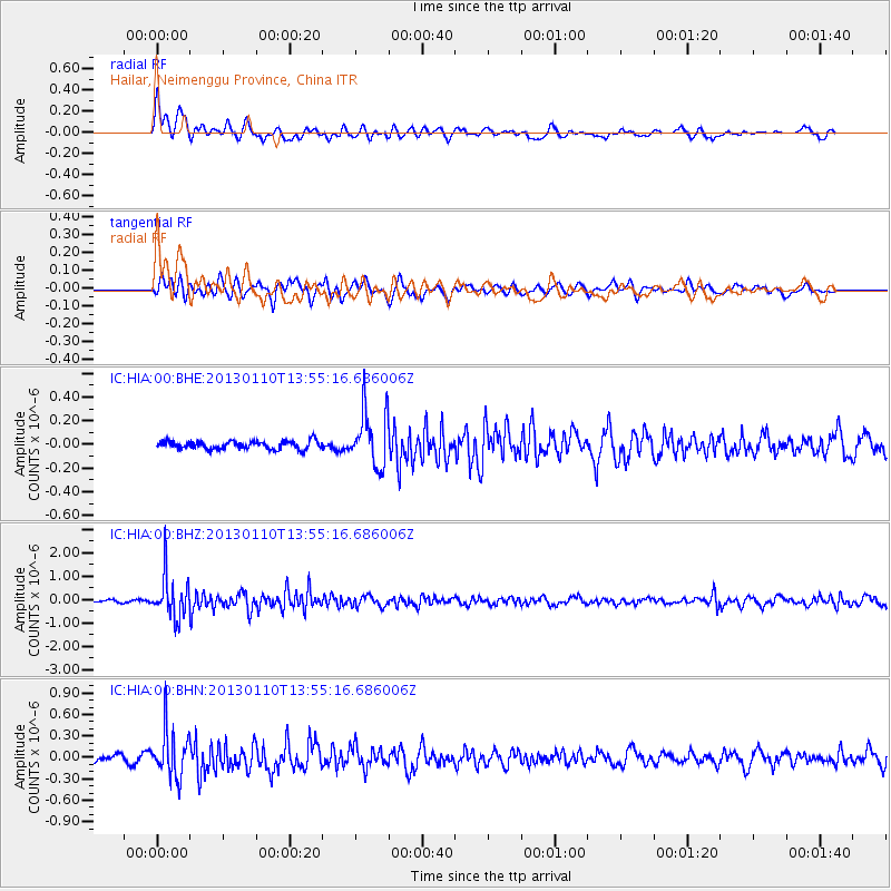
HIA Hailar, Neimenggu Province, China - Earthquake Result Viewer
*The percent match for this event was below the threshold and hence no stack was calculated.
| Earthquake location: |
Northern Sumatra, Indonesia |
| Earthquake latitude/longitude: |
4.7/95.1 |
| Earthquake time(UTC): |
2013/01/10 (010) 13:47:03 GMT |
| Earthquake Depth: |
38 km |
| Earthquake Magnitude: |
5.9 MB, 5.5 MS, 5.7 MW, 5.7 MW |
| Earthquake Catalog/Contributor: |
WHDF/NEIC |
|
| Network: |
IC New China Digital Seismograph Network |
| Station: |
HIA Hailar, Neimenggu Province, China |
| Lat/Lon: |
49.27 N/119.74 E |
| Elevation: |
620 m |
|
| Distance: |
49.1 deg |
| Az: |
21.194 deg |
| Baz: |
213.374 deg |
| Ray Param: |
$rayparam |
*The percent match for this event was below the threshold and hence was not used in the summary stack. |
|
| Radial Match: |
73.315605 % |
| Radial Bump: |
400 |
| Transverse Match: |
71.37108 % |
| Transverse Bump: |
400 |
| SOD ConfigId: |
493637 |
| Insert Time: |
2013-04-16 13:48:51.918 +0000 |
| GWidth: |
2.5 |
| Max Bumps: |
400 |
| Tol: |
0.001 |
|
Signal To Noise
| Channel | StoN | STA | LTA |
| IC:HIA:00:BHZ:20130110T13:55:16.686006Z | 9.375367 | 9.068316E-7 | 9.672491E-8 |
| IC:HIA:00:BHN:20130110T13:55:16.686006Z | 7.872127 | 3.2616862E-7 | 4.1433353E-8 |
| IC:HIA:00:BHE:20130110T13:55:16.686006Z | 6.6349645 | 2.3157767E-7 | 3.4902623E-8 |
| Arrivals |
| Ps | |
| PpPs | |
| PsPs/PpSs | |


