You are here: Home > Network List > PS - Pacific21 Stations List
> Station MCSJ Minamitorishima, Marcus Island, Japan > Earthquake Result Viewer
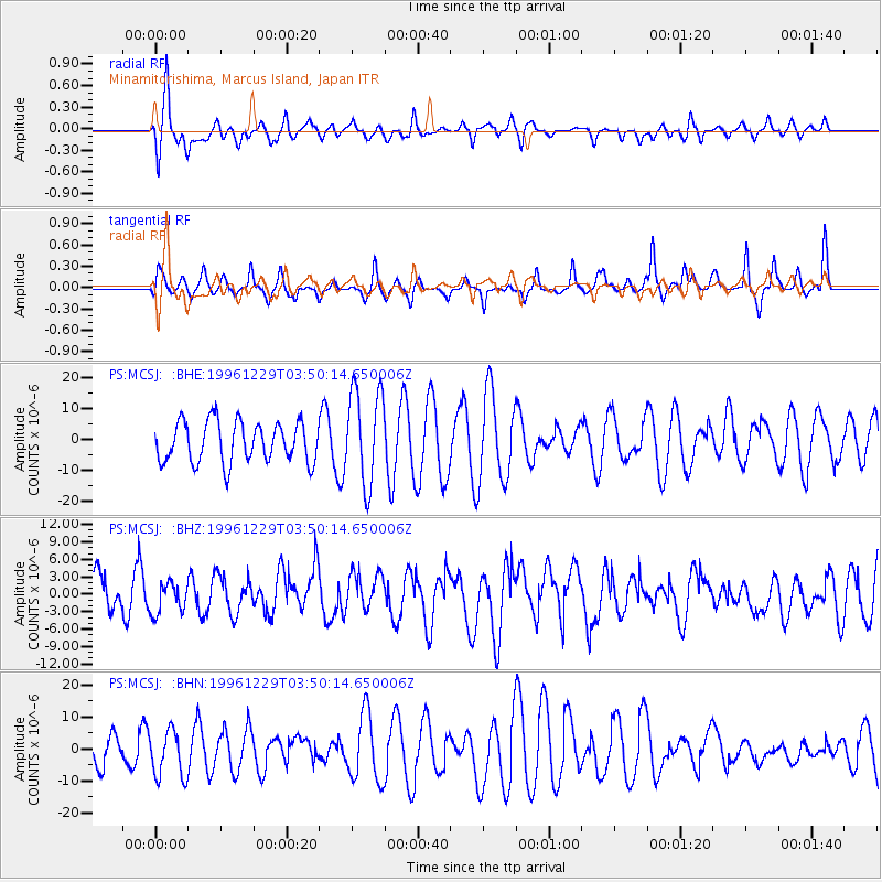
MCSJ Minamitorishima, Marcus Island, Japan - Earthquake Result Viewer
*The percent match for this event was below the threshold and hence no stack was calculated.
| Earthquake location: |
Tanimbar Islands Reg., Indonesia |
| Earthquake latitude/longitude: |
-6.9/131.1 |
| Earthquake time(UTC): |
1996/12/29 (364) 03:43:28 GMT |
| Earthquake Depth: |
31 km |
| Earthquake Magnitude: |
5.8 MB, 5.3 MS, 5.8 UNKNOWN, 5.8 MW |
| Earthquake Catalog/Contributor: |
WHDF/NEIC |
|
| Network: |
PS Pacific21 |
| Station: |
MCSJ Minamitorishima, Marcus Island, Japan |
| Lat/Lon: |
24.29 N/153.98 E |
| Elevation: |
10 m |
|
| Distance: |
38.2 deg |
| Az: |
35.06 deg |
| Baz: |
218.684 deg |
| Ray Param: |
$rayparam |
*The percent match for this event was below the threshold and hence was not used in the summary stack. |
|
| Radial Match: |
68.46852 % |
| Radial Bump: |
400 |
| Transverse Match: |
50.41639 % |
| Transverse Bump: |
302 |
| SOD ConfigId: |
4480 |
| Insert Time: |
2010-02-27 03:04:06.160 +0000 |
| GWidth: |
2.5 |
| Max Bumps: |
400 |
| Tol: |
0.001 |
|
Signal To Noise
| Channel | StoN | STA | LTA |
| PS:MCSJ: :BHZ:19961229T03:50:14.650006Z | 0.539938 | 2.721861E-6 | 5.041062E-6 |
| PS:MCSJ: :BHN:19961229T03:50:14.650006Z | 0.9186282 | 7.505765E-6 | 8.170623E-6 |
| PS:MCSJ: :BHE:19961229T03:50:14.650006Z | 2.3707669 | 1.556947E-5 | 6.567272E-6 |
| Arrivals |
| Ps | |
| PpPs | |
| PsPs/PpSs | |


