You are here: Home > Network List > PS - Pacific21 Stations List
> Station MCSJ Minamitorishima, Marcus Island, Japan > Earthquake Result Viewer
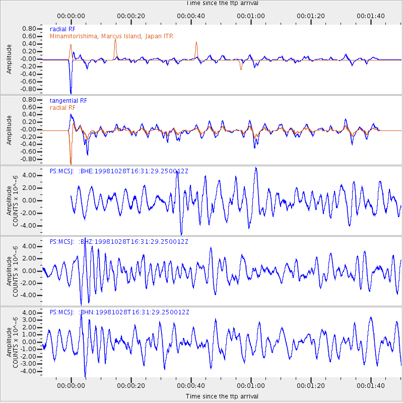
MCSJ Minamitorishima, Marcus Island, Japan - Earthquake Result Viewer
*The percent match for this event was below the threshold and hence no stack was calculated.
| Earthquake location: |
Northern Molucca Sea |
| Earthquake latitude/longitude: |
0.8/126.0 |
| Earthquake time(UTC): |
1998/10/28 (301) 16:25:03 GMT |
| Earthquake Depth: |
33 km |
| Earthquake Magnitude: |
6.2 MB, 6.2 MS, 6.6 UNKNOWN, 6.6 MW |
| Earthquake Catalog/Contributor: |
WHDF/NEIC |
|
| Network: |
PS Pacific21 |
| Station: |
MCSJ Minamitorishima, Marcus Island, Japan |
| Lat/Lon: |
24.29 N/153.98 E |
| Elevation: |
10 m |
|
| Distance: |
35.8 deg |
| Az: |
47.168 deg |
| Baz: |
233.473 deg |
| Ray Param: |
$rayparam |
*The percent match for this event was below the threshold and hence was not used in the summary stack. |
|
| Radial Match: |
79.21722 % |
| Radial Bump: |
249 |
| Transverse Match: |
58.053543 % |
| Transverse Bump: |
384 |
| SOD ConfigId: |
4480 |
| Insert Time: |
2010-02-27 03:04:11.283 +0000 |
| GWidth: |
2.5 |
| Max Bumps: |
400 |
| Tol: |
0.001 |
|
Signal To Noise
| Channel | StoN | STA | LTA |
| PS:MCSJ: :BHZ:19981028T16:31:29.250012Z | 3.7201486 | 2.5501133E-6 | 6.8548695E-7 |
| PS:MCSJ: :BHN:19981028T16:31:29.250012Z | 2.4581776 | 2.0012772E-6 | 8.1413043E-7 |
| PS:MCSJ: :BHE:19981028T16:31:29.250012Z | 0.6437762 | 8.2842456E-7 | 1.2868207E-6 |
| Arrivals |
| Ps | |
| PpPs | |
| PsPs/PpSs | |


