You are here: Home > Network List > PS - Pacific21 Stations List
> Station MCSJ Minamitorishima, Marcus Island, Japan > Earthquake Result Viewer
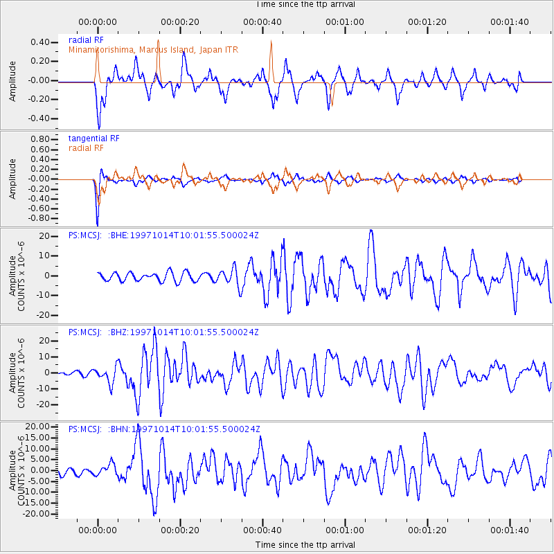
MCSJ Minamitorishima, Marcus Island, Japan - Earthquake Result Viewer
*The percent match for this event was below the threshold and hence no stack was calculated.
| Earthquake location: |
South Of Fiji Islands |
| Earthquake latitude/longitude: |
-22.1/-176.8 |
| Earthquake time(UTC): |
1997/10/14 (287) 09:53:18 GMT |
| Earthquake Depth: |
167 km |
| Earthquake Magnitude: |
6.7 MB, 7.7 UNKNOWN, 7.4 ME |
| Earthquake Catalog/Contributor: |
WHDF/NEIC |
|
| Network: |
PS Pacific21 |
| Station: |
MCSJ Minamitorishima, Marcus Island, Japan |
| Lat/Lon: |
24.29 N/153.98 E |
| Elevation: |
10 m |
|
| Distance: |
54.2 deg |
| Az: |
326.639 deg |
| Baz: |
146.021 deg |
| Ray Param: |
$rayparam |
*The percent match for this event was below the threshold and hence was not used in the summary stack. |
|
| Radial Match: |
71.74331 % |
| Radial Bump: |
400 |
| Transverse Match: |
90.40557 % |
| Transverse Bump: |
226 |
| SOD ConfigId: |
4480 |
| Insert Time: |
2010-02-27 03:04:42.125 +0000 |
| GWidth: |
2.5 |
| Max Bumps: |
400 |
| Tol: |
0.001 |
|
Signal To Noise
| Channel | StoN | STA | LTA |
| PS:MCSJ: :BHZ:19971014T10:01:55.500024Z | 7.7245355 | 5.1289226E-6 | 6.6397814E-7 |
| PS:MCSJ: :BHN:19971014T10:01:55.500024Z | 1.7915446 | 2.7483359E-6 | 1.5340594E-6 |
| PS:MCSJ: :BHE:19971014T10:01:55.500024Z | 2.071489 | 4.5281067E-6 | 2.1859187E-6 |
| Arrivals |
| Ps | |
| PpPs | |
| PsPs/PpSs | |


