You are here: Home > Network List > IC - New China Digital Seismograph Network Stations List
> Station HIA Hailar, Neimenggu Autonomous Region, China > Earthquake Result Viewer
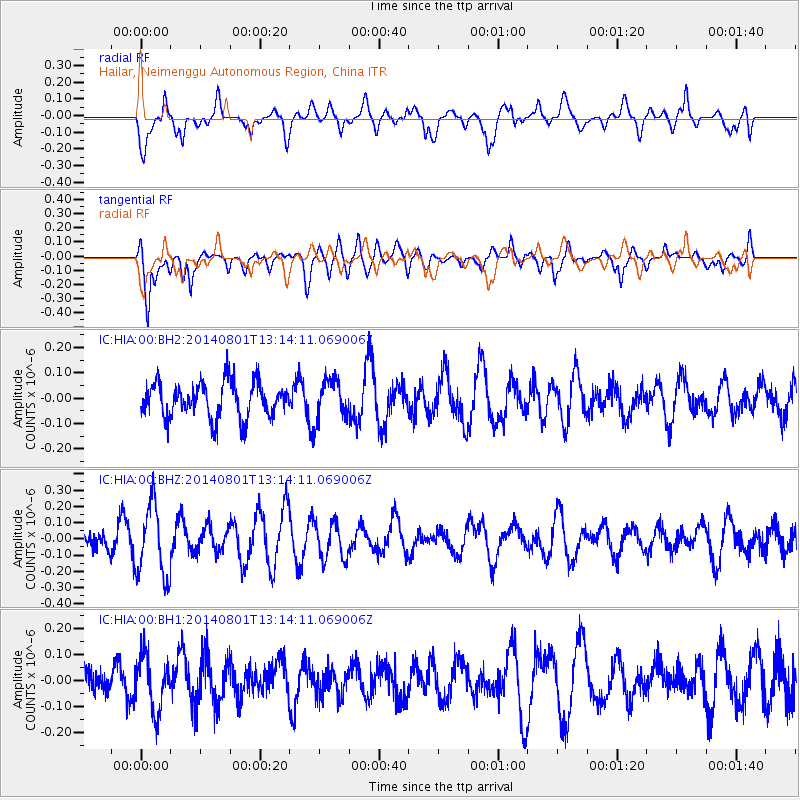
HIA Hailar, Neimenggu Autonomous Region, China - Earthquake Result Viewer
*The percent match for this event was below the threshold and hence no stack was calculated.
| Earthquake location: |
Tonga Islands |
| Earthquake latitude/longitude: |
-17.6/-173.6 |
| Earthquake time(UTC): |
2014/08/01 (213) 13:01:52 GMT |
| Earthquake Depth: |
39 km |
| Earthquake Magnitude: |
5.0 MW |
| Earthquake Catalog/Contributor: |
ISC/ISC |
|
| Network: |
IC New China Digital Seismograph Network |
| Station: |
HIA Hailar, Neimenggu Autonomous Region, China |
| Lat/Lon: |
49.27 N/119.74 E |
| Elevation: |
620 m |
|
| Distance: |
88.8 deg |
| Az: |
323.03 deg |
| Baz: |
118.876 deg |
| Ray Param: |
$rayparam |
*The percent match for this event was below the threshold and hence was not used in the summary stack. |
|
| Radial Match: |
52.90195 % |
| Radial Bump: |
400 |
| Transverse Match: |
68.57092 % |
| Transverse Bump: |
400 |
| SOD ConfigId: |
3390531 |
| Insert Time: |
2019-04-13 03:40:09.504 +0000 |
| GWidth: |
2.5 |
| Max Bumps: |
400 |
| Tol: |
0.001 |
|
Signal To Noise
| Channel | StoN | STA | LTA |
| IC:HIA:00:BHZ:20140801T13:14:11.069006Z | 2.3121104 | 2.239565E-7 | 9.686237E-8 |
| IC:HIA:00:BH1:20140801T13:14:11.069006Z | 1.5421072 | 1.0330946E-7 | 6.69924E-8 |
| IC:HIA:00:BH2:20140801T13:14:11.069006Z | 1.1670393 | 8.1316344E-8 | 6.9677476E-8 |
| Arrivals |
| Ps | |
| PpPs | |
| PsPs/PpSs | |


