You are here: Home > Network List > IU - Global Seismograph Network (GSN - IRIS/USGS) Stations List
> Station KOWA Kowa, Mali > Earthquake Result Viewer
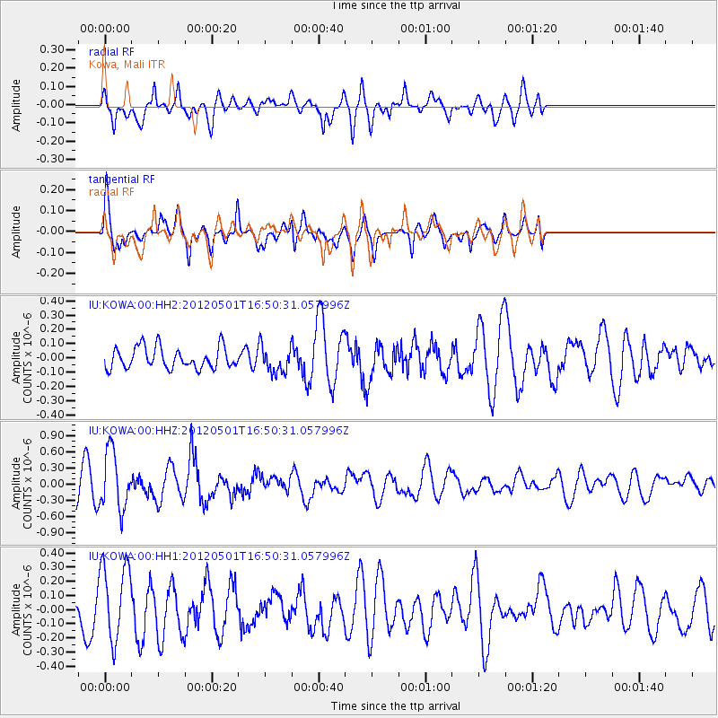
KOWA Kowa, Mali - Earthquake Result Viewer
*The percent match for this event was below the threshold and hence no stack was calculated.
| Earthquake location: |
Guerrero, Mexico |
| Earthquake latitude/longitude: |
18.3/-101.1 |
| Earthquake time(UTC): |
2012/05/01 (122) 16:37:58 GMT |
| Earthquake Depth: |
51 km |
| Earthquake Magnitude: |
5.7 MW, 5.5 MB, 5.7 MW |
| Earthquake Catalog/Contributor: |
NEIC PDE/NEIC PDE-M |
|
| Network: |
IU Global Seismograph Network (GSN - IRIS/USGS) |
| Station: |
KOWA Kowa, Mali |
| Lat/Lon: |
14.50 N/4.01 W |
| Elevation: |
321 m |
|
| Distance: |
92.1 deg |
| Az: |
74.116 deg |
| Baz: |
289.318 deg |
| Ray Param: |
$rayparam |
*The percent match for this event was below the threshold and hence was not used in the summary stack. |
|
| Radial Match: |
68.934845 % |
| Radial Bump: |
400 |
| Transverse Match: |
69.02552 % |
| Transverse Bump: |
400 |
| SOD ConfigId: |
558545 |
| Insert Time: |
2013-09-19 17:42:05.550 +0000 |
| GWidth: |
2.5 |
| Max Bumps: |
400 |
| Tol: |
0.001 |
|
Signal To Noise
| Channel | StoN | STA | LTA |
| IU:KOWA:00:HHZ:20120501T16:50:31.057996Z | 2.3290005 | 5.472843E-7 | 2.3498676E-7 |
| IU:KOWA:00:HH1:20120501T16:50:31.057996Z | 2.134836 | 2.7510174E-7 | 1.2886318E-7 |
| IU:KOWA:00:HH2:20120501T16:50:31.057996Z | 1.2639076 | 9.456383E-8 | 7.481863E-8 |
| Arrivals |
| Ps | |
| PpPs | |
| PsPs/PpSs | |


