
Station IU KOWA - Kowa, Mali
Network: IU - Global Seismograph Network (GSN - IRIS/USGS)
Nearby stations (2 deg radius)
| Station | Name | (Lat, Lon) | Start / End | Elevation |
| KOWA | Kowa, Mali | (14.50, -4.01) | 1998-03-08 / 2599-12-31 | 321 m |
| KOWA | Kowa, Mali | (14.50, -4.01) | 2011-05-27 / 2599-12-31 | 321 m |
| Crust2 Type: | G3,Archean 2.0 km seds. |
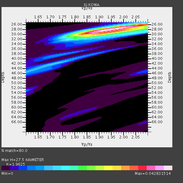
| Thickness Estimate: | 28 km |
| Thickness StdDev: | 1.0 km |
| Vp/Vs Estimate: | 1.96 |
| Vp/Vs StdDev: | 0.06 |
| Vs Estimate: | 3.215 km/s |
| Poisson's Ratio: | 0.32 |
| Peak Value: | 0.04 |
| Assumed Vp: | 6.31 km/s |
| Ps Weight: | 0.33333334 |
| PpPs Weight: | 0.33333334 |
| PsPs Weight: | 0.33333328 |
| Residual Complexity: | 0.500 |
| Nearby stations H: | +- |
| (2.0 deg) Vp/Vs: | +- |
4 with match > 90% ( 50.0 %) and 5 with match > 80% ( 62.5 %) out of 8.
Download stack as xyz text file.
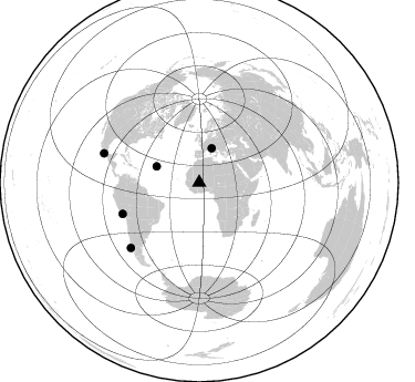
Azimuth Distribution of Events:
Prior Results for this Station
| Study | Thickness | Vp/Vs | Vp | Vs | Poissons Ratio | Extra |
| EARS | 28 km | 1.96 | 6.31 km/s | 3.215 km/s | 0.32 | |
| Crust2.0 | 41 km | 1.77 | 6.31 km/s | 3.568 km/s | 0.26 | G3,Archean 2.0 km seds. |
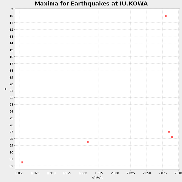
| Global Maxima | 28 km | 1.96 | 6.31 km/s | 3.215 km/s | 0.32 | amp=0.042831514 |
| Local Maxima 1 | 29 km | 1.93 | 6.31 km/s | 3.274 km/s | 0.32 | amp=0.021497454 |
| Local Maxima 2 | 29 km | 2.10 | 6.31 km/s | 3.012 km/s | 0.35 | amp=0.014157422 |
| Local Maxima 3 | 42 km | 1.73 | 6.31 km/s | 3.653 km/s | 0.25 | amp=0.013042082 |
| Local Maxima 4 | 26 km | 2.09 | 6.31 km/s | 3.015 km/s | 0.35 | amp=0.011053228 |
| Predicted Arrivals for vertical incidence (zero ray parameter) | |
| Ps | 4.19 SECOND |
| PpPs | 12.91 SECOND |
| PsPs/PpSs | 17.11 SECOND |
Events Processed for this Station
Download zip of receiver functions as SAC
Plot maxima for each earthquake.
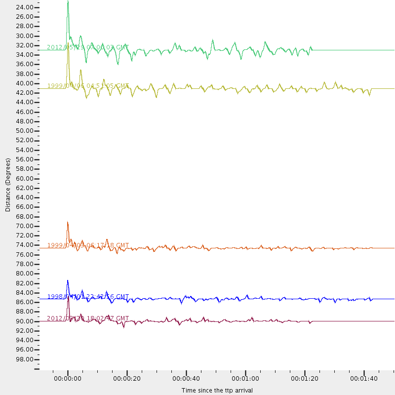
Events Used in the Stack
(5 events)| Radial Match | Distance | Baz | FERegion | Time | Lat/Lon | Depth | Magnitude |
| 97.40414 | 74.5 deg | 247.885 deg | Near Coast Of Peru | 1999/04/03 06:17:18 GMT | (-16.7, -72.7) | 87 km | 6.1 MB, 6.2 MS, 6.8 MW, 6.8 MW |
| 96.43893 | 89.9 deg | 286.908 deg | Near Coast Of Guerrero, Mexico | 2012/03/20 18:02:47 GMT | (16.5, -98.2) | 20 km | 6.6 MB, 7.6 MS, 7.4 MW, 7.4 MW |
| 93.078255 | 85.3 deg | 226.455 deg | Off Coast Of Southern Chile | 1998/04/01 22:42:56 GMT | (-40.3, -74.9) | 9.0 km | 6.2 MB, 6.0 MS, 6.7 UNKNOWN, 6.6 ME |
| 91.7169 | 41.0 deg | 290.629 deg | Northern Mid-Atlantic Ridge | 1999/04/06 04:51:05 GMT | (24.5, -46.4) | 10 km | 5.6 MS, 5.3 MB, 5.9 MW, 5.8 MW |
| 82.312126 | 32.9 deg | 19.969 deg | Northern Italy | 2012/05/29 07:00:03 GMT | (44.9, 11.1) | 10 km | 5.9 MB, 5.8 MS, 5.8 MW, 5.8 MW |
Losers
(3 events)| Radial Match | Distance | Baz | FERegion | Time | Lat/Lon | Depth | Magnitude | Reason |
| 74.443695 | 71.4 deg | 233.165 deg | Santiago Del Estero Prov., Arg. | 2012/03/05 07:46:10 GMT | (-28.2, -63.3) | 554 km | 6.0 MB, 6.1 MW, 6.1 MW | |
| 72.62606 | 31.7 deg | 41.245 deg | Southern Greece | 2012/04/16 11:23:43 GMT | (36.6, 21.5) | 29 km | 5.8 MW, 5.7 MW | |
| 68.934845 | 92.1 deg | 289.318 deg | Guerrero, Mexico | 2012/05/01 16:37:58 GMT | (18.3, -101.1) | 51 km | 5.7 MW, 5.5 MB, 5.7 MW |
