059A Moore Haven, FL, USA - Earthquake Result Viewer
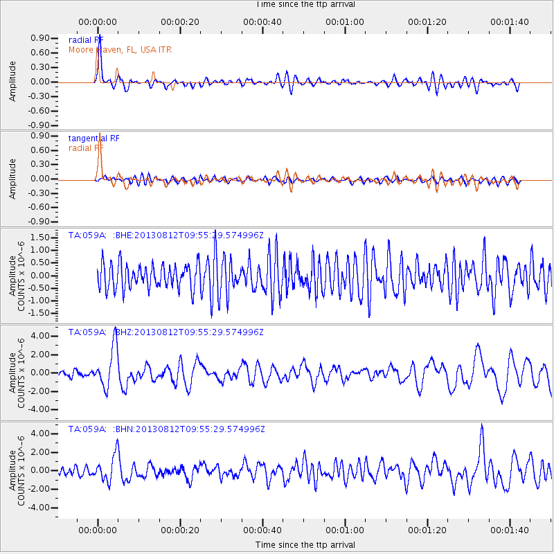
Earthquake location: Near Coast Of Northern Peru
Earthquake latitude/longitude: -5.4/-81.9
Earthquake time(UTC): 2013/08/12 (224) 09:49:32 GMT
Earthquake Depth: 10 km
Earthquake Magnitude: 6.2 MWW, 6.1 MWB, 6.2 MWW, 6.2 MWC, 6.3 MWC
Earthquake Catalog/Contributor: NEIC PDE/NEIC COMCAT
Network: TA USArray Transportable Network (new EarthScope stations)
Station: 059A Moore Haven, FL, USA
Lat/Lon: 26.97 N/81.14 W
Elevation: 11 m
Distance: 32.2 deg
Az: 1.312 deg
Baz: 181.463 deg
Ray Param: 0.078761
Estimated Moho Depth: 11.5 km
Estimated Crust Vp/Vs: 2.10
Assumed Crust Vp: 6.347 km/s
Estimated Crust Vs: 3.026 km/s
Estimated Crust Poisson's Ratio: 0.35
Radial Match: 84.93819 %
Radial Bump: 400
Transverse Match: 36.58815 %
Transverse Bump: 400
SOD ConfigId: 626651
Insert Time: 2014-04-17 23:17:22.027 +0000
GWidth: 2.5
Max Bumps: 400
Tol: 0.001

Signal To Noise

ChannelStoNSTALTA
TA:059A: :BHZ:20130812T09:55:29.574996Z8.8970522.3019472E-62.5873143E-7
TA:059A: :BHN:20130812T09:55:29.574996Z2.85995821.4085059E-64.924918E-7
TA:059A: :BHE:20130812T09:55:29.574996Z1.42061676.610446E-74.6532227E-7
Arrivals
Ps2.1 SECOND
PpPs5.3 SECOND
PsPs/PpSs7.4 SECOND