758A Lake Helen, FL, USA - Earthquake Result Viewer
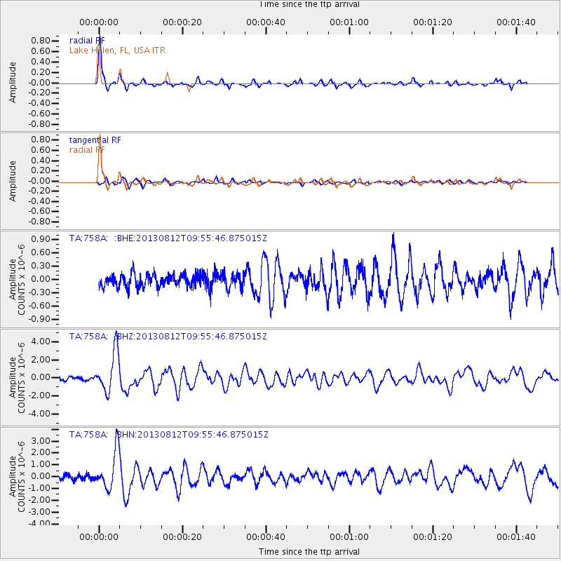
Earthquake location: Near Coast Of Northern Peru
Earthquake latitude/longitude: -5.4/-81.9
Earthquake time(UTC): 2013/08/12 (224) 09:49:32 GMT
Earthquake Depth: 10 km
Earthquake Magnitude: 6.2 MWW, 6.1 MWB, 6.2 MWW, 6.2 MWC, 6.3 MWC
Earthquake Catalog/Contributor: NEIC PDE/NEIC COMCAT
Network: TA USArray Transportable Network (new EarthScope stations)
Station: 758A Lake Helen, FL, USA
Lat/Lon: 28.96 N/81.20 W
Elevation: 16 m
Distance: 34.2 deg
Az: 1.135 deg
Baz: 181.289 deg
Ray Param: 0.07787197
Estimated Moho Depth: 56.5 km
Estimated Crust Vp/Vs: 1.77
Assumed Crust Vp: 6.134 km/s
Estimated Crust Vs: 3.465 km/s
Estimated Crust Poisson's Ratio: 0.27
Radial Match: 90.627205 %
Radial Bump: 332
Transverse Match: 80.68793 %
Transverse Bump: 400
SOD ConfigId: 626651
Insert Time: 2014-04-17 23:20:51.521 +0000
GWidth: 2.5
Max Bumps: 400
Tol: 0.001

Signal To Noise

ChannelStoNSTALTA
TA:758A: :BHZ:20130812T09:55:46.875015Z11.8735962.2887498E-61.9275963E-7
TA:758A: :BHN:20130812T09:55:46.875015Z9.4145421.6576312E-61.7607135E-7
TA:758A: :BHE:20130812T09:55:46.875015Z1.16093921.6066497E-71.3839224E-7
Arrivals
Ps7.6 SECOND
PpPs24 SECOND
PsPs/PpSs31 SECOND