
858A St. Cloud, FL, USA - Earthquake Result Viewer
| ||||||||||||||||||
| ||||||||||||||||||
| ||||||||||||||||||
|
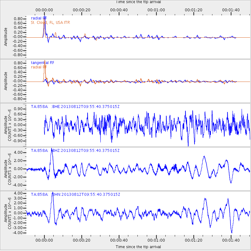
Signal To Noise
| Channel | StoN | STA | LTA |
| TA:858A: :BHZ:20130812T09:55:40.375015Z | 13.641891 | 2.211044E-6 | 1.6207753E-7 |
| TA:858A: :BHN:20130812T09:55:40.375015Z | 6.681759 | 1.8058499E-6 | 2.7026564E-7 |
| TA:858A: :BHE:20130812T09:55:40.375015Z | 1.2414724 | 3.4266455E-7 | 2.7601465E-7 |
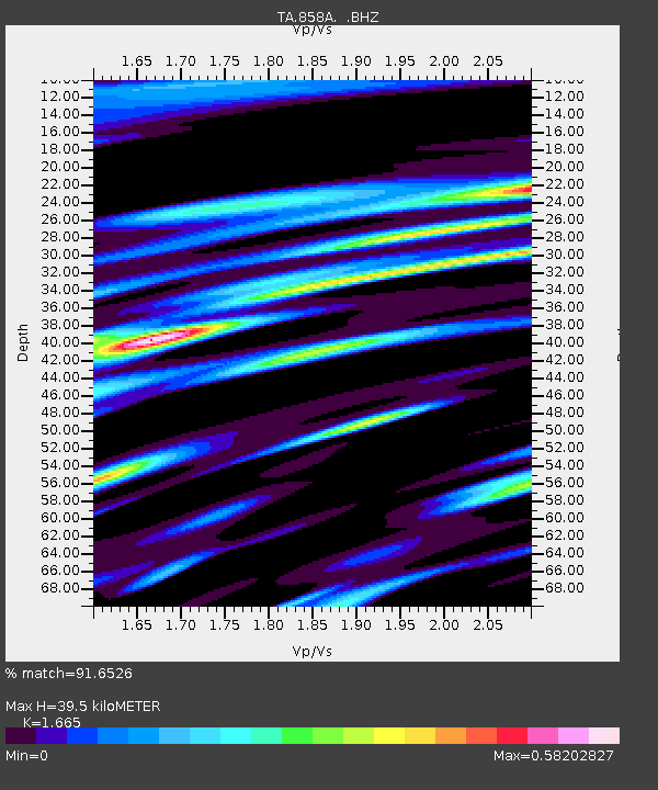
| Arrivals | |
| Ps | 4.6 SECOND |
| PpPs | 16 SECOND |
| PsPs/PpSs | 21 SECOND |

