You are here: Home > Network List > TA - USArray Transportable Network (new EarthScope stations) Stations List
> Station S61A Accomac, VA, USA > Earthquake Result Viewer
S61A Accomac, VA, USA - Earthquake Result Viewer
*The percent match for this event was below the threshold and hence no stack was calculated.
| Earthquake location: |
Near Coast Of Northern Peru |
| Earthquake latitude/longitude: |
-5.4/-81.9 |
| Earthquake time(UTC): |
2013/08/12 (224) 09:49:32 GMT |
| Earthquake Depth: |
10 km |
| Earthquake Magnitude: |
6.2 MWW, 6.1 MWB, 6.2 MWW, 6.2 MWC, 6.3 MWC |
| Earthquake Catalog/Contributor: |
NEIC PDE/NEIC COMCAT |
|
| Network: |
TA USArray Transportable Network (new EarthScope stations) |
| Station: |
S61A Accomac, VA, USA |
| Lat/Lon: |
37.68 N/75.67 W |
| Elevation: |
58 m |
|
| Distance: |
43.2 deg |
| Az: |
7.247 deg |
| Baz: |
189.108 deg |
| Ray Param: |
$rayparam |
*The percent match for this event was below the threshold and hence was not used in the summary stack. |
|
| Radial Match: |
83.77081 % |
| Radial Bump: |
367 |
| Transverse Match: |
66.36794 % |
| Transverse Bump: |
400 |
| SOD ConfigId: |
626651 |
| Insert Time: |
2014-04-17 23:34:24.795 +0000 |
| GWidth: |
2.5 |
| Max Bumps: |
400 |
| Tol: |
0.001 |
|
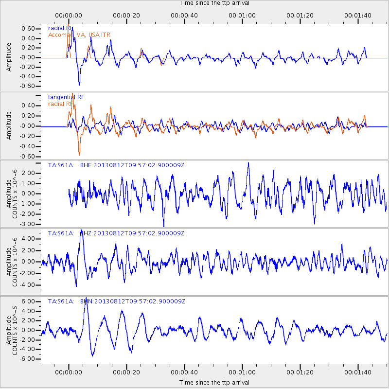
Signal To Noise
| Channel | StoN | STA | LTA |
| TA:S61A: :BHZ:20130812T09:57:02.900009Z | 3.8133204 | 2.6455093E-6 | 6.9375477E-7 |
| TA:S61A: :BHN:20130812T09:57:02.900009Z | 1.2198132 | 9.349611E-7 | 7.6647893E-7 |
| TA:S61A: :BHE:20130812T09:57:02.900009Z | 1.6164488 | 1.2089578E-6 | 7.479098E-7 |
| Arrivals |
| Ps | |
| PpPs | |
| PsPs/PpSs | |


