You are here: Home > Network List > IC - New China Digital Seismograph Network Stations List
> Station HIA Hailar, Neimenggu Autonomous Region, China > Earthquake Result Viewer
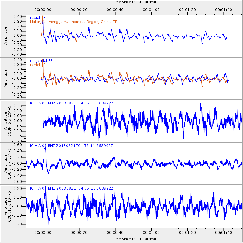
HIA Hailar, Neimenggu Autonomous Region, China - Earthquake Result Viewer
*The percent match for this event was below the threshold and hence no stack was calculated.
| Earthquake location: |
Southeast Of Loyalty Islands |
| Earthquake latitude/longitude: |
-22.3/171.7 |
| Earthquake time(UTC): |
2013/08/21 (233) 04:43:18 GMT |
| Earthquake Depth: |
92 km |
| Earthquake Magnitude: |
5.7 MWW, 5.7 MWB, 5.7 MWC |
| Earthquake Catalog/Contributor: |
NEIC PDE/NEIC COMCAT |
|
| Network: |
IC New China Digital Seismograph Network |
| Station: |
HIA Hailar, Neimenggu Autonomous Region, China |
| Lat/Lon: |
49.27 N/119.74 E |
| Elevation: |
620 m |
|
| Distance: |
84.9 deg |
| Az: |
328.822 deg |
| Baz: |
132.947 deg |
| Ray Param: |
$rayparam |
*The percent match for this event was below the threshold and hence was not used in the summary stack. |
|
| Radial Match: |
67.88398 % |
| Radial Bump: |
391 |
| Transverse Match: |
62.616123 % |
| Transverse Bump: |
400 |
| SOD ConfigId: |
626651 |
| Insert Time: |
2014-04-18 01:36:32.460 +0000 |
| GWidth: |
2.5 |
| Max Bumps: |
400 |
| Tol: |
0.001 |
|
Signal To Noise
| Channel | StoN | STA | LTA |
| IC:HIA:00:BHZ:20130821T04:55:11.568992Z | 4.057497 | 2.6201016E-7 | 6.457433E-8 |
| IC:HIA:00:BH1:20130821T04:55:11.568992Z | 2.2908528 | 1.009049E-7 | 4.4046875E-8 |
| IC:HIA:00:BH2:20130821T04:55:11.568992Z | 1.835399 | 7.813726E-8 | 4.2572356E-8 |
| Arrivals |
| Ps | |
| PpPs | |
| PsPs/PpSs | |


