
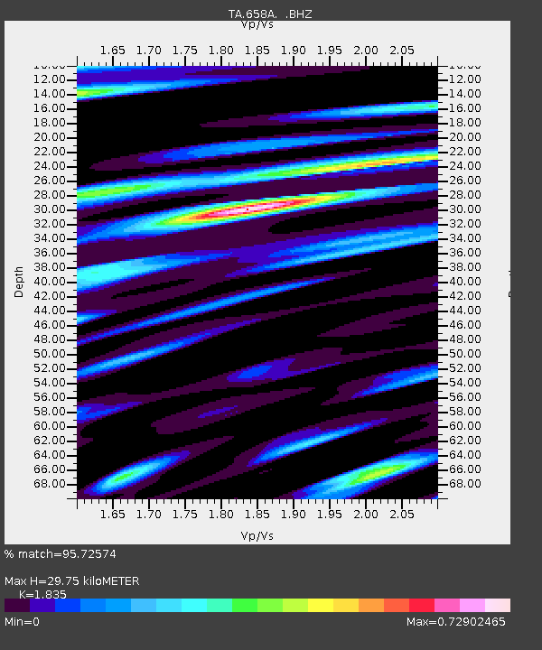
658A Bunnell, FL, USA - Earthquake Result Viewer
| ||||||||||||||||||
| ||||||||||||||||||
| ||||||||||||||||||
|
Signal To Noise
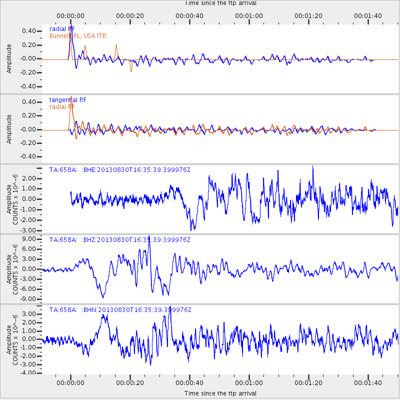
| Channel | StoN | STA | LTA |
| TA:658A: :BHZ:20130830T16:35:39.399976Z | 4.9303293 | 1.6629186E-6 | 3.3728347E-7 |
| TA:658A: :BHN:20130830T16:35:39.399976Z | 1.9273449 | 6.1731356E-7 | 3.2029223E-7 |
| TA:658A: :BHE:20130830T16:35:39.399976Z | 2.021297 | 6.315028E-7 | 3.1242453E-7 |
| Arrivals | |
| Ps | 4.2 SECOND |
| PpPs | 13 SECOND |
| PsPs/PpSs | 17 SECOND |

