You are here: Home > Network List > IC - New China Digital Seismograph Network Stations List
> Station HIA Hailar, Neimenggu Autonomous Region, China > Earthquake Result Viewer
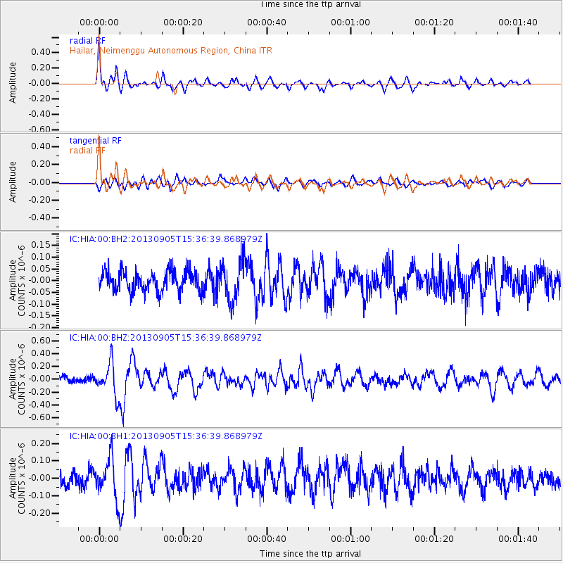
HIA Hailar, Neimenggu Autonomous Region, China - Earthquake Result Viewer
*The percent match for this event was below the threshold and hence no stack was calculated.
| Earthquake location: |
Near S Coast Of New Guinea, P.N.G. |
| Earthquake latitude/longitude: |
-7.3/144.0 |
| Earthquake time(UTC): |
2013/09/05 (248) 15:27:03 GMT |
| Earthquake Depth: |
9.6 km |
| Earthquake Magnitude: |
5.5 MW, 5.3 MWB, 5.5 MWC |
| Earthquake Catalog/Contributor: |
NEIC PDE/NEIC COMCAT |
|
| Network: |
IC New China Digital Seismograph Network |
| Station: |
HIA Hailar, Neimenggu Autonomous Region, China |
| Lat/Lon: |
49.27 N/119.74 E |
| Elevation: |
620 m |
|
| Distance: |
60.2 deg |
| Az: |
341.905 deg |
| Baz: |
151.938 deg |
| Ray Param: |
$rayparam |
*The percent match for this event was below the threshold and hence was not used in the summary stack. |
|
| Radial Match: |
76.51767 % |
| Radial Bump: |
400 |
| Transverse Match: |
55.891705 % |
| Transverse Bump: |
400 |
| SOD ConfigId: |
626651 |
| Insert Time: |
2014-04-18 14:18:09.731 +0000 |
| GWidth: |
2.5 |
| Max Bumps: |
400 |
| Tol: |
0.001 |
|
Signal To Noise
| Channel | StoN | STA | LTA |
| IC:HIA:00:BHZ:20130905T15:36:39.868979Z | 6.1376014 | 2.6363543E-7 | 4.2954145E-8 |
| IC:HIA:00:BH1:20130905T15:36:39.868979Z | 2.6720092 | 1.2056319E-7 | 4.51208E-8 |
| IC:HIA:00:BH2:20130905T15:36:39.868979Z | 2.0446131 | 8.6592394E-8 | 4.235148E-8 |
| Arrivals |
| Ps | |
| PpPs | |
| PsPs/PpSs | |


