
658A Bunnell, FL, USA - Earthquake Result Viewer
| ||||||||||||||||||
| ||||||||||||||||||
| ||||||||||||||||||
|
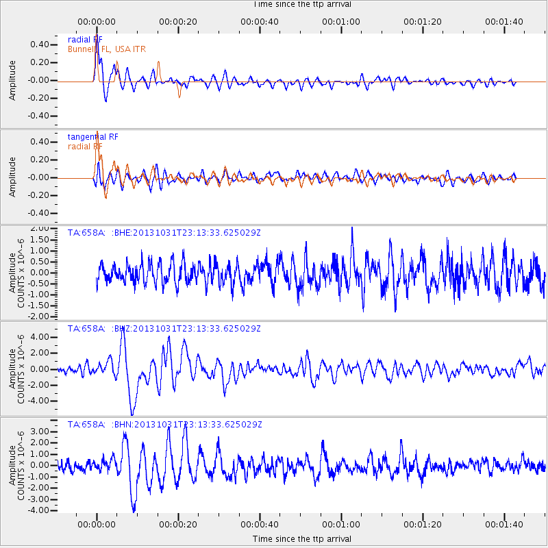
Signal To Noise
| Channel | StoN | STA | LTA |
| TA:658A: :BHZ:20131031T23:13:33.625029Z | 2.6358767 | 8.618566E-7 | 3.2697153E-7 |
| TA:658A: :BHN:20131031T23:13:33.625029Z | 1.3809156 | 5.095068E-7 | 3.68963E-7 |
| TA:658A: :BHE:20131031T23:13:33.625029Z | 1.1126736 | 4.69614E-7 | 4.2205906E-7 |
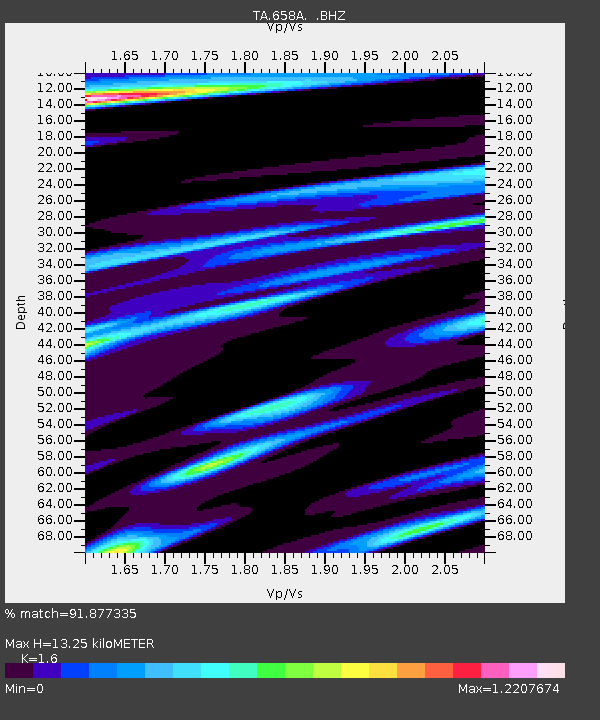
| Arrivals | |
| Ps | 1.4 SECOND |
| PpPs | 5.4 SECOND |
| PsPs/PpSs | 6.7 SECOND |

