You are here: Home > Network List > IC - New China Digital Seismograph Network Stations List
> Station HIA Hailar, Neimenggu Autonomous Region, China > Earthquake Result Viewer
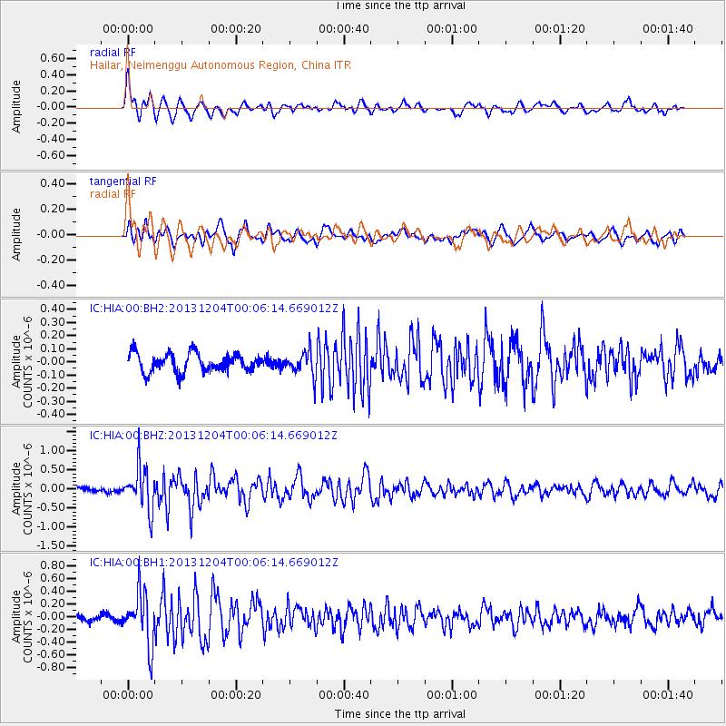
HIA Hailar, Neimenggu Autonomous Region, China - Earthquake Result Viewer
*The percent match for this event was below the threshold and hence no stack was calculated.
| Earthquake location: |
Mindanao, Philippines |
| Earthquake latitude/longitude: |
6.6/126.2 |
| Earthquake time(UTC): |
2013/12/03 (337) 23:58:49 GMT |
| Earthquake Depth: |
30 km |
| Earthquake Magnitude: |
5.6 MWB, 5.6 MWC |
| Earthquake Catalog/Contributor: |
NEIC PDE/NEIC COMCAT |
|
| Network: |
IC New China Digital Seismograph Network |
| Station: |
HIA Hailar, Neimenggu Autonomous Region, China |
| Lat/Lon: |
49.27 N/119.74 E |
| Elevation: |
620 m |
|
| Distance: |
42.8 deg |
| Az: |
353.804 deg |
| Baz: |
170.579 deg |
| Ray Param: |
$rayparam |
*The percent match for this event was below the threshold and hence was not used in the summary stack. |
|
| Radial Match: |
63.400307 % |
| Radial Bump: |
400 |
| Transverse Match: |
52.233562 % |
| Transverse Bump: |
395 |
| SOD ConfigId: |
626651 |
| Insert Time: |
2014-04-19 23:01:32.187 +0000 |
| GWidth: |
2.5 |
| Max Bumps: |
400 |
| Tol: |
0.001 |
|
Signal To Noise
| Channel | StoN | STA | LTA |
| IC:HIA:00:BHZ:20131204T00:06:14.669012Z | 11.005989 | 5.7306187E-7 | 5.2068184E-8 |
| IC:HIA:00:BH1:20131204T00:06:14.669012Z | 7.146248 | 4.2361563E-7 | 5.927805E-8 |
| IC:HIA:00:BH2:20131204T00:06:14.669012Z | 1.3144937 | 9.3299434E-8 | 7.0977464E-8 |
| Arrivals |
| Ps | |
| PpPs | |
| PsPs/PpSs | |


