You are here: Home > Network List > IC - New China Digital Seismograph Network Stations List
> Station HIA Hailar, Neimenggu Autonomous Region, China > Earthquake Result Viewer
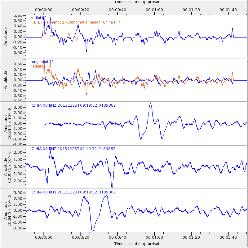
HIA Hailar, Neimenggu Autonomous Region, China - Earthquake Result Viewer
*The percent match for this event was below the threshold and hence no stack was calculated.
| Earthquake location: |
South Of Mariana Islands |
| Earthquake latitude/longitude: |
12.8/143.0 |
| Earthquake time(UTC): |
2013/12/23 (357) 09:12:27 GMT |
| Earthquake Depth: |
92 km |
| Earthquake Magnitude: |
5.8 MWW, 5.9 MWC, 5.9 MWB |
| Earthquake Catalog/Contributor: |
NEIC PDE/NEIC COMCAT |
|
| Network: |
IC New China Digital Seismograph Network |
| Station: |
HIA Hailar, Neimenggu Autonomous Region, China |
| Lat/Lon: |
49.27 N/119.74 E |
| Elevation: |
620 m |
|
| Distance: |
41.2 deg |
| Az: |
336.823 deg |
| Baz: |
144.113 deg |
| Ray Param: |
$rayparam |
*The percent match for this event was below the threshold and hence was not used in the summary stack. |
|
| Radial Match: |
66.696884 % |
| Radial Bump: |
325 |
| Transverse Match: |
61.162594 % |
| Transverse Bump: |
393 |
| SOD ConfigId: |
626651 |
| Insert Time: |
2014-04-20 03:40:25.361 +0000 |
| GWidth: |
2.5 |
| Max Bumps: |
400 |
| Tol: |
0.001 |
|
Signal To Noise
| Channel | StoN | STA | LTA |
| IC:HIA:00:BHZ:20131223T09:19:32.018988Z | 6.2199287 | 1.3117952E-6 | 2.1090197E-7 |
| IC:HIA:00:BH1:20131223T09:19:32.018988Z | 4.865957 | 6.2221534E-7 | 1.2787112E-7 |
| IC:HIA:00:BH2:20131223T09:19:32.018988Z | 2.3870351 | 3.3213948E-7 | 1.391431E-7 |
| Arrivals |
| Ps | |
| PpPs | |
| PsPs/PpSs | |


