
N63A Mattituck, NY, USA - Earthquake Result Viewer
| ||||||||||||||||||
| ||||||||||||||||||
| ||||||||||||||||||
|
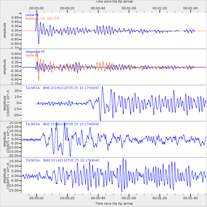
Signal To Noise
| Channel | StoN | STA | LTA |
| TA:N63A: :BHZ:20140310T05:25:10.174994Z | 6.207682 | 3.3106946E-6 | 5.333222E-7 |
| TA:N63A: :BHN:20140310T05:25:10.174994Z | 1.4634391 | 1.8163438E-6 | 1.2411475E-6 |
| TA:N63A: :BHE:20140310T05:25:10.174994Z | 1.5506952 | 2.4217877E-6 | 1.5617434E-6 |
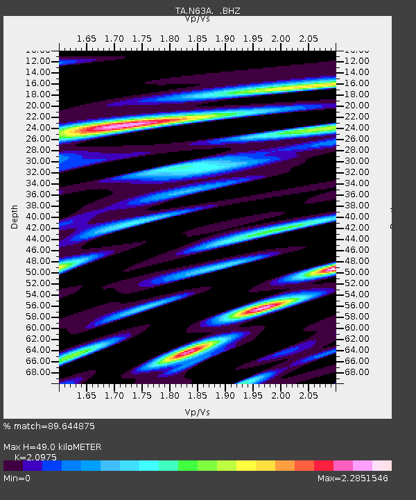
| Arrivals | |
| Ps | 8.8 SECOND |
| PpPs | 22 SECOND |
| PsPs/PpSs | 31 SECOND |

