You are here: Home > Network List > IC - New China Digital Seismograph Network Stations List
> Station HIA Hailar, Neimenggu Autonomous Region, China > Earthquake Result Viewer
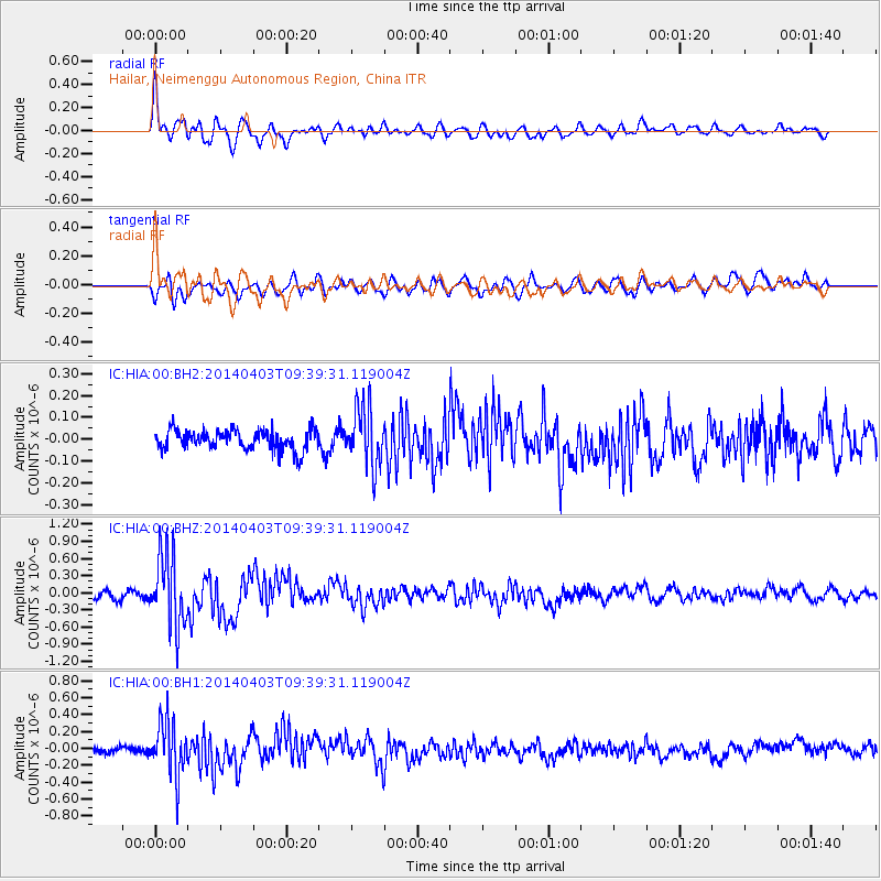
HIA Hailar, Neimenggu Autonomous Region, China - Earthquake Result Viewer
*The percent match for this event was below the threshold and hence no stack was calculated.
| Earthquake location: |
Southern Sumatra, Indonesia |
| Earthquake latitude/longitude: |
-5.4/102.1 |
| Earthquake time(UTC): |
2014/04/03 (093) 09:30:19 GMT |
| Earthquake Depth: |
11 km |
| Earthquake Magnitude: |
5.6 MB, 5.9 MWC |
| Earthquake Catalog/Contributor: |
NEIC PDE/NEIC COMCAT |
|
| Network: |
IC New China Digital Seismograph Network |
| Station: |
HIA Hailar, Neimenggu Autonomous Region, China |
| Lat/Lon: |
49.27 N/119.74 E |
| Elevation: |
620 m |
|
| Distance: |
56.6 deg |
| Az: |
13.731 deg |
| Baz: |
201.149 deg |
| Ray Param: |
$rayparam |
*The percent match for this event was below the threshold and hence was not used in the summary stack. |
|
| Radial Match: |
78.610146 % |
| Radial Bump: |
400 |
| Transverse Match: |
65.408485 % |
| Transverse Bump: |
400 |
| SOD ConfigId: |
626651 |
| Insert Time: |
2014-04-22 09:23:26.067 +0000 |
| GWidth: |
2.5 |
| Max Bumps: |
400 |
| Tol: |
0.001 |
|
Signal To Noise
| Channel | StoN | STA | LTA |
| IC:HIA:00:BHZ:20140403T09:39:31.119004Z | 11.001786 | 6.325549E-7 | 5.7495647E-8 |
| IC:HIA:00:BH1:20140403T09:39:31.119004Z | 7.5190735 | 3.20749E-7 | 4.2658048E-8 |
| IC:HIA:00:BH2:20140403T09:39:31.119004Z | 2.9256492 | 1.339385E-7 | 4.578078E-8 |
| Arrivals |
| Ps | |
| PpPs | |
| PsPs/PpSs | |


