C0213 991021 - Earthquake Result Viewer
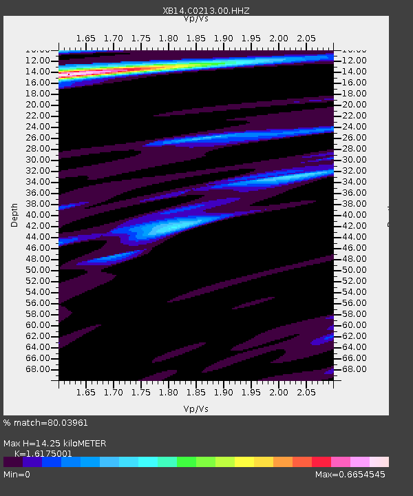
Earthquake location: Near Coast Of Northern Chile
Earthquake latitude/longitude: -20.6/-70.7
Earthquake time(UTC): 2014/04/04 (094) 01:37:51 GMT
Earthquake Depth: 20 km
Earthquake Magnitude: 6.1 MWP, 6.1 MWB, 6.1 MWW, 6.3 MWC
Earthquake Catalog/Contributor: NEIC PDE/NEIC COMCAT
Network: XB Sweetwater Array
Station: C0213 991021
Lat/Lon: 32.68 N/100.41 W
Elevation: 616 m
Distance: 60.1 deg
Az: 331.22 deg
Baz: 147.674 deg
Ray Param: 0.061723083
Estimated Moho Depth: 14.25 km
Estimated Crust Vp/Vs: 1.62
Assumed Crust Vp: 6.426 km/s
Estimated Crust Vs: 3.973 km/s
Estimated Crust Poisson's Ratio: 0.19
Radial Match: 80.03961 %
Radial Bump: 400
Transverse Match: 46.66676 %
Transverse Bump: 400
SOD ConfigId: 626651
Insert Time: 2014-04-22 10:13:07.557 +0000
GWidth: 2.5
Max Bumps: 400
Tol: 0.001

Signal To Noise

ChannelStoNSTALTA
XB:C0213:00:HHZ:20140404T01:47:25.970027Z11.6767131.7471397E-61.4962599E-7
XB:C0213:00:HH1:20140404T01:47:25.970027Z3.9007865.296855E-71.3578943E-7
XB:C0213:00:HH2:20140404T01:47:25.970027Z2.83813142.901763E-71.0224202E-7
Arrivals
Ps1.4 SECOND
PpPs5.5 SECOND
PsPs/PpSs7.0 SECOND