ANBD Bethesda, Antigua - Earthquake Result Viewer
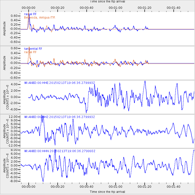
Earthquake location: Northern Mid-Atlantic Ridge
Earthquake latitude/longitude: 52.6/-31.9
Earthquake time(UTC): 2015/02/13 (044) 18:59:12 GMT
Earthquake Depth: 16 km
Earthquake Magnitude: 7.1 MWW, 6.8 MI, 7.0 MWB, 7.0 MWC, 7.1 MWC
Earthquake Catalog/Contributor: NEIC PDE/NEIC COMCAT
Network: WI West Indies IPGP Network
Station: ANBD Bethesda, Antigua
Lat/Lon: 17.05 N/61.76 W
Elevation: 26 m
Distance: 42.6 deg
Az: 224.795 deg
Baz: 26.672 deg
Ray Param: 0.07308644
Estimated Moho Depth: 10.25 km
Estimated Crust Vp/Vs: 1.79
Assumed Crust Vp: 6.048 km/s
Estimated Crust Vs: 3.379 km/s
Estimated Crust Poisson's Ratio: 0.27
Radial Match: 80.24654 %
Radial Bump: 295
Transverse Match: 58.827614 %
Transverse Bump: 400
SOD ConfigId: 7019011
Insert Time: 2019-04-16 19:32:45.527 +0000
GWidth: 2.5
Max Bumps: 400
Tol: 0.001

Signal To Noise

ChannelStoNSTALTA
WI:ANBD:00:HHZ:20150213T19:06:36.279993Z2.3809111.243203E-65.221543E-7
WI:ANBD:00:HHN:20150213T19:06:36.279993Z1.42846527.110147E-74.977473E-7
WI:ANBD:00:HHE:20150213T19:06:36.279993Z1.39215096.094064E-74.3774452E-7
Arrivals
Ps1.4 SECOND
PpPs4.5 SECOND
PsPs/PpSs5.9 SECOND