You are here: Home > Network List > TA - USArray Transportable Network (new EarthScope stations) Stations List
> Station M66A Nantucket, MA, USA > Earthquake Result Viewer
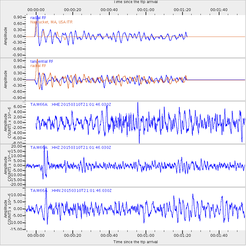
M66A Nantucket, MA, USA - Earthquake Result Viewer
*The percent match for this event was below the threshold and hence no stack was calculated.
| Earthquake location: |
Northern Colombia |
| Earthquake latitude/longitude: |
6.8/-73.0 |
| Earthquake time(UTC): |
2015/03/10 (069) 20:55:43 GMT |
| Earthquake Depth: |
147 km |
| Earthquake Magnitude: |
6.2 MWB |
| Earthquake Catalog/Contributor: |
NEIC PDE/NEIC COMCAT |
|
| Network: |
TA USArray Transportable Network (new EarthScope stations) |
| Station: |
M66A Nantucket, MA, USA |
| Lat/Lon: |
41.26 N/70.14 W |
| Elevation: |
9.0 m |
|
| Distance: |
34.4 deg |
| Az: |
3.841 deg |
| Baz: |
185.062 deg |
| Ray Param: |
$rayparam |
*The percent match for this event was below the threshold and hence was not used in the summary stack. |
|
| Radial Match: |
71.78368 % |
| Radial Bump: |
400 |
| Transverse Match: |
62.027832 % |
| Transverse Bump: |
364 |
| SOD ConfigId: |
7019011 |
| Insert Time: |
2019-04-17 07:02:22.334 +0000 |
| GWidth: |
2.5 |
| Max Bumps: |
400 |
| Tol: |
0.001 |
|
Signal To Noise
| Channel | StoN | STA | LTA |
| TA:M66A: :HHZ:20150310T21:01:46.030Z | 5.216985 | 6.2586205E-6 | 1.1996623E-6 |
| TA:M66A: :HHN:20150310T21:01:46.030Z | 2.5337002 | 3.1603931E-6 | 1.247343E-6 |
| TA:M66A: :HHE:20150310T21:01:46.030Z | 1.3609495 | 2.1141727E-6 | 1.5534544E-6 |
| Arrivals |
| Ps | |
| PpPs | |
| PsPs/PpSs | |


