You are here: Home > Network List > CI - Caltech Regional Seismic Network Stations List
> Station GPO Geothermal Program Office, California, USA > Earthquake Result Viewer
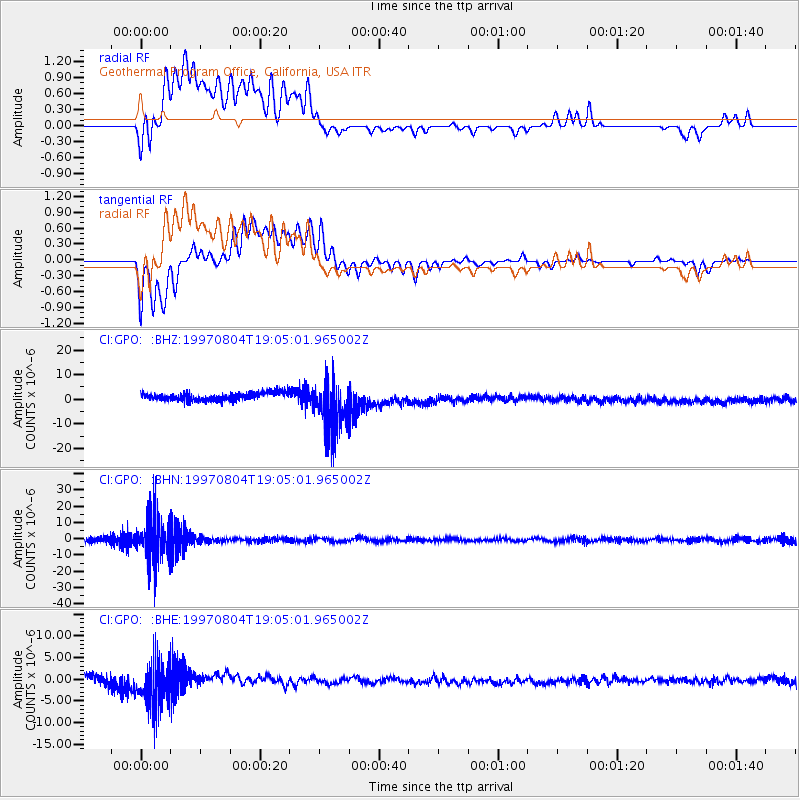
GPO Geothermal Program Office, California, USA - Earthquake Result Viewer
*The percent match for this event was below the threshold and hence no stack was calculated.
| Earthquake location: |
Tonga Islands |
| Earthquake latitude/longitude: |
-15.2/-175.3 |
| Earthquake time(UTC): |
1997/08/04 (216) 18:53:58 GMT |
| Earthquake Depth: |
33 km |
| Earthquake Magnitude: |
5.5 MB, 6.0 MS, 6.1 UNKNOWN, 6.0 MW |
| Earthquake Catalog/Contributor: |
WHDF/NEIC |
|
| Network: |
CI Caltech Regional Seismic Network |
| Station: |
GPO Geothermal Program Office, California, USA |
| Lat/Lon: |
35.65 N/117.66 W |
| Elevation: |
735 m |
|
| Distance: |
74.3 deg |
| Az: |
45.592 deg |
| Baz: |
237.886 deg |
| Ray Param: |
$rayparam |
*The percent match for this event was below the threshold and hence was not used in the summary stack. |
|
| Radial Match: |
30.404078 % |
| Radial Bump: |
400 |
| Transverse Match: |
34.320248 % |
| Transverse Bump: |
400 |
| SOD ConfigId: |
4480 |
| Insert Time: |
2010-02-25 21:10:20.219 +0000 |
| GWidth: |
2.5 |
| Max Bumps: |
400 |
| Tol: |
0.001 |
|
Signal To Noise
| Channel | StoN | STA | LTA |
| CI:GPO: :BHN:19970804T19:05:01.965002Z | 5.982354 | 1.4156301E-5 | 2.366343E-6 |
| CI:GPO: :BHE:19970804T19:05:01.965002Z | 3.7780821 | 5.3853378E-6 | 1.4254158E-6 |
| CI:GPO: :BHZ:19970804T19:05:01.965002Z | 6.6486926 | 1.06339285E-5 | 1.5994015E-6 |
| Arrivals |
| Ps | |
| PpPs | |
| PsPs/PpSs | |


