You are here: Home > Network List > IC - New China Digital Seismograph Network Stations List
> Station HIA Hailar, Neimenggu Autonomous Region, China > Earthquake Result Viewer
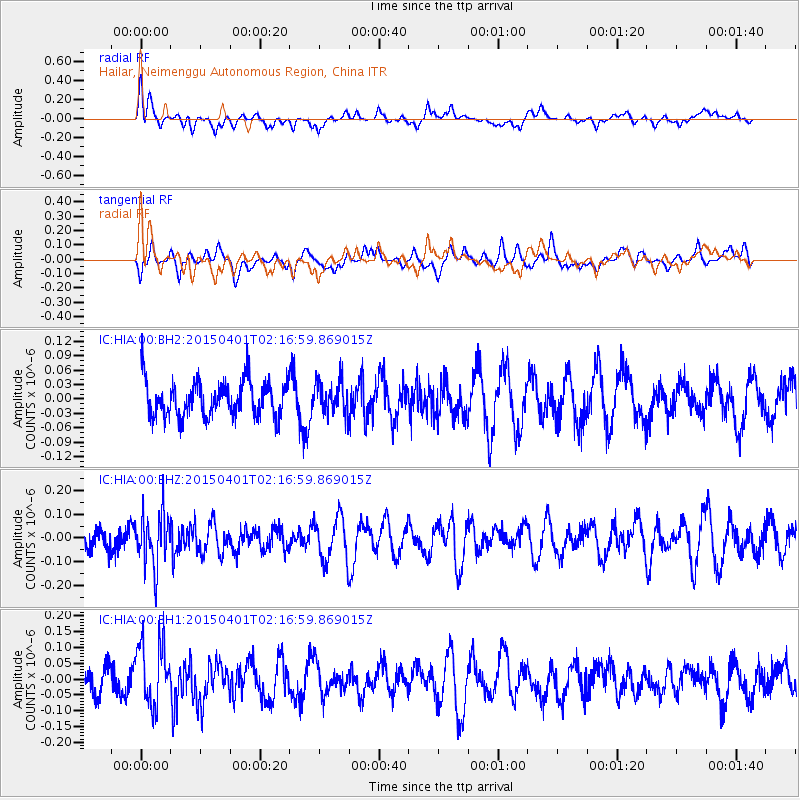
HIA Hailar, Neimenggu Autonomous Region, China - Earthquake Result Viewer
*The percent match for this event was below the threshold and hence no stack was calculated.
| Earthquake location: |
Minahassa Peninsula, Sulawesi |
| Earthquake latitude/longitude: |
0.9/124.0 |
| Earthquake time(UTC): |
2015/04/01 (091) 02:09:10 GMT |
| Earthquake Depth: |
219 km |
| Earthquake Magnitude: |
5.0 MW |
| Earthquake Catalog/Contributor: |
ISC/ISC |
|
| Network: |
IC New China Digital Seismograph Network |
| Station: |
HIA Hailar, Neimenggu Autonomous Region, China |
| Lat/Lon: |
49.27 N/119.74 E |
| Elevation: |
620 m |
|
| Distance: |
48.4 deg |
| Az: |
356.281 deg |
| Baz: |
174.318 deg |
| Ray Param: |
$rayparam |
*The percent match for this event was below the threshold and hence was not used in the summary stack. |
|
| Radial Match: |
42.116512 % |
| Radial Bump: |
400 |
| Transverse Match: |
46.00919 % |
| Transverse Bump: |
386 |
| SOD ConfigId: |
7422571 |
| Insert Time: |
2019-04-18 00:50:39.701 +0000 |
| GWidth: |
2.5 |
| Max Bumps: |
400 |
| Tol: |
0.001 |
|
Signal To Noise
| Channel | StoN | STA | LTA |
| IC:HIA:00:BHZ:20150401T02:16:59.869015Z | 2.5467615 | 1.13099574E-7 | 4.4409173E-8 |
| IC:HIA:00:BH1:20150401T02:16:59.869015Z | 2.3852375 | 9.943528E-8 | 4.168779E-8 |
| IC:HIA:00:BH2:20150401T02:16:59.869015Z | 0.92363065 | 3.4225415E-8 | 3.7055308E-8 |
| Arrivals |
| Ps | |
| PpPs | |
| PsPs/PpSs | |


