You are here: Home > Network List > CM - Red Sismologica Nacional de Columbia Stations List
> Station TUM Tumaco, Columbia > Earthquake Result Viewer
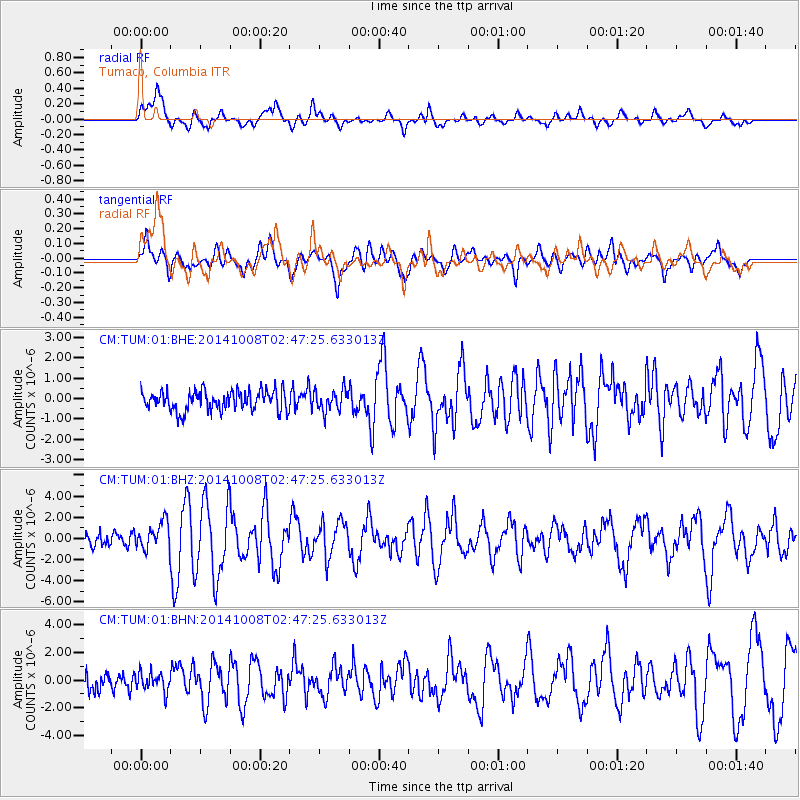
TUM Tumaco, Columbia - Earthquake Result Viewer
*The percent match for this event was below the threshold and hence no stack was calculated.
| Earthquake location: |
Gulf Of California |
| Earthquake latitude/longitude: |
23.8/-108.4 |
| Earthquake time(UTC): |
2014/10/08 (281) 02:40:54 GMT |
| Earthquake Depth: |
10 km |
| Earthquake Magnitude: |
6.2 MWP |
| Earthquake Catalog/Contributor: |
NEIC PDE/NEIC COMCAT |
|
| Network: |
CM Red Sismologica Nacional de Columbia |
| Station: |
TUM Tumaco, Columbia |
| Lat/Lon: |
1.84 N/78.73 W |
| Elevation: |
50 m |
|
| Distance: |
36.1 deg |
| Az: |
122.83 deg |
| Baz: |
309.651 deg |
| Ray Param: |
$rayparam |
*The percent match for this event was below the threshold and hence was not used in the summary stack. |
|
| Radial Match: |
76.056465 % |
| Radial Bump: |
400 |
| Transverse Match: |
79.0082 % |
| Transverse Bump: |
400 |
| SOD ConfigId: |
803114 |
| Insert Time: |
2014-10-22 03:00:22.081 +0000 |
| GWidth: |
2.5 |
| Max Bumps: |
400 |
| Tol: |
0.001 |
|
Signal To Noise
| Channel | StoN | STA | LTA |
| CM:TUM:01:BHZ:20141008T02:47:25.633013Z | 2.3957283 | 1.3279903E-6 | 5.543159E-7 |
| CM:TUM:01:BHN:20141008T02:47:25.633013Z | 1.015723 | 6.7408695E-7 | 6.636523E-7 |
| CM:TUM:01:BHE:20141008T02:47:25.633013Z | 1.0567081 | 5.1718547E-7 | 4.894308E-7 |
| Arrivals |
| Ps | |
| PpPs | |
| PsPs/PpSs | |


