You are here: Home > Network List > IC - New China Digital Seismograph Network Stations List
> Station HIA Hailar, Neimenggu Autonomous Region, China > Earthquake Result Viewer
HIA Hailar, Neimenggu Autonomous Region, China - Earthquake Result Viewer
*The percent match for this event was below the threshold and hence no stack was calculated.
| Earthquake location: |
Northern Sumatra, Indonesia |
| Earthquake latitude/longitude: |
4.8/95.1 |
| Earthquake time(UTC): |
2014/11/07 (311) 00:20:47 GMT |
| Earthquake Depth: |
39 km |
| Earthquake Magnitude: |
5.7 MB, 5.4 MWB |
| Earthquake Catalog/Contributor: |
NEIC PDE/NEIC COMCAT |
|
| Network: |
IC New China Digital Seismograph Network |
| Station: |
HIA Hailar, Neimenggu Autonomous Region, China |
| Lat/Lon: |
49.27 N/119.74 E |
| Elevation: |
620 m |
|
| Distance: |
49.0 deg |
| Az: |
21.204 deg |
| Baz: |
213.387 deg |
| Ray Param: |
$rayparam |
*The percent match for this event was below the threshold and hence was not used in the summary stack. |
|
| Radial Match: |
59.460712 % |
| Radial Bump: |
400 |
| Transverse Match: |
54.942734 % |
| Transverse Bump: |
400 |
| SOD ConfigId: |
815426 |
| Insert Time: |
2014-11-21 00:35:19.485 +0000 |
| GWidth: |
2.5 |
| Max Bumps: |
400 |
| Tol: |
0.001 |
|
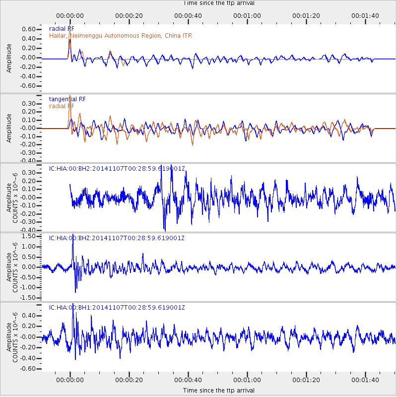
Signal To Noise
| Channel | StoN | STA | LTA |
| IC:HIA:00:BHZ:20141107T00:28:59.619001Z | 6.381843 | 5.075147E-7 | 7.952479E-8 |
| IC:HIA:00:BH1:20141107T00:28:59.619001Z | 2.849682 | 2.2665895E-7 | 7.953833E-8 |
| IC:HIA:00:BH2:20141107T00:28:59.619001Z | 2.901114 | 1.8828831E-7 | 6.4902075E-8 |
| Arrivals |
| Ps | |
| PpPs | |
| PsPs/PpSs | |


