JEM Erimo - Earthquake Result Viewer
Earthquake location: Northern Molucca Sea
Earthquake latitude/longitude: 1.9/126.5
Earthquake time(UTC): 2014/11/26 (330) 14:33:43 GMT
Earthquake Depth: 39 km
Earthquake Magnitude: 6.8 MWW, 6.8 MWC, 6.8 MWB, 7.0 MI
Earthquake Catalog/Contributor: NEIC PDE/NEIC COMCAT
Network: JP Japan Meteorological Agency Seismic Network
Station: JEM Erimo
Lat/Lon: 42.02 N/143.15 E
Elevation: 40 m
Distance: 42.6 deg
Az: 18.349 deg
Baz: 204.976 deg
Ray Param: 0.07298081
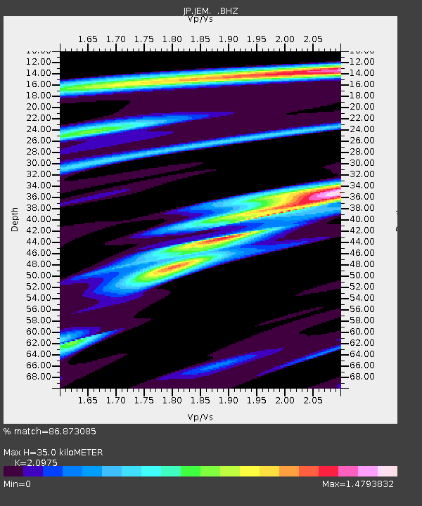
Estimated Moho Depth: 35.0 km
Estimated Crust Vp/Vs: 2.10
Assumed Crust Vp: 6.461 km/s
Estimated Crust Vs: 3.081 km/s
Estimated Crust Poisson's Ratio: 0.35
Radial Match: 86.873085 %
Radial Bump: 400
Transverse Match: 90.806984 %
Transverse Bump: 400
SOD ConfigId: 820627
Insert Time: 2014-12-10 14:59:24.478 +0000
GWidth: 2.5
Max Bumps: 400
Tol: 0.001

Signal To Noise

ChannelStoNSTALTA
JP:JEM: :BHZ:20141126T14:41:19.699996Z12.8214634.695463E-63.6621896E-7
JP:JEM: :BHN:20141126T14:41:19.699996Z9.2404392.4791532E-62.6829386E-7
JP:JEM: :BHE:20141126T14:41:19.699996Z6.72975641.8467758E-62.7441942E-7
Arrivals
Ps6.3 SECOND
PpPs16 SECOND
PsPs/PpSs22 SECOND