You are here: Home > Network List > NM - Cooperative New Madrid Seismic Network Stations List
> Station HDBT Mud Island,Memphis,TN(CERI) > Earthquake Result Viewer
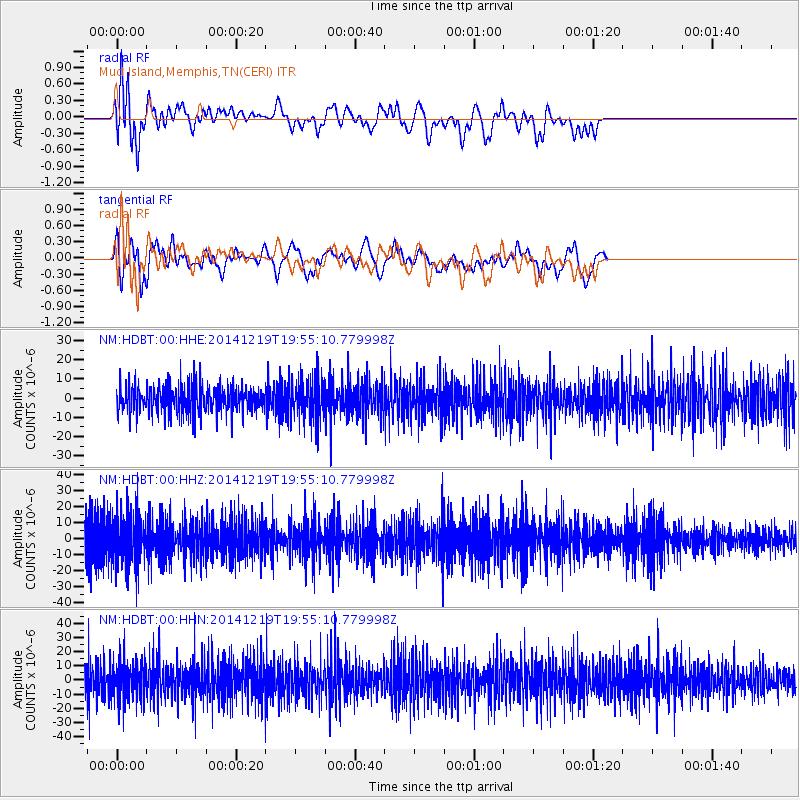
HDBT Mud Island,Memphis,TN(CERI) - Earthquake Result Viewer
*The percent match for this event was below the threshold and hence no stack was calculated.
| Earthquake location: |
Leeward Islands |
| Earthquake latitude/longitude: |
16.2/-61.8 |
| Earthquake time(UTC): |
2014/12/19 (353) 19:49:29 GMT |
| Earthquake Depth: |
114 km |
| Earthquake Magnitude: |
5.6 MWW, 5.6 MWB |
| Earthquake Catalog/Contributor: |
NEIC PDE/NEIC COMCAT |
|
| Network: |
NM Cooperative New Madrid Seismic Network |
| Station: |
HDBT Mud Island,Memphis,TN(CERI) |
| Lat/Lon: |
35.15 N/90.06 W |
| Elevation: |
66 m |
|
| Distance: |
31.5 deg |
| Az: |
312.11 deg |
| Baz: |
119.557 deg |
| Ray Param: |
$rayparam |
*The percent match for this event was below the threshold and hence was not used in the summary stack. |
|
| Radial Match: |
52.239967 % |
| Radial Bump: |
400 |
| Transverse Match: |
54.602966 % |
| Transverse Bump: |
400 |
| SOD ConfigId: |
826536 |
| Insert Time: |
2015-01-02 20:16:39.262 +0000 |
| GWidth: |
2.5 |
| Max Bumps: |
400 |
| Tol: |
0.001 |
|
Signal To Noise
| Channel | StoN | STA | LTA |
| NM:HDBT:00:HHZ:20141219T19:55:10.779998Z | 1.9556634 | 1.6468044E-5 | 8.420694E-6 |
| NM:HDBT:00:HHN:20141219T19:55:10.779998Z | 1.4228185 | 1.3467457E-5 | 9.465338E-6 |
| NM:HDBT:00:HHE:20141219T19:55:10.779998Z | 1.4896044 | 1.0604007E-5 | 7.1186732E-6 |
| Arrivals |
| Ps | |
| PpPs | |
| PsPs/PpSs | |


