You are here: Home > Network List > IU - Global Seismograph Network (GSN - IRIS/USGS) Stations List
> Station TARA Tarawa Island, Republic of Kiribati > Earthquake Result Viewer
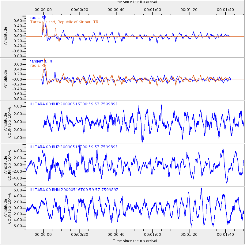
TARA Tarawa Island, Republic of Kiribati - Earthquake Result Viewer
*The percent match for this event was below the threshold and hence no stack was calculated.
| Earthquake location: |
Kermadec Islands Region |
| Earthquake latitude/longitude: |
-31.5/-178.8 |
| Earthquake time(UTC): |
2009/05/16 (136) 00:53:52 GMT |
| Earthquake Depth: |
55 km |
| Earthquake Magnitude: |
6.1 MB, 6.5 MW, 6.3 MW |
| Earthquake Catalog/Contributor: |
WHDF/NEIC |
|
| Network: |
IU Global Seismograph Network (GSN - IRIS/USGS) |
| Station: |
TARA Tarawa Island, Republic of Kiribati |
| Lat/Lon: |
1.35 N/172.92 E |
| Elevation: |
4.0 m |
|
| Distance: |
33.6 deg |
| Az: |
344.922 deg |
| Baz: |
167.16 deg |
| Ray Param: |
$rayparam |
*The percent match for this event was below the threshold and hence was not used in the summary stack. |
|
| Radial Match: |
74.61234 % |
| Radial Bump: |
384 |
| Transverse Match: |
59.412956 % |
| Transverse Bump: |
400 |
| SOD ConfigId: |
2760 |
| Insert Time: |
2010-03-04 16:13:19.108 +0000 |
| GWidth: |
2.5 |
| Max Bumps: |
400 |
| Tol: |
0.001 |
|
Signal To Noise
| Channel | StoN | STA | LTA |
| IU:TARA:00:BHZ:20090516T00:59:57.759989Z | 3.9123166 | 2.6938708E-6 | 6.8856156E-7 |
| IU:TARA:00:BHN:20090516T00:59:57.759989Z | 1.9296578 | 2.2639185E-6 | 1.1732228E-6 |
| IU:TARA:00:BHE:20090516T00:59:57.759989Z | 0.84374636 | 9.0789644E-7 | 1.07603E-6 |
| Arrivals |
| Ps | |
| PpPs | |
| PsPs/PpSs | |


