You are here: Home > Network List > IU - Global Seismograph Network (GSN - IRIS/USGS) Stations List
> Station TARA Tarawa Island, Republic of Kiribati > Earthquake Result Viewer
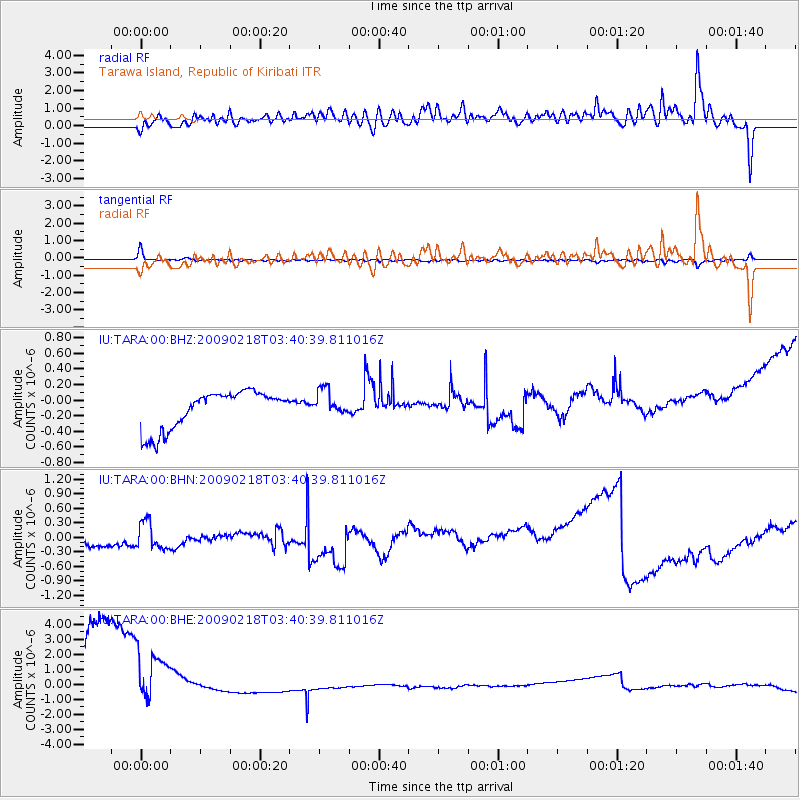
TARA Tarawa Island, Republic of Kiribati - Earthquake Result Viewer
*The percent match for this event was below the threshold and hence no stack was calculated.
| Earthquake location: |
Balleny Islands Region |
| Earthquake latitude/longitude: |
-61.7/154.8 |
| Earthquake time(UTC): |
2009/02/18 (049) 03:30:34 GMT |
| Earthquake Depth: |
10 km |
| Earthquake Magnitude: |
5.7 MW, 5.2 MB |
| Earthquake Catalog/Contributor: |
WHDF/NEIC |
|
| Network: |
IU Global Seismograph Network (GSN - IRIS/USGS) |
| Station: |
TARA Tarawa Island, Republic of Kiribati |
| Lat/Lon: |
1.35 N/172.92 E |
| Elevation: |
4.0 m |
|
| Distance: |
64.4 deg |
| Az: |
20.223 deg |
| Baz: |
189.483 deg |
| Ray Param: |
$rayparam |
*The percent match for this event was below the threshold and hence was not used in the summary stack. |
|
| Radial Match: |
78.140015 % |
| Radial Bump: |
400 |
| Transverse Match: |
86.36825 % |
| Transverse Bump: |
377 |
| SOD ConfigId: |
2658 |
| Insert Time: |
2010-03-04 16:13:19.848 +0000 |
| GWidth: |
2.5 |
| Max Bumps: |
400 |
| Tol: |
0.001 |
|
Signal To Noise
| Channel | StoN | STA | LTA |
| IU:TARA:00:BHN:20090218T03:40:39.811016Z | 1.3477393 | 2.8723483E-7 | 2.1312341E-7 |
| IU:TARA:00:BHE:20090218T03:40:39.811016Z | 0.7535376 | 4.384368E-6 | 5.8183796E-6 |
| IU:TARA:00:BHZ:20090218T03:40:39.811016Z | 0.7054435 | 1.7112183E-7 | 2.425734E-7 |
| Arrivals |
| Ps | |
| PpPs | |
| PsPs/PpSs | |


