You are here: Home > Network List > IU - Global Seismograph Network (GSN - IRIS/USGS) Stations List
> Station TARA Tarawa Island, Republic of Kiribati > Earthquake Result Viewer
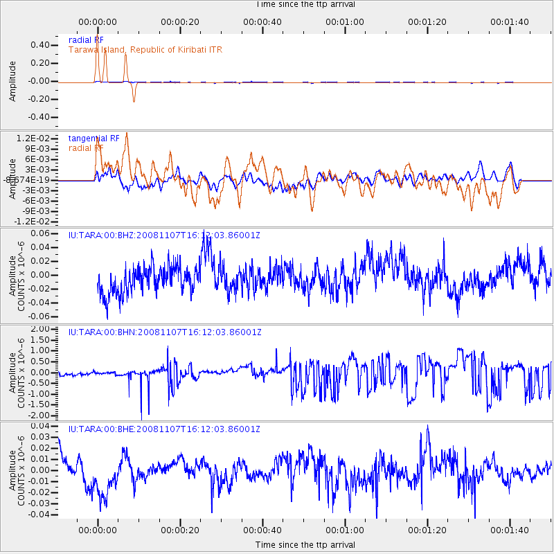
TARA Tarawa Island, Republic of Kiribati - Earthquake Result Viewer
*The percent match for this event was below the threshold and hence no stack was calculated.
| Earthquake location: |
Banda Sea |
| Earthquake latitude/longitude: |
-6.7/129.1 |
| Earthquake time(UTC): |
2008/11/07 (312) 16:04:23 GMT |
| Earthquake Depth: |
10 km |
| Earthquake Magnitude: |
5.9 MB, 5.9 MS, 6.2 MW, 6.2 MW |
| Earthquake Catalog/Contributor: |
WHDF/NEIC |
|
| Network: |
IU Global Seismograph Network (GSN - IRIS/USGS) |
| Station: |
TARA Tarawa Island, Republic of Kiribati |
| Lat/Lon: |
1.35 N/172.92 E |
| Elevation: |
4.0 m |
|
| Distance: |
44.5 deg |
| Az: |
81.214 deg |
| Baz: |
259.068 deg |
| Ray Param: |
$rayparam |
*The percent match for this event was below the threshold and hence was not used in the summary stack. |
|
| Radial Match: |
52.420883 % |
| Radial Bump: |
400 |
| Transverse Match: |
27.155582 % |
| Transverse Bump: |
400 |
| SOD ConfigId: |
2658 |
| Insert Time: |
2010-03-04 16:13:40.528 +0000 |
| GWidth: |
2.5 |
| Max Bumps: |
400 |
| Tol: |
0.001 |
|
Signal To Noise
| Channel | StoN | STA | LTA |
| IU:TARA:00:BHN:20081107T16:12:03.86001Z | 0.22404322 | 5.741231E-8 | 2.5625553E-7 |
| IU:TARA:00:BHE:20081107T16:12:03.86001Z | 2.0652964 | 2.148295E-8 | 1.0401872E-8 |
| IU:TARA:00:BHZ:20081107T16:12:03.86001Z | 0.8488398 | 1.5625337E-8 | 1.8407874E-8 |
| Arrivals |
| Ps | |
| PpPs | |
| PsPs/PpSs | |


