You are here: Home > Network List > IU - Global Seismograph Network (GSN - IRIS/USGS) Stations List
> Station TARA Tarawa Island, Republic of Kiribati > Earthquake Result Viewer
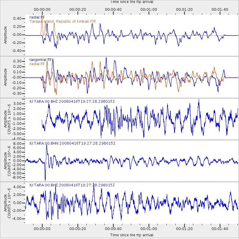
TARA Tarawa Island, Republic of Kiribati - Earthquake Result Viewer
*The percent match for this event was below the threshold and hence no stack was calculated.
| Earthquake location: |
Eastern Honshu, Japan |
| Earthquake latitude/longitude: |
39.0/140.0 |
| Earthquake time(UTC): |
2008/04/16 (107) 19:19:36 GMT |
| Earthquake Depth: |
166 km |
| Earthquake Magnitude: |
5.6 MB, 5.8 MW, 5.8 MW |
| Earthquake Catalog/Contributor: |
WHDF/NEIC |
|
| Network: |
IU Global Seismograph Network (GSN - IRIS/USGS) |
| Station: |
TARA Tarawa Island, Republic of Kiribati |
| Lat/Lon: |
1.35 N/172.92 E |
| Elevation: |
4.0 m |
|
| Distance: |
48.1 deg |
| Az: |
133.079 deg |
| Baz: |
325.314 deg |
| Ray Param: |
$rayparam |
*The percent match for this event was below the threshold and hence was not used in the summary stack. |
|
| Radial Match: |
53.01409 % |
| Radial Bump: |
400 |
| Transverse Match: |
48.908382 % |
| Transverse Bump: |
400 |
| SOD ConfigId: |
2504 |
| Insert Time: |
2010-03-04 16:13:42.943 +0000 |
| GWidth: |
2.5 |
| Max Bumps: |
400 |
| Tol: |
0.001 |
|
Signal To Noise
| Channel | StoN | STA | LTA |
| IU:TARA:00:BHN:20080416T19:27:28.298015Z | 4.92082 | 3.3946153E-6 | 6.898474E-7 |
| IU:TARA:00:BHE:20080416T19:27:28.298015Z | 1.393568 | 2.0972668E-6 | 1.504962E-6 |
| IU:TARA:00:BHZ:20080416T19:27:28.298015Z | 1.3115634 | 1.333757E-6 | 1.0169215E-6 |
| Arrivals |
| Ps | |
| PpPs | |
| PsPs/PpSs | |


