TBT Taburiente, Canary Islands, Spain - Earthquake Result Viewer
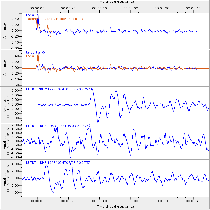
Earthquake location: Near Coast Of Guerrero, Mexico
Earthquake latitude/longitude: 16.8/-98.7
Earthquake time(UTC): 1993/10/24 (297) 07:52:17 GMT
Earthquake Depth: 32 km
Earthquake Magnitude: 6.2 MB, 6.6 MS, 6.5 UNKNOWN, 6.8 MW
Earthquake Catalog/Contributor: WHDF/NEIC
Network: IU Global Seismograph Network (GSN - IRIS/USGS)
Station: TBT Taburiente, Canary Islands, Spain
Lat/Lon: 28.68 N/17.91 W
Elevation: 180 m
Distance: 74.3 deg
Az: 64.318 deg
Baz: 280.721 deg
Ray Param: 0.05241161
Estimated Moho Depth: 33.0 km
Estimated Crust Vp/Vs: 1.72
Assumed Crust Vp: 4.662 km/s
Estimated Crust Vs: 2.707 km/s
Estimated Crust Poisson's Ratio: 0.25
Radial Match: 97.212555 %
Radial Bump: 323
Transverse Match: 90.366615 %
Transverse Bump: 400
SOD ConfigId: 16938
Insert Time: 2010-03-04 19:40:38.268 +0000
GWidth: 2.5
Max Bumps: 400
Tol: 0.001

Signal To Noise

ChannelStoNSTALTA
IU:TBT: :BHN:19931024T08:03:20.275Z1.89403833.1714328E-71.674429E-7
IU:TBT: :BHE:19931024T08:03:20.275Z1.78881594.1046104E-72.2945964E-7
IU:TBT: :BHZ:19931024T08:03:20.275Z8.2574341.8320283E-62.2186411E-7
Arrivals
Ps5.2 SECOND
PpPs19 SECOND
PsPs/PpSs24 SECOND