
Station AZ SMER2 - AZ.SMER2
Network: AZ - ANZA Regional Network
Nearby stations (2 deg radius)
| Station | Name | (Lat, Lon) | Start / End | Elevation |
| SMER2 | AZ.SMER2 | (33.46, -117.17) | 2002-08-21 / 2499-01-01 | 355 m |
| Crust2 Type: | MG,very thin extended crust, 0.5 km seds. |
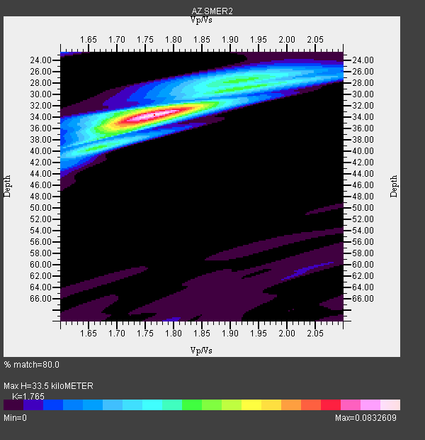
| Thickness Estimate: | 34 km |
| Thickness StdDev: | 3.0 km |
| Vp/Vs Estimate: | 1.76 |
| Vp/Vs StdDev: | 0.08 |
| Vs Estimate: | 3.549 km/s |
| Poisson's Ratio: | 0.26 |
| Peak Value: | 0.08 |
| Assumed Vp: | 6.264 km/s |
| Ps Weight: | 0.33333334 |
| PpPs Weight: | 0.33333334 |
| PsPs Weight: | 0.33333328 |
| Residual Complexity: | 0.479 |
| Nearby stations H: | 33 km +- 1.4 km |
| (2.0 deg) Vp/Vs: | 1.75 +- 0.02 |
1 with match > 90% ( 50.0 %) and 2 with match > 80% ( 100.0 %) out of 2.
Download stack as xyz text file.
Azimuth Distribution of Events:

Prior Results for this Station
| Study | Thickness | Vp/Vs | Vp | Vs | Poissons Ratio | Extra |
| EARS | 34 km | 1.76 | 6.264 km/s | 3.549 km/s | 0.26 | |
| Crust2.0 | 28 km | 1.78 | 6.264 km/s | 3.524 km/s | 0.27 | MG,very thin extended crust, 0.5 km seds. |
| Global Maxima | 34 km | 1.76 | 6.264 km/s | 3.549 km/s | 0.26 | amp=0.0832609 |
| Local Maxima 1 | 28 km | 1.94 | 6.264 km/s | 3.225 km/s | 0.32 | amp=0.034022078 |
| Local Maxima 2 | 36 km | 1.71 | 6.264 km/s | 3.674 km/s | 0.24 | amp=0.031407278 |
| Local Maxima 3 | 27 km | 1.89 | 6.264 km/s | 3.314 km/s | 0.31 | amp=0.027474348 |
| Local Maxima 4 | 38 km | 1.63 | 6.264 km/s | 3.831 km/s | 0.20 | amp=0.016292885 |
| Predicted Arrivals for vertical incidence (zero ray parameter) | |
| Ps | 4.09 SECOND |
| PpPs | 14.79 SECOND |
| PsPs/PpSs | 18.88 SECOND |
Events Processed for this Station
Download zip of receiver functions as SAC
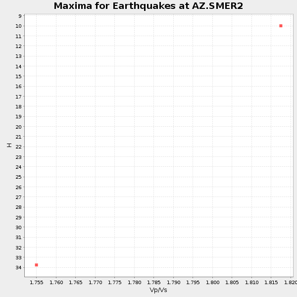
Plot maxima for each earthquake.
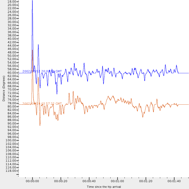
Events Used in the Stack
(2 events)| Radial Match | Distance | Baz | FERegion | Time | Lat/Lon | Depth | Magnitude |
| 90.207695 | 59.9 deg | 125.392 deg | Western Brazil | 2002/10/12 20:09:11 GMT | (-8.3, -71.7) | 534 km | 6.5 MB, 6.9 MW, 6.9 MW |
| 84.953705 | 78.9 deg | 139.724 deg | San Juan Province, Argentina | 2002/09/24 03:57:22 GMT | (-31.5, -69.2) | 120 km | 6.2 MB, 6.4 MW, 6.3 MW |
Losers
(0 events)| Radial Match | Distance | Baz | FERegion | Time | Lat/Lon | Depth | Magnitude | Reason |
