
Station C1 BI04 - Isla Mocha
Network: C1 - Red Sismologica Nacional
Nearby stations (2 deg radius)

| Station | Name | (Lat, Lon) | Start / End | Elevation |
| BI04 | Isla Mocha | (-38.41, -73.89) | 2016-10-28 / 2599-12-31 | 41 m |
| Crust2 Type: | L3,continental arc, Southern Andes, 0.2 km seds. |
| Thickness Estimate: | 38 km |
| Thickness StdDev: | 11 km |
| Vp/Vs Estimate: | 1.72 |
| Vp/Vs StdDev: | 0.16 |
| Vs Estimate: | 3.836 km/s |
| Poisson's Ratio: | 0.24 |
| Peak Value: | 0.02 |
| Assumed Vp: | 6.597 km/s |
| Ps Weight: | 0.33333334 |
| PpPs Weight: | 0.33333334 |
| PsPs Weight: | 0.33333328 |
| Residual Complexity: | 0.791 |
| Nearby stations H: | +- |
| (2.0 deg) Vp/Vs: | +- |
2 with match > 90% ( 4.0816326 %) and 12 with match > 80% ( 24.489796 %) out of 49.
Download stack as xyz text file.
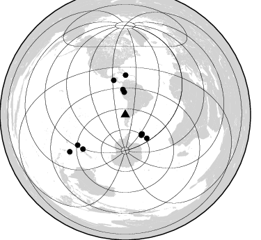
Azimuth Distribution of Events:
Prior Results for this Station
| Study | Thickness | Vp/Vs | Vp | Vs | Poissons Ratio | Extra |
| EARS | 38 km | 1.72 | 6.597 km/s | 3.836 km/s | 0.24 | |
| Crust2.0 | 40 km | 1.77 | 6.597 km/s | 3.723 km/s | 0.27 | L3,continental arc, Southern Andes, 0.2 km seds. |
| Global Maxima | 38 km | 1.72 | 6.597 km/s | 3.836 km/s | 0.24 | amp=0.016679293 |
| Local Maxima 1 | 30 km | 1.83 | 6.597 km/s | 3.6 km/s | 0.29 | amp=0.0141211385 |
| Local Maxima 2 | 52 km | 2.10 | 6.597 km/s | 3.149 km/s | 0.35 | amp=0.013336735 |
| Local Maxima 3 | 27 km | 2.02 | 6.597 km/s | 3.266 km/s | 0.34 | amp=0.009327661 |
| Local Maxima 4 | 70 km | 1.82 | 6.597 km/s | 3.62 km/s | 0.28 | amp=0.007542444 |
| Predicted Arrivals for vertical incidence (zero ray parameter) | |
| Ps | 4.09 SECOND |
| PpPs | 15.46 SECOND |
| PsPs/PpSs | 19.55 SECOND |
Events Processed for this Station
Download zip of receiver functions as SAC
Plot maxima for each earthquake.
Events Used in the Stack
(12 events)| Radial Match | Distance | Baz | FERegion | Time | Lat/Lon | Depth | Magnitude |
| 95.26236 | 78.6 deg | 230.958 deg | Off E. Coast Of N. Island, N.Z. | 2021/03/04 13:27:35 UTC | (-37.6, 179.5) | 10 km | 6.9 mww |
| 93.84646 | 36.3 deg | 139.418 deg | South Sandwich Islands Region | 2018/12/11 02:26:32 UTC | (-58.6, -26.5) | 165 km | 7.1 mww |
| 88.99925 | 96.0 deg | 236.277 deg | Loyalty Islands | 2017/11/04 09:27:42 UTC | (-21.8, 169.0) | 9.5 km | 5.5 mb |
| 88.71428 | 46.1 deg | 137.476 deg | East Of South Sandwich Islands | 2021/04/03 01:16:39 UTC | (-58.0, -7.9) | 10 km | 6.4 Mwp |
| 88.67592 | 32.4 deg | 357.374 deg | Northern Peru | 2019/05/26 07:41:13 UTC | (-5.9, -75.3) | 105 km | 7.5 Mi |
| 88.5474 | 37.0 deg | 139.194 deg | South Sandwich Islands Region | 2019/04/09 17:53:59 UTC | (-58.6, -25.3) | 46 km | 6.5 Mww |
| 87.5897 | 52.0 deg | 341.322 deg | Off Coast Of Central America | 2016/11/24 18:43:48 UTC | (12.0, -88.8) | 10 km | 7.0 MWW, 6.7 MWB, 7.2 MI |
| 87.22824 | 36.9 deg | 138.911 deg | South Sandwich Islands Region | 2021/08/12 18:35:20 UTC | (-58.4, -25.3) | 48 km | 8.1 Mww |
| 85.96729 | 56.7 deg | 0.385 deg | Haiti Region | 2021/08/14 12:29:08 UTC | (18.6, -73.5) | 10 km | 7.0 Mi |
| 83.99716 | 36.2 deg | 354.682 deg | Peru-Ecuador Border Region | 2019/02/22 10:17:22 UTC | (-2.2, -77.0) | 132 km | 7.5 mww |
| 81.95545 | 37.5 deg | 141.877 deg | South Sandwich Islands Region | 2021/08/22 21:33:20 UTC | (-60.3, -24.9) | 14 km | 7.1 mww |
| 81.88077 | 81.4 deg | 237.519 deg | Kermadec Islands, New Zealand | 2019/06/15 22:55:02 UTC | (-30.8, -178.1) | 35 km | 7.4 Mwp |
Losers
(37 events)| Radial Match | Distance | Baz | FERegion | Time | Lat/Lon | Depth | Magnitude | Reason |
| 99.941414 | 55.7 deg | 338.658 deg | Near Coast Of Chiapas, Mexico | 2017/06/14 07:29:03 UTC | (14.9, -92.0) | 98 km | 7.0 Mi | |
| 94.37088 | 37.0 deg | 140.682 deg | South Sandwich Islands Region | 2021/08/12 18:47:04 UTC | (-59.5, -25.6) | 35 km | 5.6 mb | |
| 91.22596 | 50.1 deg | 14.151 deg | Near Coast Of Venezuela | 2018/08/21 21:31:46 UTC | (10.9, -62.9) | 154 km | 7.3 Mww | |
| 82.88178 | 84.3 deg | 325.577 deg | Central California | 2019/07/06 03:47:53 UTC | (35.9, -117.7) | 3.4 km | 5.4 Mww | |
| 79.82618 | 55.6 deg | 338.276 deg | Near Coast Of Chiapas, Mexico | 2019/02/01 16:14:13 UTC | (14.8, -92.3) | 68 km | 6.6 Mww | |
| 79.335556 | 81.6 deg | 236.029 deg | Kermadec Islands Region | 2018/09/10 04:19:02 UTC | (-31.8, -179.3) | 111 km | 6.9 mww | |
| 78.4523 | 37.9 deg | 138.55 deg | South Sandwich Islands Region | 2021/08/16 11:10:35 UTC | (-58.4, -23.3) | 10 km | 6.9 Mww | |
| 76.23126 | 30.2 deg | 4.554 deg | Western Brazil | 2019/01/05 19:25:38 UTC | (-8.1, -71.6) | 575 km | 6.8 Mww | |
| 75.3509 | 36.6 deg | 140.426 deg | South Sandwich Islands Region | 2020/01/20 06:51:37 UTC | (-59.2, -26.3) | 91 km | 6.1 Mww | |
| 74.840546 | 79.1 deg | 224.27 deg | South Island, New Zealand | 2016/11/13 11:19:34 UTC | (-42.2, 173.4) | 10 km | 5.5 MB | |
| 74.34203 | 36.7 deg | 142.09 deg | South Sandwich Islands Region | 2019/08/27 23:55:18 UTC | (-60.2, -26.5) | 10 km | 6.6 mww | |
| 74.26529 | 36.6 deg | 142.276 deg | South Sandwich Islands Region | 2019/08/27 23:55:30 UTC | (-60.3, -26.8) | 116 km | 6.8 Mi | |
| 73.56881 | 58.2 deg | 27.487 deg | North Atlantic Ocean | 2018/11/11 14:03:59 UTC | (15.6, -49.9) | 10 km | 6.2 mb | |
| 73.38556 | 33.9 deg | 347.934 deg | Peru-Ecuador Border Region | 2021/07/30 17:10:19 UTC | (-4.9, -80.6) | 33 km | 6.2 Mww | |
| 73.291885 | 81.9 deg | 240.047 deg | Kermadec Islands Region | 2021/03/04 22:05:56 UTC | (-28.6, -176.7) | 10 km | 5.5 mb | |
| 73.215416 | 36.7 deg | 142.267 deg | South Sandwich Islands Region | 2021/08/12 18:41:58 UTC | (-60.3, -26.6) | 35 km | 6.1 mb | |
| 72.66388 | 36.4 deg | 135.43 deg | South Sandwich Islands Region | 2017/05/10 23:23:39 UTC | (-56.3, -25.5) | 41 km | 6.8 Mi | |
| 67.75687 | 80.4 deg | 138.213 deg | Prince Edward Islands Region | 2019/01/22 19:01:43 UTC | (-43.1, 42.3) | 13 km | 6.7 Mww | |
| 66.67941 | 36.9 deg | 138.4 deg | South Sandwich Islands Region | 2018/08/14 03:29:53 UTC | (-58.1, -25.3) | 35 km | 6.1 Mww | |
| 61.623093 | 85.6 deg | 249.19 deg | Tonga Islands | 2020/10/01 01:13:39 UTC | (-19.1, -173.6) | 10 km | 6.7 Mi | |
| 60.04215 | 36.2 deg | 351.502 deg | Ecuador | 2018/09/07 02:12:04 UTC | (-2.3, -78.9) | 94 km | 6.2 Mww | |
| 59.212337 | 85.9 deg | 248.511 deg | Tonga Islands | 2020/10/01 01:13:37 UTC | (-19.5, -174.2) | 35 km | 6.4 Mww | |
| 58.628723 | 56.4 deg | 336.581 deg | Near Coast Of Chiapas, Mexico | 2017/09/09 04:54:52 UTC | (15.1, -93.9) | 29 km | 5.5 Mww | |
| 56.752506 | 90.2 deg | 248.117 deg | Fiji Islands Region | 2018/08/19 04:28:58 UTC | (-17.0, -178.0) | 416 km | 6.8 mww | |
| 56.369774 | 80.9 deg | 237.638 deg | Kermadec Islands Region | 2019/06/18 16:05:17 UTC | (-31.0, -177.6) | 16 km | 5.9 Mww | |
| 55.774353 | 85.1 deg | 245.757 deg | Tonga Islands Region | 2020/04/22 22:31:25 UTC | (-22.1, -175.5) | 40 km | 5.5 Mww | |
| 54.657738 | 82.0 deg | 240.259 deg | Kermadec Islands Region | 2021/03/04 22:41:05 UTC | (-28.4, -176.6) | 10 km | 5.8 mb | |
| 54.12939 | 95.6 deg | 236.581 deg | Southeast Of Loyalty Islands | 2018/12/05 04:31:23 UTC | (-21.9, 169.5) | 10 km | 5.6 mb | |
| 51.596935 | 36.9 deg | 138.331 deg | South Sandwich Islands Region | 2018/11/01 19:30:20 UTC | (-58.1, -25.2) | 29 km | 5.8 Mww | |
| 50.711735 | 87.5 deg | 249.636 deg | Tonga Islands | 2021/05/25 21:36:44 UTC | (-17.6, -174.8) | 200 km | 5.7 mww | |
| 50.137123 | 95.1 deg | 236.728 deg | Southeast Of Loyalty Islands | 2018/09/10 19:31:42 UTC | (-22.1, 170.0) | 10 km | 6.6 Mi | |
| 49.557026 | 44.1 deg | 122.354 deg | Southern Mid-Atlantic Ridge | 2018/03/17 05:50:09 UTC | (-47.7, -13.5) | 10 km | 5.5 mb | |
| 48.509457 | 79.7 deg | 231.412 deg | Off E. Coast Of N. Island, N.Z. | 2020/03/14 10:05:15 UTC | (-36.5, 178.9) | 41 km | 5.6 mb | |
| 47.569168 | 53.4 deg | 339.82 deg | Off Coast Of Central America | 2018/10/28 22:23:54 UTC | (12.9, -90.4) | 25 km | 6.1 Mww | |
| 42.06662 | 89.6 deg | 247.436 deg | Fiji Islands Region | 2018/08/19 00:39:07 UTC | (-17.9, -178.0) | 576 km | 5.7 mb | |
| 24.837263 | 32.4 deg | 273.569 deg | Easter Island Region | 2018/06/18 07:09:41 UTC | (-29.9, -111.9) | 10 km | 5.9 Mww | |
| 9.6561575 | 95.6 deg | 236.496 deg | Southeast Of Loyalty Islands | 2018/10/16 04:42:42 UTC | (-21.9, 169.4) | 10 km | 5.6 Mww |

