
Station LD LOZ - Lake Ozonia, New York
Network: LD - Lamont-Doherty Cooperative Seismographic Network
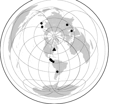
Nearby stations (2 deg radius)

| Station | Name | (Lat, Lon) | Start / End | Elevation |
| LOZ | Lake Ozonia, New York | (44.62, -74.58) | 1984-11-01 / 2499-01-01 | 440 m |
| Crust2 Type: | Q2,orogen/39km no ice, Appalachians, North Andes, 0.5 km seds. |
| Thickness Estimate: | 43 km |
| Thickness StdDev: | 5.7 km |
| Vp/Vs Estimate: | 1.82 |
| Vp/Vs StdDev: | 0.12 |
| Vs Estimate: | 3.522 km/s |
| Poisson's Ratio: | 0.28 |
| Peak Value: | 0.01 |
| Assumed Vp: | 6.419 km/s |
| Ps Weight: | 0.33333334 |
| PpPs Weight: | 0.33333334 |
| PsPs Weight: | 0.33333328 |
| Residual Complexity: | 0.735 |
| Nearby stations H: | 44 km +- 2.1 km |
| (2.0 deg) Vp/Vs: | 1.81 +- 0.01 |
4 with match > 90% ( 36.363636 %) and 11 with match > 80% ( 100.0 %) out of 11.
Download stack as xyz text file.
Azimuth Distribution of Events:
Prior Results for this Station
| Study | Thickness | Vp/Vs | Vp | Vs | Poissons Ratio | Extra |
| EARS | 43 km | 1.82 | 6.419 km/s | 3.522 km/s | 0.28 | |
| Crust2.0 | 39 km | 1.75 | 6.419 km/s | 3.659 km/s | 0.26 | Q2,orogen/39km no ice, Appalachians, North Andes, 0.5 km seds. |
| Global Maxima | 43 km | 1.82 | 6.419 km/s | 3.522 km/s | 0.28 | amp=0.008780399 |
| Local Maxima 1 | 31 km | 2.09 | 6.419 km/s | 3.075 km/s | 0.35 | amp=0.008241076 |
| Local Maxima 2 | 61 km | 1.77 | 6.419 km/s | 3.622 km/s | 0.27 | amp=0.004681087 |
| Local Maxima 3 | 41 km | 1.91 | 6.419 km/s | 3.361 km/s | 0.31 | amp=0.004321104 |
| Local Maxima 4 | 31 km | 1.99 | 6.419 km/s | 3.234 km/s | 0.33 | amp=0.0038364285 |
| Predicted Arrivals for vertical incidence (zero ray parameter) | |
| Ps | 5.54 SECOND |
| PpPs | 19.02 SECOND |
| PsPs/PpSs | 24.56 SECOND |
Events Processed for this Station
Download zip of receiver functions as SAC
Plot maxima for each earthquake.
Events Used in the Stack
(11 events)| Radial Match | Distance | Baz | FERegion | Time | Lat/Lon | Depth | Magnitude |
| 96.52319 | 85.2 deg | 42.9 deg | Western Iran | 2002/06/22 02:58:21 GMT | (35.6, 49.0) | 10 km | 6.2 MB, 6.4 MS, 6.5 MW, 6.5 MW |
| 94.917984 | 93.3 deg | 27.589 deg | Hindu Kush Region, Afghanistan | 2002/03/03 12:08:07 GMT | (36.4, 70.4) | 209 km | 6.3 MB |
| 94.29506 | 93.3 deg | 27.527 deg | Hindu Kush Region, Afghanistan | 2002/03/03 12:08:19 GMT | (36.5, 70.5) | 226 km | 6.6 MB, 7.4 MW, 7.3 MW |
| 92.50048 | 97.6 deg | 333.968 deg | Near S. Coast Of Western Honshu | 2004/09/05 10:07:07 GMT | (33.1, 136.6) | 14 km | 6.7 MB, 7.0 MS, 7.2 MW, 7.0 MW |
| 89.71335 | 39.8 deg | 184.553 deg | Near West Coast Of Colombia | 2004/11/15 09:06:56 GMT | (4.7, -77.5) | 15 km | 6.6 MB, 7.1 MS, 7.2 MW, 7.1 MW |
| 89.6448 | 37.2 deg | 193.517 deg | South Of Panama | 2002/07/31 00:16:44 GMT | (7.9, -82.8) | 10 km | 6.0 MB, 6.4 MS, 6.5 MW, 6.4 MW |
| 88.493744 | 36.6 deg | 195.716 deg | Costa Rica | 2002/06/16 02:46:14 GMT | (8.8, -84.0) | 35 km | 5.4 MB, 6.2 MS, 6.4 MW, 6.4 MW |
| 86.14901 | 34.7 deg | 201.145 deg | Near Coast Of Nicaragua | 2004/10/09 21:26:53 GMT | (11.4, -86.7) | 35 km | 6.0 MB, 7.0 MS, 6.9 MW, 6.8 MW |
| 85.04266 | 85.8 deg | 331.976 deg | Hokkaido, Japan Region | 2004/11/28 18:32:14 GMT | (43.0, 145.1) | 39 km | 6.4 MB, 6.7 MS, 7.0 MW, 7.0 MW |
| 82.637314 | 73.3 deg | 171.975 deg | Santiago Del Estero Prov., Arg. | 2004/09/07 11:53:06 GMT | (-28.6, -65.8) | 22 km | 6.1 MB, 6.1 MS, 6.4 MW, 6.2 MW |
| 81.79697 | 37.5 deg | 193.393 deg | South Of Panama | 2001/08/25 02:02:02 GMT | (7.6, -82.8) | 24 km | 5.9 MB, 5.7 MS, 6.2 MW, 6.1 MW |
Losers
(0 events)| Radial Match | Distance | Baz | FERegion | Time | Lat/Lon | Depth | Magnitude | Reason |
