
Station XC BLBA - Blackbirch
Network: XC95 - Southern Alps Passive Seismic Experiment
Nearby stations (2 deg radius)
| Station | Name | (Lat, Lon) | Start / End | Elevation |
| BLBA | Blackbirch | (-41.71, 173.88) | 1995-11-13 / 1996-12-31 | 253 m |
| Crust2 Type: | K1,forearc, New Zealand, 2 km seds. |
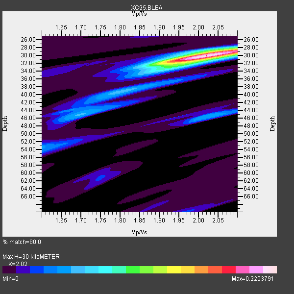
| Thickness Estimate: | 30 km |
| Thickness StdDev: | 0.3 km |
| Vp/Vs Estimate: | 2.02 |
| Vp/Vs StdDev: | 0.02 |
| Vs Estimate: | 3.113 km/s |
| Poisson's Ratio: | 0.34 |
| Peak Value: | 0.22 |
| Assumed Vp: | 6.289 km/s |
| Ps Weight: | 0.33333334 |
| PpPs Weight: | 0.33333334 |
| PsPs Weight: | 0.33333328 |
| Residual Complexity: | 0.424 |
| Nearby stations H: | +- |
| (2.0 deg) Vp/Vs: | +- |
1 with match > 90% ( 50.0 %) and 2 with match > 80% ( 100.0 %) out of 2.
Download stack as xyz text file.
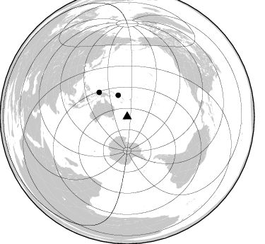
Azimuth Distribution of Events:
Prior Results for this Station
| Study | Thickness | Vp/Vs | Vp | Vs | Poissons Ratio | Extra |
| EARS | 30 km | 2.02 | 6.289 km/s | 3.113 km/s | 0.34 | |
| Crust2.0 | 35 km | 1.76 | 6.289 km/s | 3.569 km/s | 0.26 | K1,forearc, New Zealand, 2 km seds. |
| Global Maxima | 30 km | 2.02 | 6.289 km/s | 3.113 km/s | 0.34 | amp=0.2203791 |
| Local Maxima 1 | 32 km | 1.95 | 6.289 km/s | 3.233 km/s | 0.32 | amp=0.070600845 |
| Local Maxima 2 | 45 km | 1.69 | 6.289 km/s | 3.716 km/s | 0.23 | amp=0.054512974 |
| Local Maxima 3 | 28 km | 2.10 | 6.289 km/s | 2.998 km/s | 0.35 | amp=0.053140163 |
| Local Maxima 4 | 46 km | 2.01 | 6.289 km/s | 3.129 km/s | 0.34 | amp=0.05285038 |
| Predicted Arrivals for vertical incidence (zero ray parameter) | |
| Ps | 4.87 SECOND |
| PpPs | 14.41 SECOND |
| PsPs/PpSs | 19.27 SECOND |
Events Processed for this Station
Download zip of receiver functions as SAC
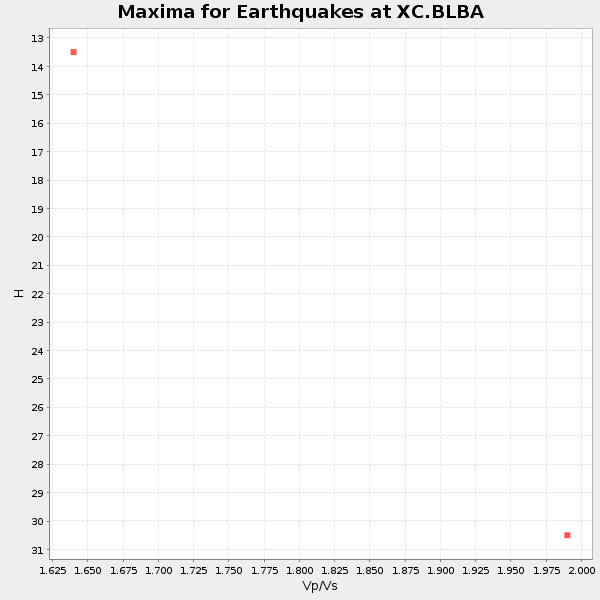
Plot maxima for each earthquake.
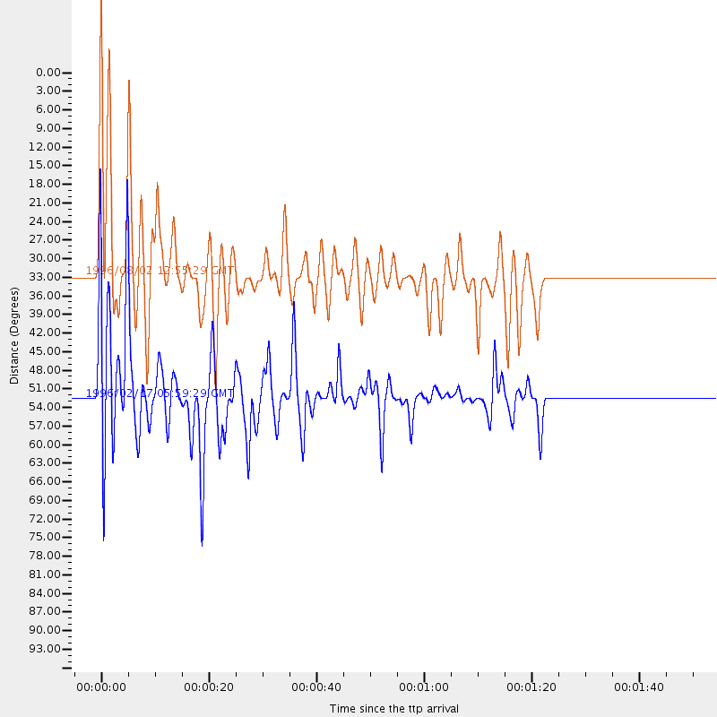
Events Used in the Stack
(2 events)| Radial Match | Distance | Baz | FERegion | Time | Lat/Lon | Depth | Magnitude |
| 90.0715 | 52.4 deg | 310.826 deg | Irian Jaya Region, Indonesia | 1996/02/17 05:59:29 GMT | (-0.9, 137.0) | 33 km | 6.5 MB, 8.1 MS, 7.9 UNKNOWN |
| 85.376045 | 32.7 deg | 336.949 deg | Solomon Islands | 1996/08/02 12:55:29 GMT | (-10.8, 161.4) | 33 km | 6.2 MB, 7.1 MS, 6.9 UNKNOWN, 6.9 MW |
Losers
(0 events)| Radial Match | Distance | Baz | FERegion | Time | Lat/Lon | Depth | Magnitude | Reason |
