
Station XG MKR - Meeker, CO
Network: XG92 - Rocky Mountain Front
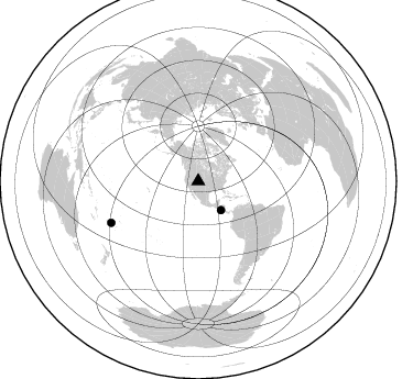
Nearby stations (2 deg radius)
| Station | Name | (Lat, Lon) | Start / End | Elevation |
| MKR | Meeker, CO | (40.03, -107.74) | 1992-08-29 / 2499-01-01 | 2.0 km |
| Crust2 Type: | P1,orogen/46km, Urals, Tethian Orogen, 2 km seds. |
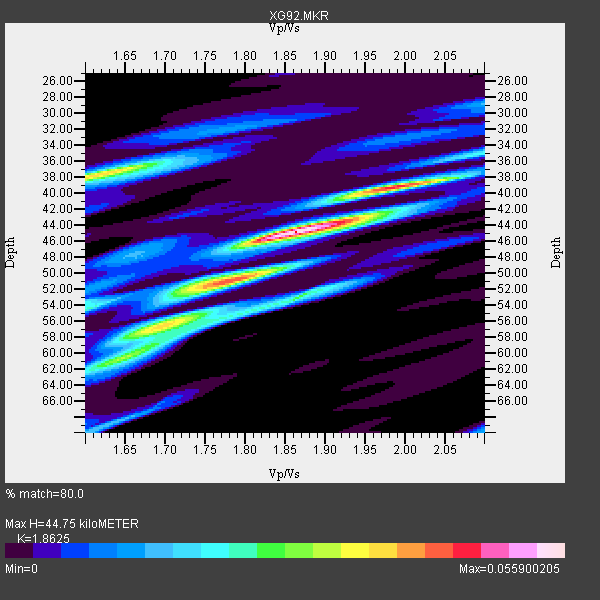
| Thickness Estimate: | 45 km |
| Thickness StdDev: | 4.1 km |
| Vp/Vs Estimate: | 1.86 |
| Vp/Vs StdDev: | 0.11 |
| Vs Estimate: | 3.307 km/s |
| Poisson's Ratio: | 0.30 |
| Peak Value: | 0.06 |
| Assumed Vp: | 6.159 km/s |
| Ps Weight: | 0.33333334 |
| PpPs Weight: | 0.33333334 |
| PsPs Weight: | 0.33333328 |
| Residual Complexity: | 0.712 |
| Nearby stations H: | +- |
| (2.0 deg) Vp/Vs: | +- |
1 with match > 90% ( 50.0 %) and 2 with match > 80% ( 100.0 %) out of 2.
Download stack as xyz text file.
Azimuth Distribution of Events:
Prior Results for this Station
| Study | Thickness | Vp/Vs | Vp | Vs | Poissons Ratio | Extra |
| EARS | 45 km | 1.86 | 6.159 km/s | 3.307 km/s | 0.30 | |
| Crust2.0 | 46 km | 1.76 | 6.159 km/s | 3.507 km/s | 0.26 | P1,orogen/46km, Urals, Tethian Orogen, 2 km seds. |
| Global Maxima | 45 km | 1.86 | 6.159 km/s | 3.307 km/s | 0.30 | amp=0.055900205 |
| Local Maxima 1 | 38 km | 1.62 | 6.159 km/s | 3.802 km/s | 0.19 | amp=0.03887527 |
| Local Maxima 2 | 39 km | 2.00 | 6.159 km/s | 3.087 km/s | 0.33 | amp=0.037670895 |
| Local Maxima 3 | 50 km | 1.80 | 6.159 km/s | 3.426 km/s | 0.28 | amp=0.033238884 |
| Local Maxima 4 | 53 km | 1.87 | 6.159 km/s | 3.298 km/s | 0.30 | amp=0.027248261 |
| Predicted Arrivals for vertical incidence (zero ray parameter) | |
| Ps | 6.27 SECOND |
| PpPs | 20.80 SECOND |
| PsPs/PpSs | 27.07 SECOND |
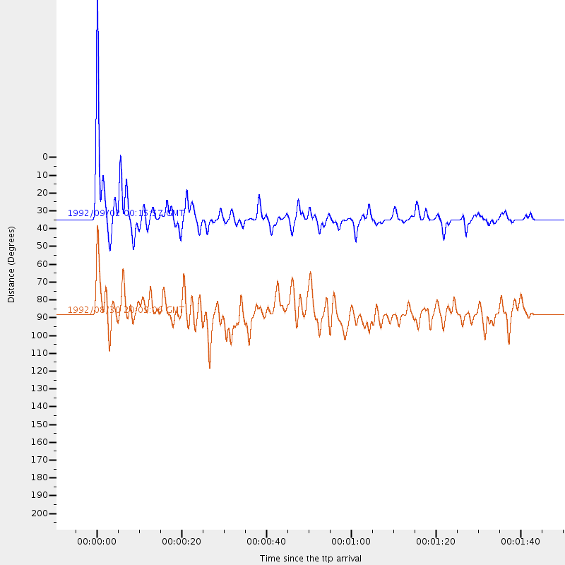
Events Processed for this Station
Download zip of receiver functions as SAC
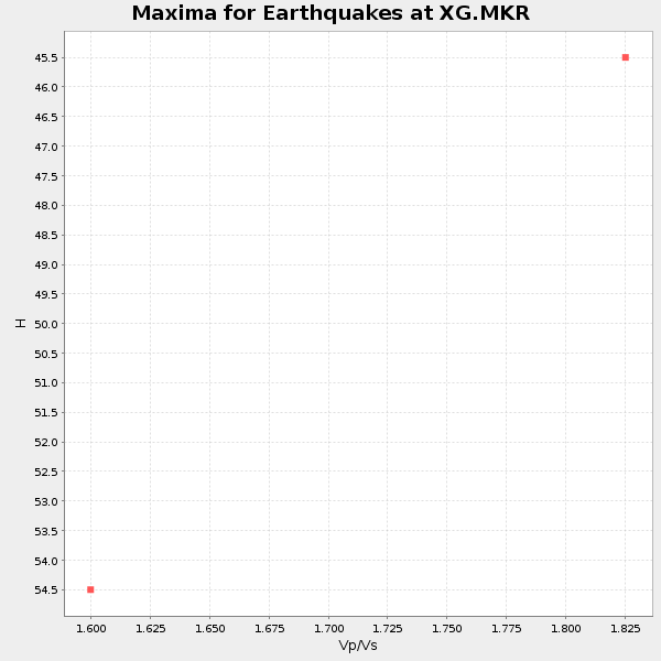
Plot maxima for each earthquake.
Events Used in the Stack
(2 events)| Radial Match | Distance | Baz | FERegion | Time | Lat/Lon | Depth | Magnitude |
| 94.40034 | 33.4 deg | 141.839 deg | Near Coast Of Nicaragua | 1992/09/02 00:15:57 GMT | (11.8, -87.4) | 10 km | 5.3 MB, 7.2 MS |
| 85.98988 | 87.5 deg | 244.444 deg | Fiji Islands Region | 1992/08/30 20:09:06 GMT | (-17.7, -178.8) | 573 km | 5.8 MB |
Losers
(0 events)| Radial Match | Distance | Baz | FERegion | Time | Lat/Lon | Depth | Magnitude | Reason |
