
Station XH KUL - Kula
Network: XH02 - Western Anatolia Linear Array and Regional Network
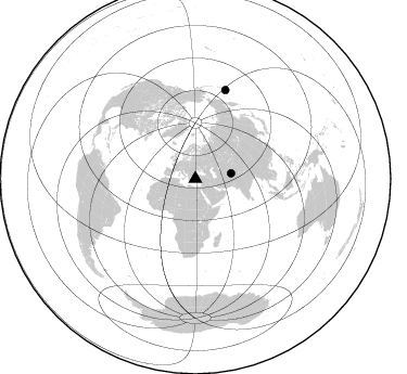
Nearby stations (2 deg radius)

| Station | Name | (Lat, Lon) | Start / End | Elevation |
| KUL | Kula | (38.54, 28.63) | 2002-12-22 / 2003-12-31 | 0.7 km |
| Crust2 Type: | M9,thick extended crust, 0.5 km seds. |
| Thickness Estimate: | 56 km |
| Thickness StdDev: | 12 km |
| Vp/Vs Estimate: | 1.75 |
| Vp/Vs StdDev: | 0.11 |
| Vs Estimate: | 3.6 km/s |
| Poisson's Ratio: | 0.26 |
| Peak Value: | 0.04 |
| Assumed Vp: | 6.291 km/s |
| Ps Weight: | 0.33333334 |
| PpPs Weight: | 0.33333334 |
| PsPs Weight: | 0.33333328 |
| Residual Complexity: | 0.875 |
| Nearby stations H: | +- |
| (2.0 deg) Vp/Vs: | +- |
0 with match > 90% ( 0.0 %) and 2 with match > 80% ( 100.0 %) out of 2.
Download stack as xyz text file.
Azimuth Distribution of Events:
Prior Results for this Station
| Study | Thickness | Vp/Vs | Vp | Vs | Poissons Ratio | Extra |
| EARS | 56 km | 1.75 | 6.291 km/s | 3.6 km/s | 0.26 | |
| Crust2.0 | 40 km | 1.78 | 6.291 km/s | 3.539 km/s | 0.27 | M9,thick extended crust, 0.5 km seds. |
| Global Maxima | 56 km | 1.75 | 6.291 km/s | 3.6 km/s | 0.26 | amp=0.043606836 |
| Local Maxima 1 | 36 km | 1.66 | 6.291 km/s | 3.796 km/s | 0.21 | amp=0.037128188 |
| Local Maxima 2 | 70 km | 2.01 | 6.291 km/s | 3.126 km/s | 0.34 | amp=0.031557832 |
| Local Maxima 3 | 63 km | 2.02 | 6.291 km/s | 3.118 km/s | 0.34 | amp=0.030627554 |
| Local Maxima 4 | 29 km | 1.82 | 6.291 km/s | 3.466 km/s | 0.28 | amp=0.028533375 |
| Predicted Arrivals for vertical incidence (zero ray parameter) | |
| Ps | 6.59 SECOND |
| PpPs | 24.24 SECOND |
| PsPs/PpSs | 30.83 SECOND |
Events Processed for this Station
Download zip of receiver functions as SAC
Plot maxima for each earthquake.
Events Used in the Stack
(2 events)| Radial Match | Distance | Baz | FERegion | Time | Lat/Lon | Depth | Magnitude |
| 85.88915 | 86.6 deg | 18.715 deg | Rat Islands, Aleutian Islands | 2003/03/17 16:36:17 GMT | (51.3, 178.0) | 33 km | 5.9 MB, 6.7 MS, 7.0 MW, 7.0 MW |
| 81.30004 | 33.3 deg | 81.16 deg | Hindu Kush Region, Afghanistan | 2003/03/29 11:46:48 GMT | (36.0, 70.6) | 114 km | 5.9 MB, 5.9 MW, 5.8 MW |
Losers
(0 events)| Radial Match | Distance | Baz | FERegion | Time | Lat/Lon | Depth | Magnitude | Reason |
