
Station XM MB05 - Magmabody05
Network: XM99 - Rio Grande Seismic Transect
Nearby stations (2 deg radius)
| Station | Name | (Lat, Lon) | Start / End | Elevation |
| MB05 | Magmabody05 | (34.66, -108.01) | 2000-03-18 / 2001-12-31 | 2143 m |
| Crust2 Type: | H7,early/mid Proter. shield, Austr., 1.5 km seds. |
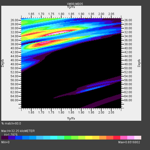
| Thickness Estimate: | 32 km |
| Thickness StdDev: | 8.4 km |
| Vp/Vs Estimate: | 1.79 |
| Vp/Vs StdDev: | 0.05 |
| Vs Estimate: | 3.634 km/s |
| Poisson's Ratio: | 0.27 |
| Peak Value: | 0.65 |
| Assumed Vp: | 6.496 km/s |
| Ps Weight: | 0.33333334 |
| PpPs Weight: | 0.33333334 |
| PsPs Weight: | 0.33333328 |
| Residual Complexity: | 0.761 |
| Nearby stations H: | +- |
| (2.0 deg) Vp/Vs: | +- |
1 with match > 90% ( 25.0 %) and 3 with match > 80% ( 75.0 %) out of 4.
Download stack as xyz text file.
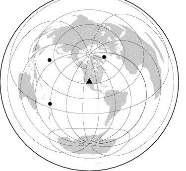
Azimuth Distribution of Events:
Prior Results for this Station
| Study | Thickness | Vp/Vs | Vp | Vs | Poissons Ratio | Extra |
| EARS | 32 km | 1.79 | 6.496 km/s | 3.634 km/s | 0.27 | |
| Crust2.0 | 38 km | 1.78 | 6.496 km/s | 3.647 km/s | 0.27 | H7,early/mid Proter. shield, Austr., 1.5 km seds. |
| Global Maxima | 32 km | 1.79 | 6.496 km/s | 3.634 km/s | 0.27 | amp=0.6516802 |
| Local Maxima 1 | 32 km | 1.65 | 6.496 km/s | 3.925 km/s | 0.21 | amp=0.46410024 |
| Local Maxima 2 | 36 km | 1.75 | 6.496 km/s | 3.717 km/s | 0.26 | amp=0.46399748 |
| Local Maxima 3 | 27 km | 1.60 | 6.496 km/s | 4.06 km/s | 0.18 | amp=0.36549518 |
| Local Maxima 4 | 38 km | 1.72 | 6.496 km/s | 3.777 km/s | 0.24 | amp=0.3152555 |
| Predicted Arrivals for vertical incidence (zero ray parameter) | |
| Ps | 3.91 SECOND |
| PpPs | 13.84 SECOND |
| PsPs/PpSs | 17.75 SECOND |
Events Processed for this Station
Download zip of receiver functions as SAC
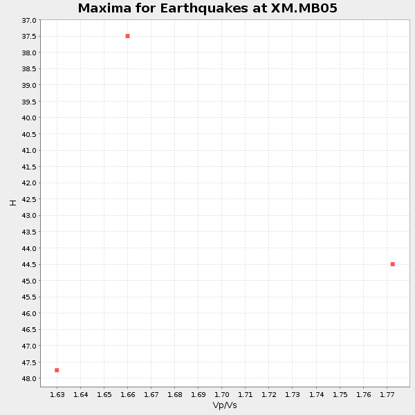
Plot maxima for each earthquake.
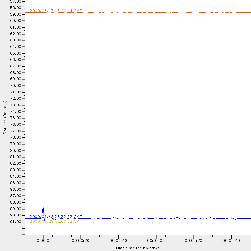
Events Used in the Stack
(3 events)| Radial Match | Distance | Baz | FERegion | Time | Lat/Lon | Depth | Magnitude |
| 96.931595 | 91.4 deg | 298.416 deg | Volcano Islands, Japan Region | 2000/03/28 11:00:22 GMT | (22.3, 143.7) | 126 km | 6.8 MB, 7.6 MS, 7.6 MW, 7.6 MW |
| 86.479965 | 90.7 deg | 240.72 deg | South Of Fiji Islands | 2000/03/18 23:22:52 GMT | (-24.4, 179.0) | 552 km | 5.1 MB, 5.5 MW |
| 81.12475 | 58.4 deg | 31.168 deg | Iceland | 2000/06/17 15:40:41 GMT | (64.0, -20.5) | 10 km | 5.7 MB, 6.6 MS, 6.8 MW, 6.5 MW |
Losers
(1 events)| Radial Match | Distance | Baz | FERegion | Time | Lat/Lon | Depth | Magnitude | Reason |
| 85.02743 | 93.0 deg | 258.231 deg | Santa Cruz Islands | 2000/06/10 09:17:53 GMT | (-11.4, 166.2) | 33 km | 5.4 MB, 5.6 MS, 5.9 MW, 5.9 MW |
