
Station XR FA02 - fled station 2
Network: XR01 - Florida to Edmonton Seismic Experiment
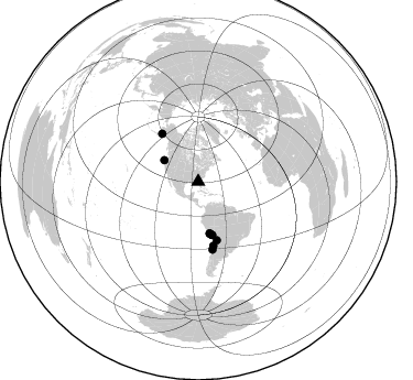
Nearby stations (2 deg radius)
| Station | Name | (Lat, Lon) | Start / End | Elevation |
| FA02 | fled station 2 | (31.17, -83.53) | 2001-05-16 / 2002-12-31 | 0.0 km |
| Crust2 Type: | DG,thin Platform 1 km seds. |
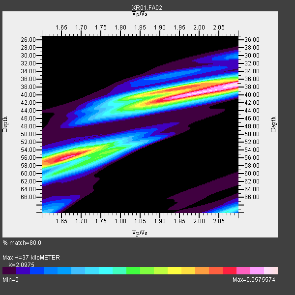
| Thickness Estimate: | 37 km |
| Thickness StdDev: | 8.6 km |
| Vp/Vs Estimate: | 2.10 |
| Vp/Vs StdDev: | 0.19 |
| Vs Estimate: | 3.13 km/s |
| Poisson's Ratio: | 0.35 |
| Peak Value: | 0.06 |
| Assumed Vp: | 6.565 km/s |
| Ps Weight: | 0.33333334 |
| PpPs Weight: | 0.33333334 |
| PsPs Weight: | 0.33333328 |
| Residual Complexity: | 0.804 |
| Nearby stations H: | +- |
| (2.0 deg) Vp/Vs: | +- |
7 with match > 90% ( 77.77778 %) and 9 with match > 80% ( 100.0 %) out of 9.
Download stack as xyz text file.
Azimuth Distribution of Events:
Prior Results for this Station
| Study | Thickness | Vp/Vs | Vp | Vs | Poissons Ratio | Extra |
| EARS | 37 km | 2.10 | 6.565 km/s | 3.13 km/s | 0.35 | |
| Crust2.0 | 31 km | 1.78 | 6.565 km/s | 3.684 km/s | 0.27 | DG,thin Platform 1 km seds. |
| Global Maxima | 37 km | 2.10 | 6.565 km/s | 3.13 km/s | 0.35 | amp=0.0575574 |
| Local Maxima 1 | 56 km | 1.66 | 6.565 km/s | 3.943 km/s | 0.22 | amp=0.04985636 |
| Local Maxima 2 | 41 km | 1.93 | 6.565 km/s | 3.397 km/s | 0.32 | amp=0.045117203 |
| Local Maxima 3 | 38 km | 1.93 | 6.565 km/s | 3.397 km/s | 0.32 | amp=0.029517502 |
| Local Maxima 4 | 56 km | 1.61 | 6.565 km/s | 4.071 km/s | 0.19 | amp=0.027484387 |
| Predicted Arrivals for vertical incidence (zero ray parameter) | |
| Ps | 6.19 SECOND |
| PpPs | 17.46 SECOND |
| PsPs/PpSs | 23.64 SECOND |
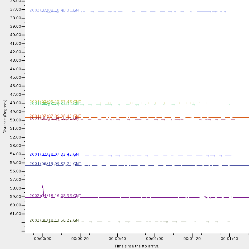
Events Processed for this Station
Download zip of receiver functions as SAC
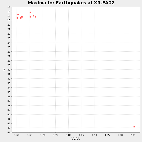
Plot maxima for each earthquake.
Events Used in the Stack
(9 events)| Radial Match | Distance | Baz | FERegion | Time | Lat/Lon | Depth | Magnitude |
| 98.55933 | 48.1 deg | 167.193 deg | Near Coast Of Peru | 2001/06/23 20:33:14 GMT | (-16.3, -73.6) | 33 km | 6.7 MB, 8.2 MS, 8.4 MW, 7.8 ME |
| 97.90172 | 49.7 deg | 165.606 deg | Near Coast Of Peru | 2001/07/07 09:38:43 GMT | (-17.5, -72.1) | 33 km | 6.6 MB, 7.3 MS, 7.6 MW, 7.5 ME |
| 97.271484 | 47.9 deg | 167.585 deg | Near Coast Of Peru | 2001/07/05 13:53:48 GMT | (-16.1, -74.0) | 62 km | 6.2 MB, 6.6 MW, 6.5 ME |
| 97.22122 | 50.0 deg | 165.145 deg | Near Coast Of Peru | 2001/06/26 04:18:31 GMT | (-17.7, -71.6) | 24 km | 6.2 MB, 6.7 MS, 6.8 MW, 6.7 ME |
| 95.89119 | 62.8 deg | 167.995 deg | Near Coast Of Central Chile | 2002/06/18 13:56:22 GMT | (-30.8, -71.1) | 54 km | 6.0 MB, 6.6 MW, 6.4 MW |
| 93.232025 | 59.7 deg | 166.672 deg | Near Coast Of Northern Chile | 2002/04/18 16:08:36 GMT | (-27.5, -70.6) | 62 km | 6.2 MB, 6.7 MW, 6.6 MW |
| 91.276215 | 55.7 deg | 162.439 deg | Chile-Bolivia Border Region | 2001/06/19 09:32:24 GMT | (-22.7, -67.9) | 147 km | 5.5 MB, 5.2 MS, 6.1 MW, 5.9 MW |
| 86.58828 | 36.4 deg | 302.268 deg | Off Coast Of Oregon | 2002/07/09 18:40:35 GMT | (43.5, -127.2) | 10 km | 5.5 MB, 5.5 MS, 6.0 MW, 5.8 MW |
| 86.33292 | 54.5 deg | 322.925 deg | Southern Alaska | 2001/07/28 07:32:43 GMT | (59.0, -155.1) | 131 km | 5.7 MB, 5.7 MS, 6.6 MW, 6.2 ME |
Losers
(0 events)| Radial Match | Distance | Baz | FERegion | Time | Lat/Lon | Depth | Magnitude | Reason |
