
Station YE DBTTP - Socorro, NM
Network: YE11 - Testing TA and FA Vaults and Directly Buried Sensors (3T)
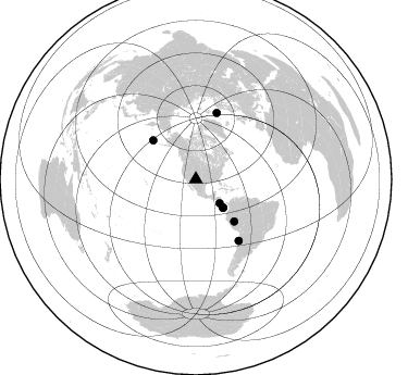
Nearby stations (2 deg radius)

| Station | Name | (Lat, Lon) | Start / End | Elevation |
| DBTTP | Socorro, NM | (33.96, -106.85) | 2012-03-13 / 2599-12-31 | 1396 m |
| Crust2 Type: | X2,Rift, Rio Grande, Baikal, 0.5km sediments |
| Thickness Estimate: | 34 km |
| Thickness StdDev: | 9.7 km |
| Vp/Vs Estimate: | 1.83 |
| Vp/Vs StdDev: | 0.11 |
| Vs Estimate: | 3.548 km/s |
| Poisson's Ratio: | 0.29 |
| Peak Value: | 0.07 |
| Assumed Vp: | 6.502 km/s |
| Ps Weight: | 0.33333334 |
| PpPs Weight: | 0.33333334 |
| PsPs Weight: | 0.33333328 |
| Residual Complexity: | 0.734 |
| Nearby stations H: | 49 km +- 12 km |
| (2.0 deg) Vp/Vs: | 1.69 +- 0.13 |
1 with match > 90% ( 3.8461537 %) and 7 with match > 80% ( 26.923077 %) out of 26.
Download stack as xyz text file.
Azimuth Distribution of Events:
Prior Results for this Station
| Study | Thickness | Vp/Vs | Vp | Vs | Poissons Ratio | Extra |
| EARS | 34 km | 1.83 | 6.502 km/s | 3.548 km/s | 0.29 | |
| Crust2.0 | 33 km | 1.77 | 6.502 km/s | 3.68 km/s | 0.26 | X2,Rift, Rio Grande, Baikal, 0.5km sediments |
| Global Maxima | 34 km | 1.83 | 6.502 km/s | 3.548 km/s | 0.29 | amp=0.07003952 |
| Local Maxima 1 | 56 km | 1.63 | 6.502 km/s | 3.995 km/s | 0.20 | amp=0.062881775 |
| Local Maxima 2 | 44 km | 1.78 | 6.502 km/s | 3.647 km/s | 0.27 | amp=0.054640803 |
| Local Maxima 3 | 30 km | 2.08 | 6.502 km/s | 3.126 km/s | 0.35 | amp=0.039814368 |
| Local Maxima 4 | 61 km | 1.91 | 6.502 km/s | 3.395 km/s | 0.31 | amp=0.028659683 |
| Predicted Arrivals for vertical incidence (zero ray parameter) | |
| Ps | 4.42 SECOND |
| PpPs | 15.03 SECOND |
| PsPs/PpSs | 19.45 SECOND |
Events Processed for this Station
Download zip of receiver functions as SAC
Plot maxima for each earthquake.
Events Used in the Stack
(7 events)| Radial Match | Distance | Baz | FERegion | Time | Lat/Lon | Depth | Magnitude |
| 94.14493 | 68.6 deg | 145.028 deg | Near Coast Of Northern Chile | 2012/05/19 08:35:10 GMT | (-25.7, -70.6) | 28 km | 5.7 MB, 5.5 MS, 5.8 MW, 5.9 MW |
| 89.3181 | 64.1 deg | 17.629 deg | Norwegian Sea | 2012/05/24 22:47:46 GMT | (73.0, 5.7) | 10 km | 5.7 MB, 6.1 MS, 6.1 MW, 6.2 MW |
| 87.76914 | 52.3 deg | 137.637 deg | Peru-Brazil Border Region | 2012/08/02 09:38:30 GMT | (-8.4, -74.3) | 145 km | 5.9 MB, 6.1 MW, 6.1 MW |
| 86.720345 | 36.2 deg | 136.09 deg | South Of Panama | 2012/06/04 03:15:24 GMT | (5.5, -82.6) | 7.0 km | 5.8 MB, 5.8 MS, 6.3 MW, 6.1 MW |
| 86.61725 | 53.2 deg | 312.361 deg | Andreanof Islands, Aleutian Is. | 2012/09/26 23:39:55 GMT | (51.6, -178.3) | 16 km | 6.3 MB, 6.5 MS, 6.4 MW, 6.4 MW |
| 85.47096 | 36.3 deg | 136.378 deg | South Of Panama | 2012/06/04 00:45:15 GMT | (5.3, -82.6) | 7.0 km | 5.9 MB, 5.9 MS, 6.3 MW, 6.2 MW |
| 84.01228 | 30.9 deg | 135.233 deg | Costa Rica | 2012/10/24 00:45:32 GMT | (10.1, -85.3) | 17 km | 6.0 MB, 6.2 MS, 6.5 MW, 6.4 MW |
Losers
(19 events)| Radial Match | Distance | Baz | FERegion | Time | Lat/Lon | Depth | Magnitude | Reason |
| 81.96548 | 62.4 deg | 139.376 deg | Peru-Bolivia Border Region | 2012/05/14 10:00:40 GMT | (-17.7, -69.6) | 106 km | 6.4 MB, 6.2 MW, 6.2 MW | |
| 80.450935 | 66.5 deg | 140.679 deg | Chile-Bolivia Border Region | 2012/10/08 01:50:26 GMT | (-21.7, -68.2) | 122 km | 6.0 MB, 5.7 MW, 5.8 MW | |
| 75.35335 | 75.2 deg | 320.415 deg | Sea Of Okhotsk | 2012/08/14 02:59:38 GMT | (49.8, 145.1) | 583 km | 6.9 MB, 7.7 MW, 7.7 MW | |
| 75.22073 | 42.7 deg | 131.659 deg | Colombia | 2012/09/30 16:31:35 GMT | (1.9, -76.4) | 170 km | 7.0 MB, 7.3 MW, 7.2 MW | |
| 74.70824 | 58.8 deg | 316.101 deg | Near Islands, Aleutian Islands | 2012/06/19 15:56:32 GMT | (53.4, 171.6) | 14 km | 6.2 MB, 5.7 MS, 6.0 MW, 6.1 MW | |
| 74.3298 | 56.6 deg | 142.971 deg | Near Coast Of Peru | 2012/07/02 23:31:37 GMT | (-14.4, -75.6) | 40 km | 6.0 MB, 5.2 MS, 5.7 MW, 5.6 MW | |
| 72.45571 | 83.6 deg | 313.005 deg | Near East Coast Of Honshu, Japan | 2012/06/17 20:32:20 GMT | (38.9, 141.8) | 36 km | 6.0 MB, 5.9 MS, 6.3 MW, 6.4 MW | |
| 70.03119 | 91.5 deg | 306.803 deg | Southeast Of Honshu, Japan | 2012/10/23 08:53:38 GMT | (29.1, 139.3) | 436 km | 6.0 MB, 5.9 MW, 6.0 MW | |
| 66.93861 | 39.3 deg | 320.492 deg | Kodiak Island Region, Alaska | 2012/09/18 01:44:50 GMT | (56.9, -154.1) | 39 km | 5.5 MB, 4.7 MS, 5.2 MW, 5.1 MW | |
| 63.14088 | 84.4 deg | 239.977 deg | Tonga Islands | 2012/09/24 10:31:23 GMT | (-21.2, -174.3) | 10 km | 5.7 MB, 5.4 MS, 5.5 MW, 5.5 MW | |
| 61.78133 | 87.3 deg | 242.709 deg | Fiji Islands Region | 2012/07/18 08:09:46 GMT | (-20.9, -178.5) | 537 km | 5.5 MB, 5.9 MW, 6.0 MW | |
| 59.350704 | 74.0 deg | 314.144 deg | Kuril Islands | 2012/07/11 02:31:16 GMT | (45.4, 151.4) | 10 km | 5.6 MB, 5.5 MS, 5.7 MW, 5.7 MW | |
| 58.875698 | 91.2 deg | 236.074 deg | Kermadec Islands Region | 2012/04/23 17:36:21 GMT | (-28.6, -177.4) | 114 km | 5.8 MB, 6.0 MW, 6.0 MW | |
| 58.101795 | 70.7 deg | 315.655 deg | Kuril Islands | 2012/10/14 09:41:58 GMT | (48.3, 154.4) | 35 km | 5.7 MB, 5.2 MS, 5.7 MW, 5.7 MW | |
| 57.901184 | 69.3 deg | 137.153 deg | Salta Province, Argentina | 2012/06/02 07:52:53 GMT | (-22.1, -63.6) | 527 km | 5.8 MB, 5.9 MW, 6.0 MW | |
| 57.25413 | 88.8 deg | 242.344 deg | South Of Fiji Islands | 2012/05/29 03:33:25 GMT | (-22.1, -179.6) | 602 km | 5.6 MB, 5.8 MW, 5.9 MW | |
| 56.61456 | 79.8 deg | 320.916 deg | Primor'ye, Russia | 2012/07/29 09:20:54 GMT | (47.4, 139.1) | 502 km | 5.6 MB, 5.6 MW, 5.7 MW | |
| 56.427753 | 95.6 deg | 233.34 deg | South Of Kermadec Islands | 2012/08/24 10:01:53 GMT | (-33.4, -179.5) | 38 km | 5.6 MW, 5.1 MS, 5.2 MB, 5.8 MW | |
| 52.301353 | 58.7 deg | 316.085 deg | Near Islands, Aleutian Islands | 2012/06/19 20:56:41 GMT | (53.4, 171.7) | 12 km | 5.9 MB, 5.2 MS, 5.6 MW, 5.7 MW |
