
Station YJ ADEE - Adele High School
Network: YJ01 - Ethiopia-Afar Geoscientific Lithospheric Experiment
Nearby stations (2 deg radius)
| Station | Name | (Lat, Lon) | Start / End | Elevation |
| ADEE | Adele High School | (7.79, 39.91) | 2001-11-09 / 2003-01-19 | 2485 m |
| Crust2 Type: | G9,thin custal Archean 0.1 km seds., South American |
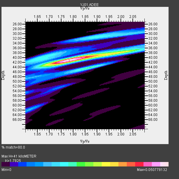
| Thickness Estimate: | 41 km |
| Thickness StdDev: | 3.0 km |
| Vp/Vs Estimate: | 1.78 |
| Vp/Vs StdDev: | 0.10 |
| Vs Estimate: | 3.626 km/s |
| Poisson's Ratio: | 0.27 |
| Peak Value: | 0.05 |
| Assumed Vp: | 6.464 km/s |
| Ps Weight: | 0.33333334 |
| PpPs Weight: | 0.33333334 |
| PsPs Weight: | 0.33333328 |
| Residual Complexity: | 0.585 |
| Nearby stations H: | +- |
| (2.0 deg) Vp/Vs: | +- |
2 with match > 90% ( 33.333332 %) and 4 with match > 80% ( 66.666664 %) out of 6.
Download stack as xyz text file.
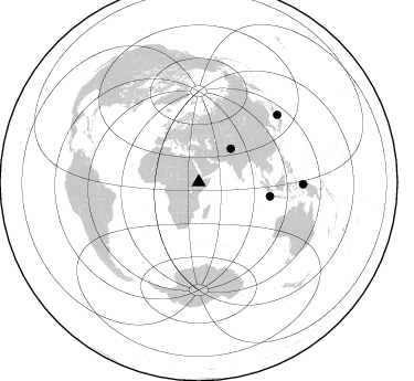
Azimuth Distribution of Events:
Prior Results for this Station
| Study | Thickness | Vp/Vs | Vp | Vs | Poissons Ratio | Extra |
| EARS | 41 km | 1.78 | 6.464 km/s | 3.626 km/s | 0.27 | |
| Crust2.0 | 31 km | 1.76 | 6.464 km/s | 3.663 km/s | 0.26 | G9,thin custal Archean 0.1 km seds., South American |
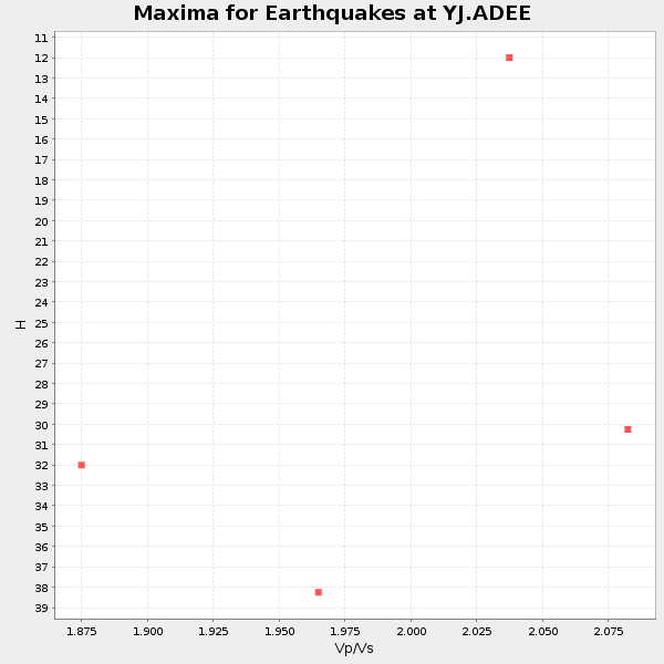
| Global Maxima | 41 km | 1.78 | 6.464 km/s | 3.626 km/s | 0.27 | amp=0.050778132 |
| Local Maxima 1 | 38 km | 2.01 | 6.464 km/s | 3.212 km/s | 0.34 | amp=0.023921167 |
| Local Maxima 2 | 40 km | 1.68 | 6.464 km/s | 3.847 km/s | 0.23 | amp=0.020178214 |
| Local Maxima 3 | 31 km | 1.90 | 6.464 km/s | 3.397 km/s | 0.31 | amp=0.018491458 |
| Local Maxima 4 | 44 km | 1.86 | 6.464 km/s | 3.48 km/s | 0.30 | amp=0.017920962 |
| Predicted Arrivals for vertical incidence (zero ray parameter) | |
| Ps | 4.96 SECOND |
| PpPs | 17.65 SECOND |
| PsPs/PpSs | 22.61 SECOND |
Events Processed for this Station
Download zip of receiver functions as SAC
Plot maxima for each earthquake.
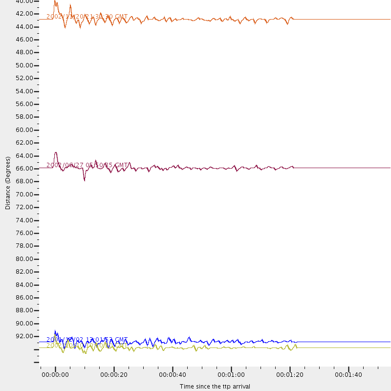
Events Used in the Stack
(4 events)| Radial Match | Distance | Baz | FERegion | Time | Lat/Lon | Depth | Magnitude |
| 94.93785 | 65.7 deg | 101.217 deg | Sunda Strait, Indonesia | 2002/06/27 05:50:35 GMT | (-7.0, 104.2) | 11 km | 6.0 MB, 6.9 MS, 6.6 MW, 6.5 MW |
| 90.363106 | 93.7 deg | 49.609 deg | Eastern Honshu, Japan | 2001/12/02 13:01:53 GMT | (39.4, 141.1) | 124 km | 6.1 MB, 6.5 MW, 6.5 MW |
| 86.895905 | 94.6 deg | 91.142 deg | Irian Jaya Region, Indonesia | 2002/10/10 10:50:20 GMT | (-1.8, 134.3) | 10 km | 6.5 MB, 7.7 MS, 7.6 MW, 7.4 MW |
| 85.218666 | 41.9 deg | 43.958 deg | Northwestern Kashmir | 2002/11/20 21:32:30 GMT | (35.4, 74.5) | 33 km | 5.7 MB, 6.5 MS, 6.4 MW, 6.0 MW |
Losers
(2 events)| Radial Match | Distance | Baz | FERegion | Time | Lat/Lon | Depth | Magnitude | Reason |
| 45.667732 | 96.2 deg | 57.659 deg | Southeast Of Honshu, Japan | 2002/08/20 10:59:32 GMT | (31.0, 142.0) | 9.0 km | 5.4 MB, 6.2 MS, 6.3 MW, 6.1 MW | |
| 29.90756 | 84.6 deg | 45.62 deg | Northeastern China | 2002/09/15 08:39:32 GMT | (44.8, 129.9) | 586 km | 5.8 MB, 6.4 MW, 6.4 MW |
