
Station YJ MELE - Melka Werer High School
Network: YJ01 - Ethiopia-Afar Geoscientific Lithospheric Experiment
Nearby stations (2 deg radius)
| Station | Name | (Lat, Lon) | Start / End | Elevation |
| MELE | Melka Werer High School | (9.31, 40.20) | 2001-11-22 / 2003-01-23 | 762 m |
| Crust2 Type: | IG,very thin late Proter., no seds. |
| Thickness Estimate: | 20 km |
| Thickness StdDev: | 16 km |
| Vp/Vs Estimate: | 1.60 |
| Vp/Vs StdDev: | 0.11 |
| Vs Estimate: | 4.152 km/s |
| Poisson's Ratio: | 0.18 |
| Peak Value: | 0.12 |
| Assumed Vp: | 6.643 km/s |
| Ps Weight: | 0.33333334 |
| PpPs Weight: | 0.33333334 |
| PsPs Weight: | 0.33333328 |
| Residual Complexity: | 0.873 |
| Nearby stations H: | +- |
| (2.0 deg) Vp/Vs: | +- |
0 with match > 90% ( 0.0 %) and 2 with match > 80% ( 66.666664 %) out of 3.
Download stack as xyz text file.
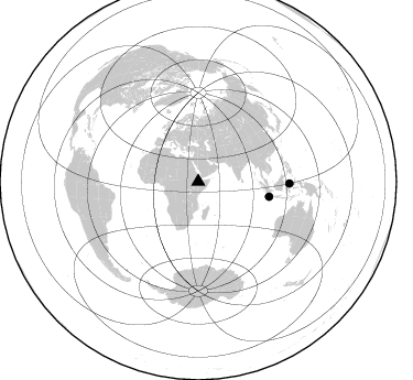
Azimuth Distribution of Events:
Prior Results for this Station
| Study | Thickness | Vp/Vs | Vp | Vs | Poissons Ratio | Extra |
| EARS | 20 km | 1.60 | 6.643 km/s | 4.152 km/s | 0.18 | |
| Crust2.0 | 23 km | 1.77 | 6.643 km/s | 3.757 km/s | 0.26 | IG,very thin late Proter., no seds. |
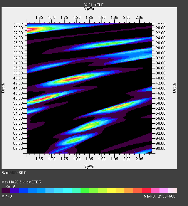
| Global Maxima | 20 km | 1.60 | 6.643 km/s | 4.152 km/s | 0.18 | amp=0.121554606 |
| Local Maxima 1 | 48 km | 1.65 | 6.643 km/s | 4.02 km/s | 0.21 | amp=0.11286657 |
| Local Maxima 2 | 40 km | 1.78 | 6.643 km/s | 3.738 km/s | 0.27 | amp=0.09616185 |
| Local Maxima 3 | 51 km | 1.96 | 6.643 km/s | 3.39 km/s | 0.32 | amp=0.08679936 |
| Local Maxima 4 | 26 km | 1.92 | 6.643 km/s | 3.456 km/s | 0.31 | amp=0.06482981 |
| Predicted Arrivals for vertical incidence (zero ray parameter) | |
| Ps | 1.85 SECOND |
| PpPs | 8.02 SECOND |
| PsPs/PpSs | 9.87 SECOND |
Events Processed for this Station
Download zip of receiver functions as SAC
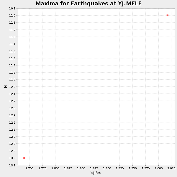
Plot maxima for each earthquake.
Events Used in the Stack
(2 events)| Radial Match | Distance | Baz | FERegion | Time | Lat/Lon | Depth | Magnitude |
| 88.118675 | 82.8 deg | 91.187 deg | Minahassa Peninsula, Sulawesi | 2001/12/09 18:15:02 GMT | (-0.0, 122.9) | 156 km | 5.7 MB, 6.2 MW, 6.0 MW |
| 85.36619 | 65.8 deg | 101.953 deg | Sunda Strait, Indonesia | 2002/06/27 05:50:35 GMT | (-7.0, 104.2) | 11 km | 6.0 MB, 6.9 MS, 6.6 MW, 6.5 MW |
Losers
(1 events)| Radial Match | Distance | Baz | FERegion | Time | Lat/Lon | Depth | Magnitude | Reason |
| 77.027435 | 30.8 deg | 334.459 deg | Southern Greece | 2002/05/21 20:53:29 GMT | (36.6, 24.3) | 97 km | 5.4 MB, 5.6 MD |
