
Station YJ NURE - Nura Hira School
Network: YJ01 - Ethiopia-Afar Geoscientific Lithospheric Experiment
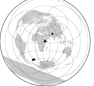
Nearby stations (2 deg radius)
| Station | Name | (Lat, Lon) | Start / End | Elevation |
| NURE | Nura Hira School | (8.73, 39.80) | 2001-11-01 / 2003-01-31 | 1182 m |
| Crust2 Type: | G9,thin custal Archean 0.1 km seds., South American |
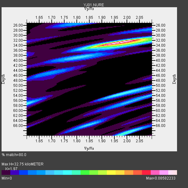
| Thickness Estimate: | 33 km |
| Thickness StdDev: | 9.3 km |
| Vp/Vs Estimate: | 1.97 |
| Vp/Vs StdDev: | 0.07 |
| Vs Estimate: | 3.281 km/s |
| Poisson's Ratio: | 0.33 |
| Peak Value: | 0.09 |
| Assumed Vp: | 6.464 km/s |
| Ps Weight: | 0.33333334 |
| PpPs Weight: | 0.33333334 |
| PsPs Weight: | 0.33333328 |
| Residual Complexity: | 0.524 |
| Nearby stations H: | +- |
| (2.0 deg) Vp/Vs: | +- |
0 with match > 90% ( 0.0 %) and 4 with match > 80% ( 50.0 %) out of 8.
Download stack as xyz text file.
Azimuth Distribution of Events:
Prior Results for this Station
| Study | Thickness | Vp/Vs | Vp | Vs | Poissons Ratio | Extra |
| EARS | 33 km | 1.97 | 6.464 km/s | 3.281 km/s | 0.33 | |
| Crust2.0 | 31 km | 1.76 | 6.464 km/s | 3.663 km/s | 0.26 | G9,thin custal Archean 0.1 km seds., South American |
| Global Maxima | 33 km | 1.97 | 6.464 km/s | 3.281 km/s | 0.33 | amp=0.08582233 |
| Local Maxima 1 | 69 km | 1.99 | 6.464 km/s | 3.248 km/s | 0.33 | amp=0.036905095 |
| Local Maxima 2 | 53 km | 1.99 | 6.464 km/s | 3.256 km/s | 0.33 | amp=0.034301963 |
| Local Maxima 3 | 57 km | 1.60 | 6.464 km/s | 4.04 km/s | 0.18 | amp=0.030539801 |
| Local Maxima 4 | 65 km | 1.86 | 6.464 km/s | 3.475 km/s | 0.30 | amp=0.028600074 |
| Predicted Arrivals for vertical incidence (zero ray parameter) | |
| Ps | 4.91 SECOND |
| PpPs | 15.05 SECOND |
| PsPs/PpSs | 19.96 SECOND |
Events Processed for this Station
Download zip of receiver functions as SAC
Plot maxima for each earthquake.
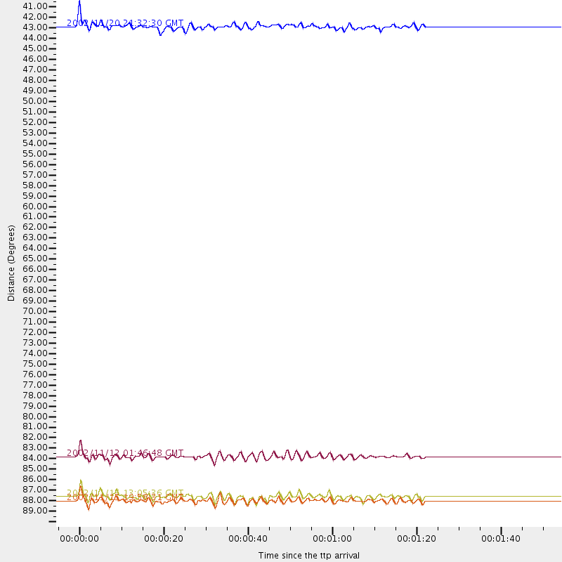
Events Used in the Stack
(4 events)| Radial Match | Distance | Baz | FERegion | Time | Lat/Lon | Depth | Magnitude |
| 84.53972 | 89.6 deg | 213.015 deg | South Georgia Island Region | 2002/11/15 19:58:31 GMT | (-56.1, -36.4) | 10 km | 6.1 MB, 6.6 MS, 6.7 MW, 6.4 MW |
| 84.02359 | 89.1 deg | 213.235 deg | South Georgia Island Region | 2002/11/15 13:05:36 GMT | (-55.7, -35.8) | 10 km | 5.8 MB, 5.5 MS, 5.8 MW, 5.8 MW |
| 82.715004 | 85.1 deg | 210.856 deg | South Sandwich Islands Region | 2002/11/12 01:46:48 GMT | (-56.5, -27.5) | 120 km | 6.0 MB, 6.3 MW, 6.2 MW |
| 80.03361 | 41.3 deg | 44.766 deg | Northwestern Kashmir | 2002/11/20 21:32:30 GMT | (35.4, 74.5) | 33 km | 5.7 MB, 6.5 MS, 6.4 MW, 6.0 MW |
Losers
(4 events)| Radial Match | Distance | Baz | FERegion | Time | Lat/Lon | Depth | Magnitude | Reason |
| 71.002014 | 77.3 deg | 99.745 deg | Bali Sea | 2002/10/03 19:05:10 GMT | (-7.5, 115.7) | 316 km | 6.0 MB, 6.0 MW, 6.0 MW | |
| 70.54026 | 81.8 deg | 92.472 deg | Sulawesi, Indonesia | 2002/08/15 05:30:26 GMT | (-1.2, 121.3) | 10 km | 5.7 MB, 5.8 MS, 6.2 MW, 6.1 MW | |
| 60.549446 | 95.7 deg | 43.569 deg | Kuril Islands | 2002/05/21 20:04:16 GMT | (44.4, 146.6) | 150 km | 5.5 MB, 5.5 MW, 5.5 MW | |
| 56.481148 | 31.1 deg | 335.407 deg | Southern Greece | 2002/05/21 20:53:29 GMT | (36.6, 24.3) | 97 km | 5.4 MB, 5.6 MD |
