
Station Z1 LTW1A - LTW1A, Maungakotukutuku, Paraparaumu
Network: Z116 - Seismic Triggering Response for Earthquakes around Wellington NZ
Nearby stations (2 deg radius)

| Station | Name | (Lat, Lon) | Start / End | Elevation |
| LTW1A | LTW1A, Maungakotukutuku, Paraparaumu | (-40.96, 175.05) | 2016-11-15 / 2017-06-01 | 198 m |
| Crust2 Type: | K2,forearc, New Zealand, 0.7 km seds. |
| Thickness Estimate: | 44 km |
| Thickness StdDev: | 7.7 km |
| Vp/Vs Estimate: | 1.75 |
| Vp/Vs StdDev: | 0.15 |
| Vs Estimate: | 3.692 km/s |
| Poisson's Ratio: | 0.26 |
| Peak Value: | 0.06 |
| Assumed Vp: | 6.461 km/s |
| Ps Weight: | 0.33333334 |
| PpPs Weight: | 0.33333334 |
| PsPs Weight: | 0.33333328 |
| Residual Complexity: | 0.764 |
| Nearby stations H: | +- |
| (2.0 deg) Vp/Vs: | +- |
2 with match > 90% ( 11.111111 %) and 4 with match > 80% ( 22.222221 %) out of 18.
Download stack as xyz text file.
Azimuth Distribution of Events:

Prior Results for this Station
| Study | Thickness | Vp/Vs | Vp | Vs | Poissons Ratio | Extra |
| EARS | 44 km | 1.75 | 6.461 km/s | 3.692 km/s | 0.26 | |
| Crust2.0 | 35 km | 1.76 | 6.461 km/s | 3.663 km/s | 0.26 | K2,forearc, New Zealand, 0.7 km seds. |
| Global Maxima | 44 km | 1.75 | 6.461 km/s | 3.692 km/s | 0.26 | amp=0.059633803 |
| Local Maxima 1 | 29 km | 2.10 | 6.461 km/s | 3.081 km/s | 0.35 | amp=0.045859635 |
| Local Maxima 2 | 38 km | 1.88 | 6.461 km/s | 3.442 km/s | 0.30 | amp=0.035970535 |
| Local Maxima 3 | 28 km | 2.10 | 6.461 km/s | 3.081 km/s | 0.35 | amp=0.032738496 |
| Local Maxima 4 | 55 km | 2.03 | 6.461 km/s | 3.187 km/s | 0.34 | amp=0.024773259 |
| Predicted Arrivals for vertical incidence (zero ray parameter) | |
| Ps | 5.14 SECOND |
| PpPs | 18.83 SECOND |
| PsPs/PpSs | 23.97 SECOND |
Events Processed for this Station
Download zip of receiver functions as SAC
Plot maxima for each earthquake.
Events Used in the Stack
(4 events)| Radial Match | Distance | Baz | FERegion | Time | Lat/Lon | Depth | Magnitude |
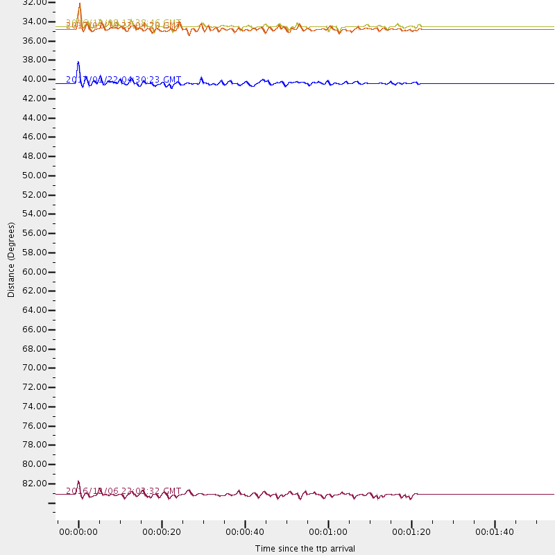
| 96.76065 | 32.5 deg | 334.288 deg | Solomon Islands | 2016/12/08 17:38:46 GMT | (-10.7, 161.3) | 41 km | 7.8 mww |
| 93.51637 | 38.9 deg | 327.355 deg | Solomon Islands | 2017/01/22 04:30:23 GMT | (-6.2, 155.1) | 136 km | 7.9 mww |
| 83.501724 | 85.1 deg | 281.225 deg | Northern Sumatra, Indonesia | 2016/12/06 22:03:32 GMT | (5.3, 96.1) | 8.2 km | 6.5 Mww |
| 83.135376 | 32.8 deg | 334.402 deg | Solomon Islands | 2017/01/19 23:04:20 GMT | (-10.4, 161.3) | 34 km | 6.8 mwp |
Losers
(14 events)| Radial Match | Distance | Baz | FERegion | Time | Lat/Lon | Depth | Magnitude | Reason |
| 64.61057 | 56.7 deg | 291.464 deg | Banda Sea | 2016/12/05 01:13:04 GMT | (-7.3, 123.4) | 526 km | 6.3 Mww | |
| 61.874626 | 98.1 deg | 353.214 deg | Near East Coast Of Kamchatka | 2017/03/29 04:09:24 GMT | (56.9, 162.7) | 23 km | 6.6 Mww | |
| 59.79326 | 39.7 deg | 326.808 deg | Solomon Islands | 2016/12/10 16:24:36 GMT | (-5.7, 154.5) | 157 km | 6.1 Mwp | |
| 59.14167 | 43.1 deg | 316.373 deg | Eastern New Guinea Reg., P.N.G. | 2017/02/23 15:11:05 GMT | (-5.9, 146.7) | 116 km | 5.4 Mww | |
| 54.36428 | 60.3 deg | 280.961 deg | South Of Bali, Indonesia | 2017/03/16 18:39:26 GMT | (-11.5, 114.6) | 10 km | 5.5 Mww | |
| 53.86814 | 70.7 deg | 308.033 deg | Philippine Islands Region | 2017/04/10 00:43:54 GMT | (13.0, 125.4) | 8.2 km | 5.6 Mww | |
| 52.39851 | 37.6 deg | 327.456 deg | Solomon Islands | 2017/03/04 02:58:24 GMT | (-7.4, 155.7) | 54 km | 5.9 Mww | |
| 49.133606 | 32.2 deg | 334.279 deg | Solomon Islands | 2016/12/09 21:38:23 GMT | (-10.9, 161.4) | 10 km | 5.8 Mww | |
| 47.41221 | 93.4 deg | 358.265 deg | Near Islands, Aleutian Islands | 2017/03/27 10:50:19 GMT | (52.8, 172.2) | 10 km | 6.1 Mww | |
| 46.77447 | 64.1 deg | 295.288 deg | Minahassa Peninsula, Sulawesi | 2017/03/31 11:21:00 GMT | (0.3, 120.6) | 93 km | 5.6 mb | |
| 43.282757 | 83.9 deg | 333.787 deg | Near East Coast Of Honshu, Japan | 2017/03/11 19:57:48 GMT | (37.5, 141.5) | 44 km | 5.3 Mww | |
| 42.28103 | 66.8 deg | 304.103 deg | Mindanao, Philippines | 2017/04/12 20:01:05 GMT | (7.7, 124.9) | 10 km | 5.5 Mww | |
| 38.13413 | 89.0 deg | 333.695 deg | Eastern Sea Of Japan | 2017/03/27 22:31:21 GMT | (42.1, 138.5) | 10 km | 5.1 Mww | |
| 23.015543 | 72.8 deg | 87.215 deg | Central East Pacific Rise | 2016/12/11 14:33:12 GMT | (-9.1, -109.8) | 10 km | 5.7 Mwb |

