
Station OK AMES - Ames, Oklahoma, USA
Network: OK - Oklahoma Seismic Network
Nearby stations (2 deg radius)

| Station | Name | (Lat, Lon) | Start / End | Elevation |
| AMES | Ames, Oklahoma, USA | (36.34, -98.19) | 2017-03-22 / 2599-12-31 | 394 m |
| Crust2 Type: | D8,thick Platform 3 km seds. |
| Thickness Estimate: | 40 km |
| Thickness StdDev: | 4.2 km |
| Vp/Vs Estimate: | 1.80 |
| Vp/Vs StdDev: | 0.09 |
| Vs Estimate: | 3.57 km/s |
| Poisson's Ratio: | 0.28 |
| Peak Value: | 0.02 |
| Assumed Vp: | 6.426 km/s |
| Ps Weight: | 0.33333334 |
| PpPs Weight: | 0.33333334 |
| PsPs Weight: | 0.33333328 |
| Residual Complexity: | 0.532 |
| Nearby stations H: | +- |
| (2.0 deg) Vp/Vs: | +- |
4 with match > 90% ( 9.302325 %) and 12 with match > 80% ( 27.906977 %) out of 43.
Download stack as xyz text file.
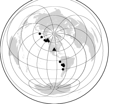
Azimuth Distribution of Events:
Prior Results for this Station
| Study | Thickness | Vp/Vs | Vp | Vs | Poissons Ratio | Extra |
| EARS | 40 km | 1.80 | 6.426 km/s | 3.57 km/s | 0.28 | |
| Crust2.0 | 46 km | 1.78 | 6.426 km/s | 3.613 km/s | 0.27 | D8,thick Platform 3 km seds. |
| Global Maxima | 40 km | 1.80 | 6.426 km/s | 3.57 km/s | 0.28 | amp=0.024817836 |
| Local Maxima 1 | 40 km | 1.63 | 6.426 km/s | 3.942 km/s | 0.20 | amp=0.011034092 |
| Local Maxima 2 | 53 km | 1.60 | 6.426 km/s | 4.016 km/s | 0.18 | amp=0.010810435 |
| Local Maxima 3 | 40 km | 1.85 | 6.426 km/s | 3.469 km/s | 0.29 | amp=0.008397235 |
| Local Maxima 4 | 31 km | 2.02 | 6.426 km/s | 3.189 km/s | 0.34 | amp=0.0076166634 |
| Predicted Arrivals for vertical incidence (zero ray parameter) | |
| Ps | 4.98 SECOND |
| PpPs | 17.43 SECOND |
| PsPs/PpSs | 22.41 SECOND |
Events Processed for this Station
Download zip of receiver functions as SAC
Plot maxima for each earthquake.
Events Used in the Stack
(12 events)| Radial Match | Distance | Baz | FERegion | Time | Lat/Lon | Depth | Magnitude |
| 94.78889 | 44.6 deg | 314.801 deg | Alaska Peninsula | 2020/07/22 06:12:44 UTC | (55.2, -158.6) | 13 km | 7.4 Mi |
| 94.38499 | 71.7 deg | 317.707 deg | East Of Kuril Islands | 2020/03/25 02:49:21 UTC | (49.0, 157.7) | 57 km | 7.5 Mww |
| 93.068214 | 39.3 deg | 316.549 deg | Gulf Of Alaska | 2018/01/23 09:31:42 UTC | (56.0, -149.1) | 25 km | 7.9 Mww |
| 90.48059 | 56.4 deg | 152.604 deg | Near Coast Of Peru | 2018/01/14 09:18:45 UTC | (-15.8, -74.7) | 36 km | 7.1 mww |
| 87.89064 | 59.4 deg | 314.877 deg | Rat Islands, Aleutian Islands | 2017/10/08 22:34:33 UTC | (52.4, 176.8) | 112 km | 6.6 mww |
| 86.35061 | 70.9 deg | 155.787 deg | Near Coast Of Central Chile | 2020/09/06 01:16:58 UTC | (-30.3, -71.6) | 31 km | 6.3 Mww |
| 84.25862 | 44.2 deg | 154.429 deg | Peru-Ecuador Border Region | 2021/07/30 17:10:19 UTC | (-4.9, -80.6) | 33 km | 6.2 Mww |
| 84.02119 | 40.2 deg | 326.503 deg | Central Alaska | 2021/05/31 06:59:54 UTC | (62.4, -148.3) | 44 km | 6.1 Mww |
| 81.73139 | 62.2 deg | 150.052 deg | Near Coast Of Northern Chile | 2020/07/17 05:40:36 UTC | (-20.2, -70.1) | 74 km | 5.9 Mww |
| 80.81309 | 61.2 deg | 148.885 deg | Northern Chile | 2018/01/21 01:06:42 UTC | (-18.9, -69.6) | 111 km | 6.3 Mww |
| 80.5156 | 34.0 deg | 325.919 deg | Southeastern Alaska | 2017/05/01 14:18:15 UTC | (59.8, -136.6) | 3.3 km | 6.3 Ml |
| 80.301476 | 57.5 deg | 148.086 deg | Southern Peru | 2020/05/31 05:09:35 UTC | (-15.3, -70.7) | 153 km | 6.0 mww |
Losers
(31 events)| Radial Match | Distance | Baz | FERegion | Time | Lat/Lon | Depth | Magnitude | Reason |
| 84.95762 | 34.0 deg | 325.969 deg | Southeastern Alaska | 2017/05/01 12:31:53 UTC | (59.9, -136.6) | 0.1 km | 6.5 Ml | |
| 76.731476 | 65.7 deg | 143.709 deg | Southern Bolivia | 2018/04/02 13:40:34 UTC | (-20.7, -63.0) | 562 km | 6.8 Mww | |
| 76.04726 | 67.5 deg | 323.649 deg | Kamchatka Peninsula, Russia | 2020/09/15 03:41:28 UTC | (55.9, 158.5) | 344 km | 6.4 Mww | |
| 73.671005 | 52.8 deg | 153.355 deg | Near Coast Of Peru | 2021/06/23 02:54:18 UTC | (-12.7, -76.7) | 51 km | 5.8 mww | |
| 69.885124 | 87.8 deg | 316.593 deg | Near East Coast Of Honshu, Japan | 2021/05/13 23:58:14 UTC | (37.7, 141.8) | 32 km | 6.0 mww | |
| 69.679405 | 56.2 deg | 311.844 deg | Andreanof Islands, Aleutian Is. | 2017/05/08 15:31:28 UTC | (51.1, -177.0) | 41 km | 5.5 Ml | |
| 68.91592 | 67.2 deg | 149.226 deg | Chile-Argentina Border Region | 2020/11/30 22:54:59 UTC | (-24.4, -67.1) | 148 km | 6.3 mww | |
| 68.8045 | 80.7 deg | 324.521 deg | Primor'ye, Russia | 2020/11/30 22:54:34 UTC | (48.3, 140.8) | 587 km | 6.4 mww | |
| 64.488464 | 92.4 deg | 102.616 deg | Ascension Island Region | 2020/01/17 06:37:52 UTC | (-11.6, -13.8) | 10 km | 5.9 Mww | |
| 63.016987 | 57.7 deg | 147.86 deg | Southern Peru | 2020/05/03 00:44:26 UTC | (-15.3, -70.4) | 186 km | 5.7 Mww | |
| 59.833942 | 71.0 deg | 147.385 deg | Santiago Del Estero Prov., Arg. | 2019/12/24 16:43:32 UTC | (-27.0, -63.4) | 560 km | 6.0 Mww | |
| 59.589375 | 93.0 deg | 250.614 deg | Fiji Islands Region | 2020/06/19 10:07:55 UTC | (-17.5, -178.9) | 535 km | 5.6 Mww | |
| 59.44882 | 58.0 deg | 312.244 deg | Andreanof Islands, Aleutian Is. | 2020/01/26 22:33:39 UTC | (50.8, -180.0) | 55 km | 5.5 Mi | |
| 59.27493 | 57.9 deg | 312.827 deg | Andreanof Islands, Aleutian Is. | 2020/01/26 22:33:40 UTC | (51.3, -180.0) | 35 km | 5.7 Mww | |
| 58.644665 | 94.1 deg | 246.198 deg | Fiji Islands Region | 2021/04/25 22:28:00 UTC | (-21.7, -177.1) | 234 km | 6.4 Mww | |
| 58.09647 | 92.9 deg | 41.5 deg | Dodecanese Islands, Greece | 2020/01/30 01:28:06 UTC | (35.2, 27.9) | 10 km | 5.6 mww | |
| 56.77659 | 75.8 deg | 159.315 deg | Near Coast Of Central Chile | 2020/03/17 08:12:02 UTC | (-36.2, -73.2) | 29 km | 5.6 Mww | |
| 56.597824 | 88.8 deg | 250.1 deg | Tonga Islands | 2019/12/06 13:04:46 UTC | (-15.3, -175.1) | 10 km | 6.0 mww | |
| 56.292168 | 92.7 deg | 248.715 deg | Fiji Islands Region | 2021/05/07 23:35:14 UTC | (-18.8, -177.5) | 384 km | 6.1 Mww | |
| 54.203003 | 90.7 deg | 319.152 deg | Near West Coast Of Honshu, Japan | 2020/03/12 17:18:46 UTC | (37.3, 136.9) | 10 km | 5.3 Mww | |
| 53.96155 | 91.3 deg | 247.8 deg | Tonga Islands | 2019/11/04 22:46:10 UTC | (-18.7, -175.7) | 10 km | 5.5 mb | |
| 52.32054 | 94.9 deg | 197.96 deg | Pacific-Antarctic Ridge | 2017/04/26 22:28:30 UTC | (-54.9, -130.3) | 10 km | 5.5 Mwb | |
| 51.758 | 88.8 deg | 37.635 deg | Turkey | 2019/09/26 10:59:26 UTC | (40.9, 28.2) | 10 km | 5.7 Mww | |
| 51.703186 | 86.3 deg | 41.797 deg | Greece | 2021/03/12 12:57:51 UTC | (39.9, 22.0) | 10 km | 5.6 Mww | |
| 50.095116 | 44.3 deg | 315.167 deg | Alaska Peninsula | 2020/08/09 14:57:52 UTC | (55.5, -158.1) | 0.0 km | 5.6 ml | |
| 49.14096 | 92.0 deg | 40.289 deg | Dodecanese Islands, Greece | 2020/06/28 17:43:28 UTC | (36.7, 28.3) | 62 km | 5.5 Mww | |
| 46.928036 | 87.7 deg | 314.503 deg | Off East Coast Of Honshu, Japan | 2017/07/30 12:45:06 UTC | (36.3, 143.7) | 17 km | 5.3 Mww | |
| 46.783665 | 72.3 deg | 180.179 deg | Southeast Of Easter Island | 2017/04/20 22:04:14 UTC | (-36.3, -98.4) | 10 km | 5.5 Mwb | |
| 44.04412 | 39.3 deg | 323.834 deg | Southern Alaska | 2017/11/27 22:18:30 UTC | (60.6, -147.4) | 16 km | 5.5 Mww | |
| 43.26213 | 90.9 deg | 251.276 deg | Fiji Islands Region | 2020/04/08 10:02:32 UTC | (-15.7, -177.6) | 421 km | 5.5 Mww | |
| 41.04128 | 45.4 deg | 313.596 deg | South Of Alaska | 2020/10/19 21:45:25 UTC | (54.3, -159.9) | 24 km | 5.9 mww |

